
Ireland Head-to-Head 2024
Contents
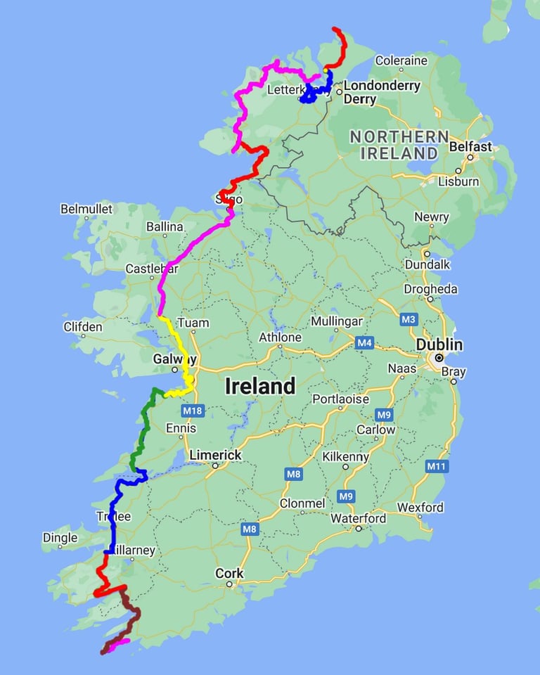
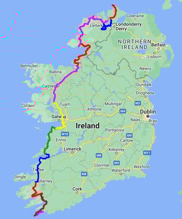
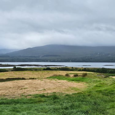
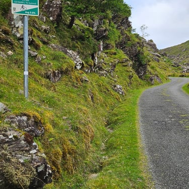
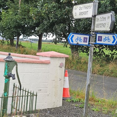
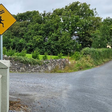
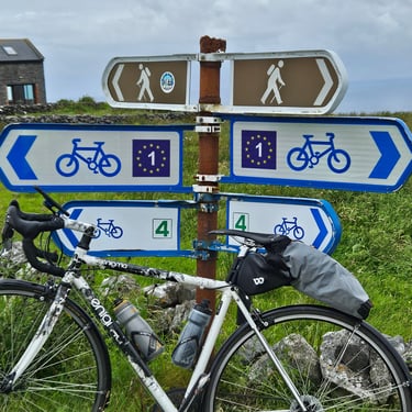
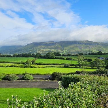
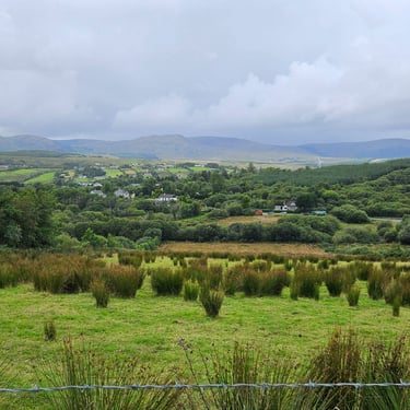
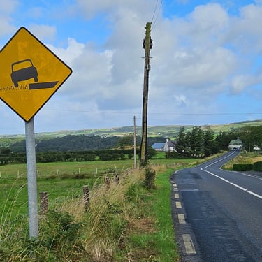
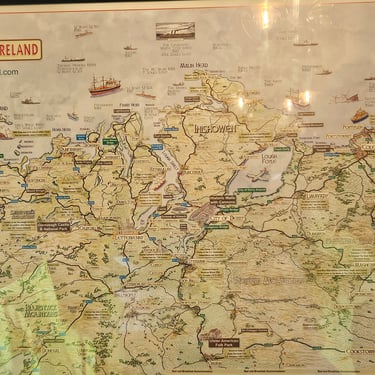
This tour was a new one in the Bike Adventures catalogue and had been designed to include more of the west coast and replace a previous shorter, 8 day, route between the two ends but located further inland. A sufficient number of people had signed up to make the adventure viable so we were the guinea pigs to try this nominally fairly easy ride. That said, one look a a good map would reveal considerable similarities with the western side of the British mainland, which is somewhat undulating. While the route had been designed to avoid main roads where possible, this principle proved to have been applied over-enthusiastically as the lesser roads often went over hills that the main roads avoided. Significat parts of the route, including some of deviations onto very minor roads, followed Euro Velo 1.
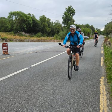
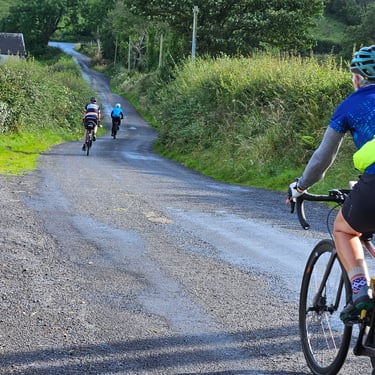
The group comprised two leaders and 14 paying participants. Eight of the latter were from my 2021 LEJOG group so it was a partial reunion. Day 1 was 31st July but we effectively started the previous day with transport from Cork to accommodation in Schull (about 18 miles from Mizen Head). The two leaders, Dominic and Andy, took turns to either drive the van or cycle at/near the back to provide any needed support.
Getting to the Start
The organisers' requirement was to be available for collection at Cork Airport at about 3pm on 30th July. After a brief review of the travel options I decided that the easiest option was to fly from Bristol to Cork on the afternoon of 29th and then stay in Cork overnight and the brand new Premier Inn. There was a frequent train service between Swindon and Bristol with a shuttle bus service to the airport. What was the 16:00 flight at the time of book had been moved to 16:30 and eventually departed at about 17:15. That type of delay is what makes any schedule based on arrival just before the designated land transport time somewhat stressful.
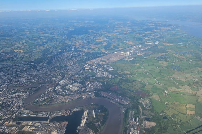
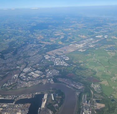
The plane was an ATR-72. I hadn't been on that type of plane before and discovered that seat 9F was next to one of the engines with minimal soundproofing. Any person being paid to sit there would have been given ear protection by their employer but there's clearly no requirement for airlines to treat customers in the same way. It was like sitting for 1½ hours next to an electric hand drier. Fortunately, the sky was fairly clear and I could look out of the window for landmarks. The photo shows the east side of Newport.
Arrival at Cork airport was free of hassle: Down the steps, across the tarmac to the terminal, walk to the other end to pass through passport control where a quick look at my passport was sufficient, then another walk to the baggage hall where, by the time I had made a quick visit to the loo, my bag was waiting on the belt. Then outside to find out where I needed to wait for a bus to the city centre. A timely comment in the WhatsApp group reminded me to exchange the pounds in my pocket with Euros in my bag so, when the bus didn't accept a contactless payment (the reader needed a special travel card), I had some cash to hand. €2.20 was good value.
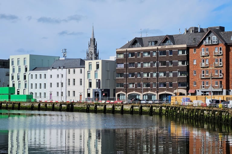
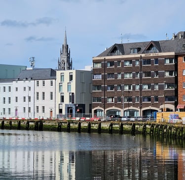
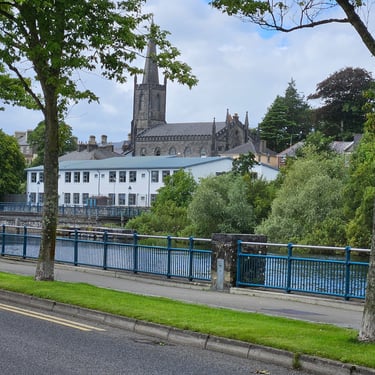
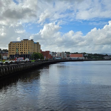
The Premier Inn wasn't difficult to find although it was one of those urban hotels with a front door and not much else visible but was actually quite extensive inside. The entrance is below the spire in the Cork waterfront photo. One unwanted feature of my room was a big telephone occupying space on the desk. It appears that a phone in the room is standard for Irish hotels although the mobile phone network proved to be very good. Another unwanted feature was that the shower door started to slide open which I was using the shower. I presume that someone didn't get something properly level.
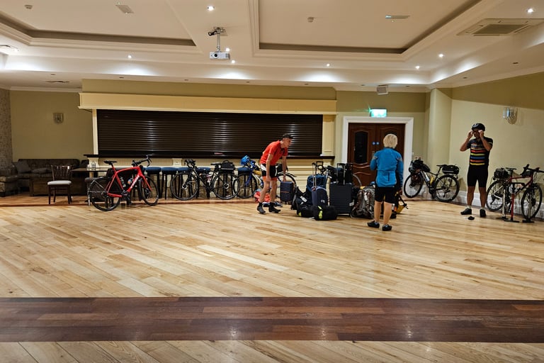
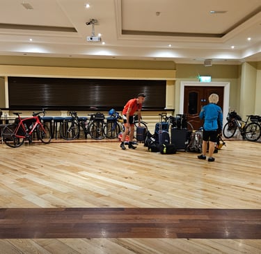
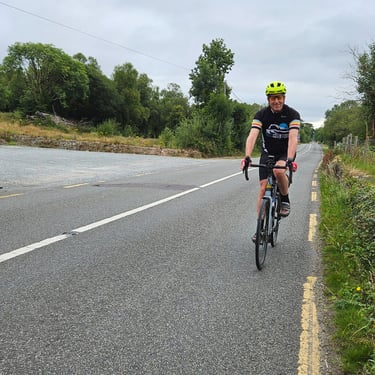
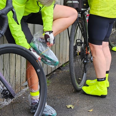
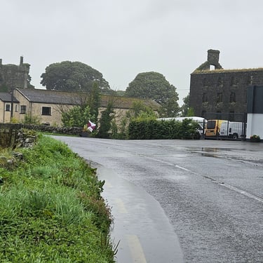
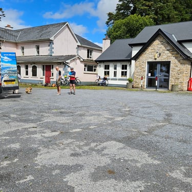
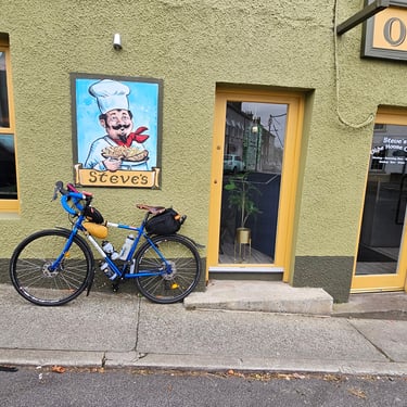
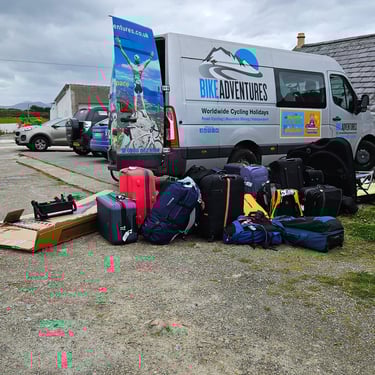
I met up with a couple of my LEJOG group for breakfast and three more arrived late morning after which we had a long lunch and a walk before being collected by the Bike Adventures van (capacity of driver and up to 6 passengers) for transfer to Schull where most of us wer staying at the Schull Harbour Hotel.. Upon arrival we checked in and bikes (boxed and unboxed) were transferred to the spacious ballroom which was serving as the bike shed and was big enough for a quick test ride without taking the bike outside.
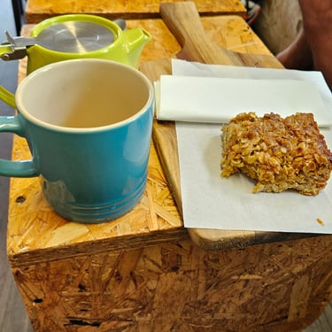
My spacious room contained a fancy coffee-making machine which I hadn't a clue how to operate but appeared to be unsuitable for making tea. I prefer a simple kettle!
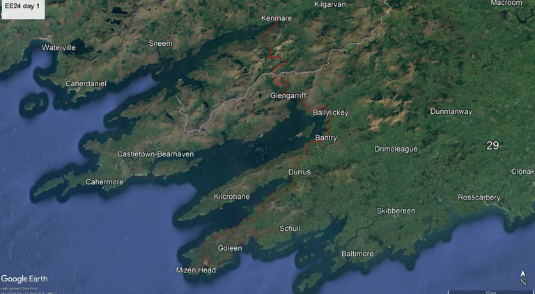
Day 1: Mizen Head to Kenmare
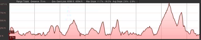
Day 1 (31st July) Summary
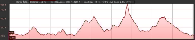
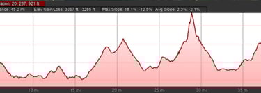
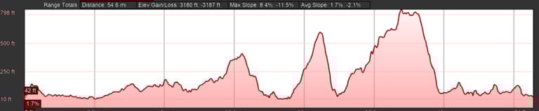
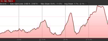
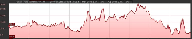
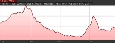
Distance 77.2 miles: Total Ascent = 1,983m (6,505ft)*
Elapsed time = 8hr 40min: Moving time = 6hr 53min
Average moving speed = 11.2mph
*Ascent according to my Garmin Edge 1040 which usually agrees closely with Google Earth. My Edge 530 usually records about 15% less climbing which is more consistent with RWGPS. I assume that the newer hardware is more accurate.
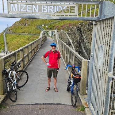
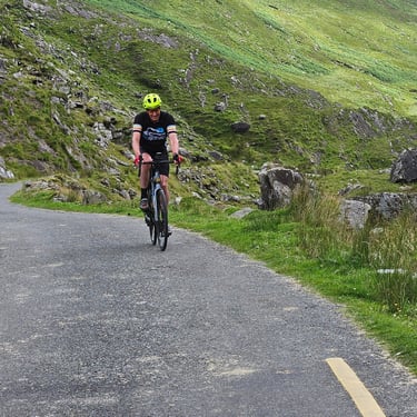
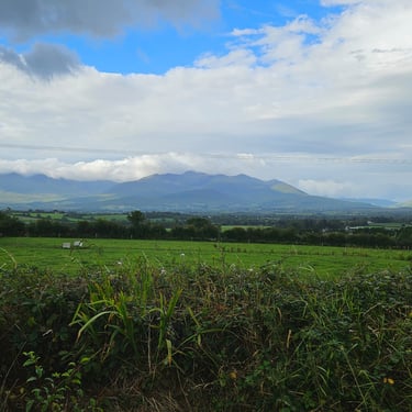
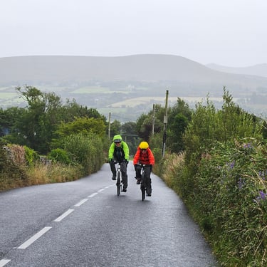
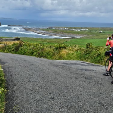
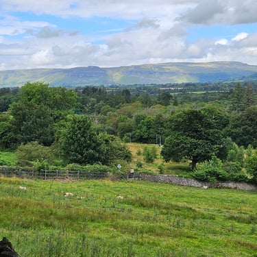
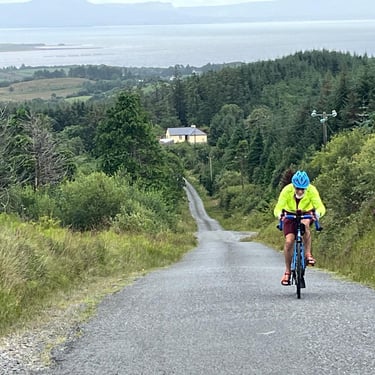
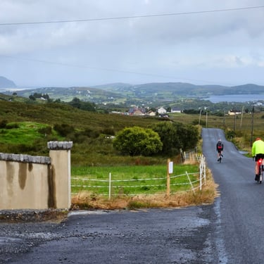
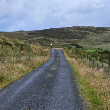
The weather forecast was favourable and some of the participants, myself included, opted to cycle from Schull to Mizen (pronounced Mizzen) Head as well as cycling the main route from Mizen Head to Kenmare. This resulted in a challenging day of 77 miles over somewhat undulating terrain which was often rewarded with some good views due to fairly clear and dry weather. My target of an 8:30 start was scuppered by slow breakfast service. While breakfast was served from 7:30, there appeared to be only one person on duty until 8am when more staff became available. I eventually set out for Mizen Head at 08:45.
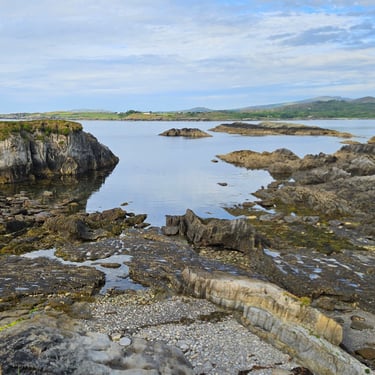
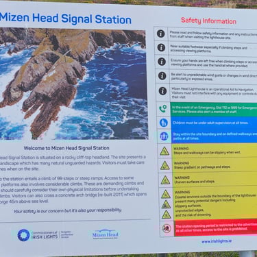
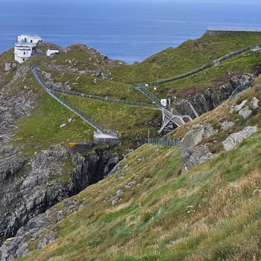
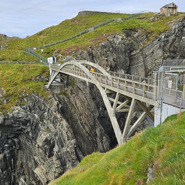
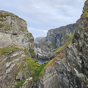
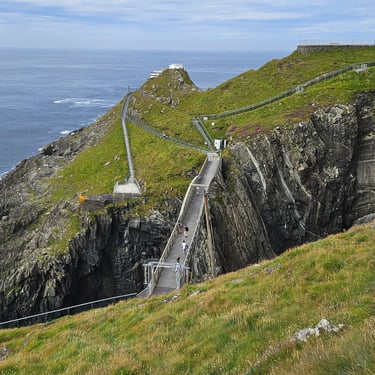
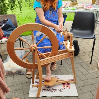
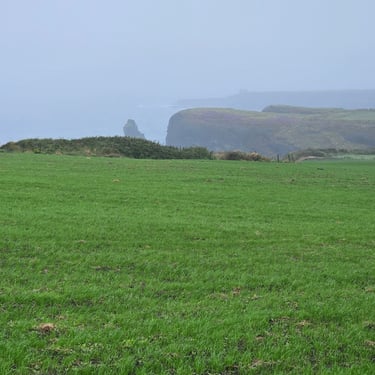
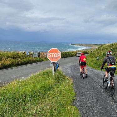
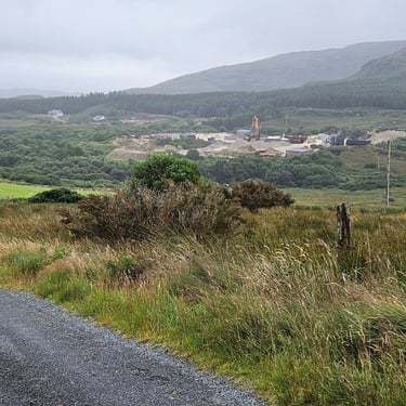
The Mizen Head visitor centre was reached at about 10:15. Nick and myself opted to pay €6 to get closer to the head itself. It was very scenic. We left the visitor centre and headed towards the day's destination. Not far along the road we encountered tour leader Dominic and Daniel try to fix a puncture on the latter's bike. Apparently the tyre was being very stubborn but they finally succeeded ton removing it. A couple of hours and numerous hills later we reached Durres where we could get some basic rations at a community cafe. Two waffles and a banana were better than nothing so I got something extra from my bag (which contains enough emergency rations to get me through a day). There was also an interesting demonstration of wool spinning with thick knitted socks available for purchase.
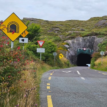
The longest climb of the day, to the Turner's Rock tunnel, was in the afternoon. This was a fairly steady ascent with a modest gradient and was followed by a pleasant descent until the route took us off the main road and up a track to another hill. The main tunnel was only about 200m long and was followed by three other short tunnels. I finally reached the destination at about 5:30pm. It was a long day on the saddle with distance and hills to contend with but, fortunately, not the weather (otherwise I wouldn't have done the optional 18 miles). My room at the Kenmare Bay Hotel and Leisure Resort had plenty of space for both myself and my bicycle and had a kettle.
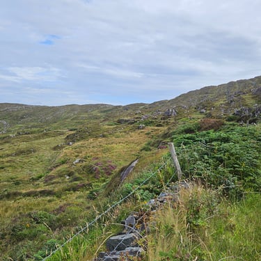
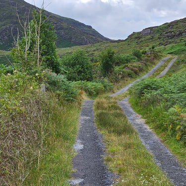
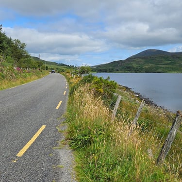
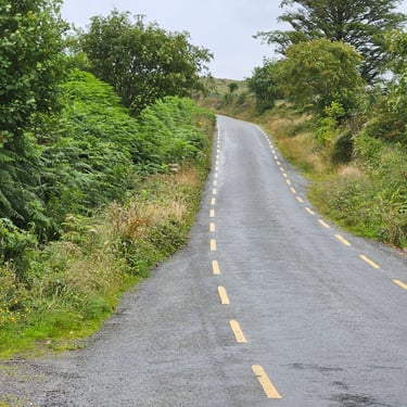
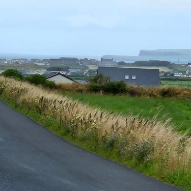
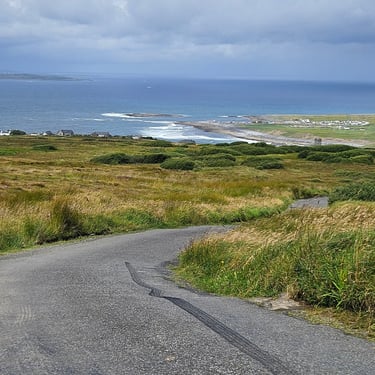
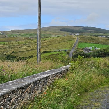
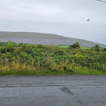
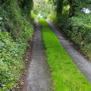
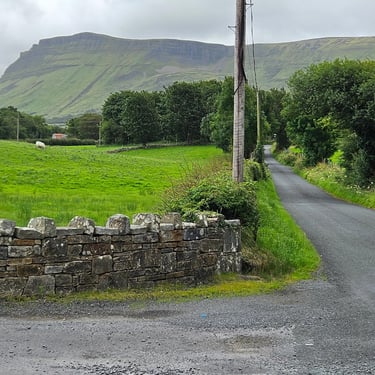
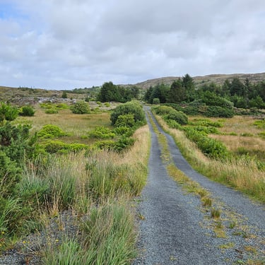
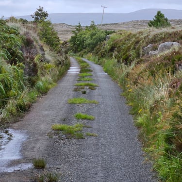
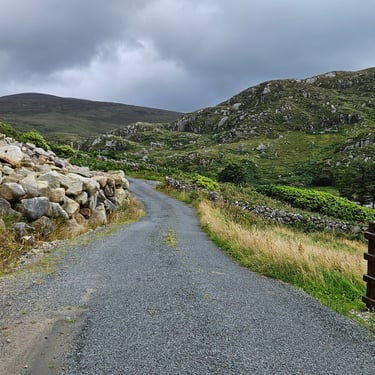
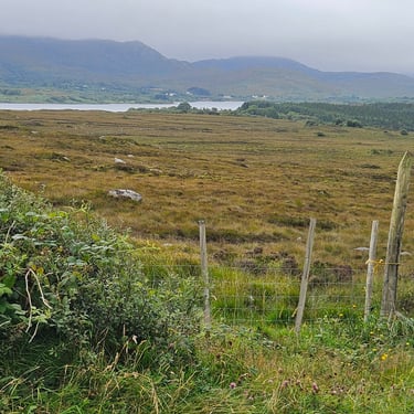
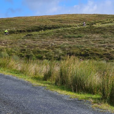
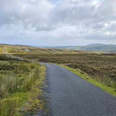
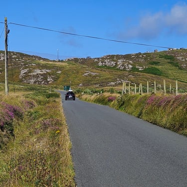
The day's route included two sections on roads which were little better than tracks (both with grass down the middle) which took us off main roads which weren't very busy. The first of these was between 35 and 38 miles (distance from Schull) which took the cyclists over a moderate hill with a moderate view while the pleasant main road was half a mile shorter and much flatter.
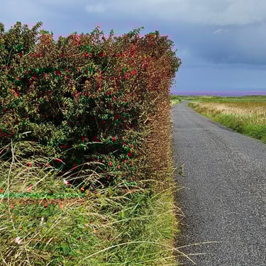
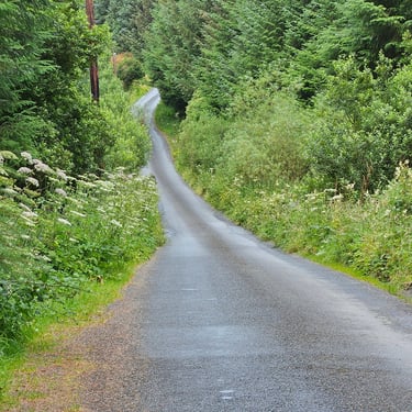
The second of these deviations (starting 66 miles from Schull) included a substantial, unwelcome, big hill and used a narrow lane with hedgerows and, in places, a rough tarmac surface which did not provide pleasant cycling conditions and was potentially hazardous on the descent from the summit. This was was particularly unwanted towards the end of a long day. I like my hill climbing to be followed by a pleasant downhill cruise, not a steep, rough descents with heavy use of brakes. Some participants walked down the steeper sections. A gentle cruise along the not very busy and almost flat main road would have been much more pleasant.
Day 2: Kenmare to Killorglin
Day 2 (1st August) Summary
Distance 45.7 miles: Total Ascent = 881m (2,890ft)*
Elapsed time = 5hr 45min: Moving time = 3hr 48min
Average moving speed = 12.0mph
*Ascent according to my Garmin Edge 1040 which usually agrees closely with Google Earth. My Edge 530 usually records about 15% less climbing which is more consistent with RWGPS. I assume that the newer hardware is more accurate.
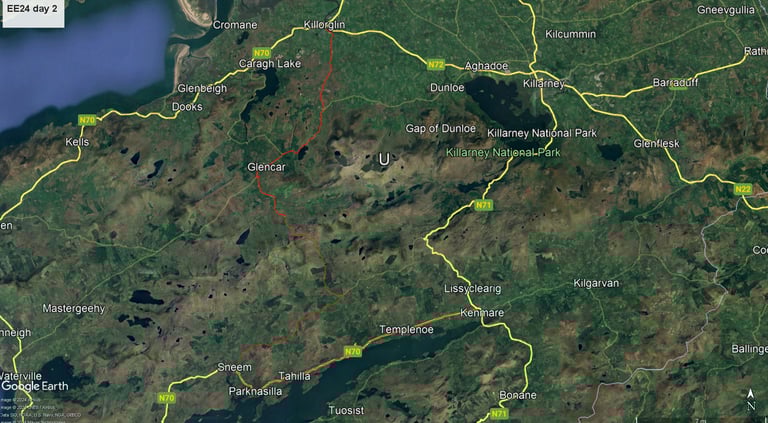
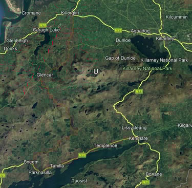
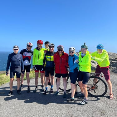
The weather forecast predicted another day of fair weather which proved to be correct and suitable for sitting outside at the stops. It is was a welcome, after the previous day's exertions, relatively short day of less than 46 miles and we set out after a group photo at 9am. The first section of the ride was into the light SW wind. There was no hurry which resulted in a two stop approach to pass the time before check-in at the next accommodation.
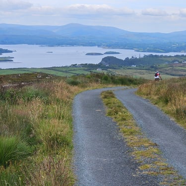
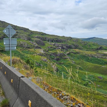
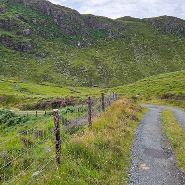
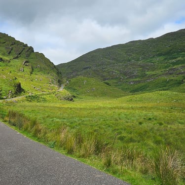
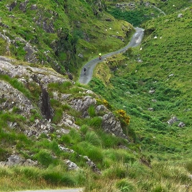
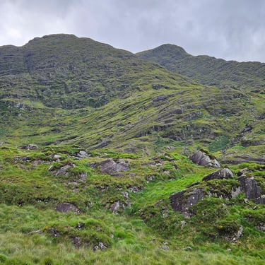
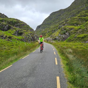
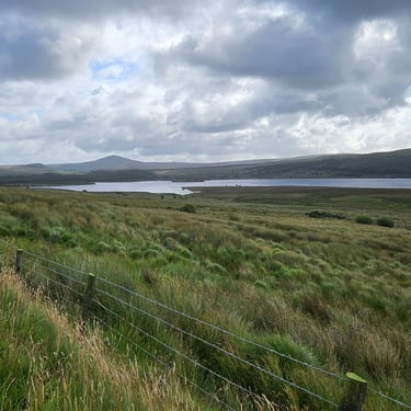
First was a cafe stop at Sneem after about 16 miles. After this was a moderate hill to pass over before embarking on the biggest climb of the day through the Ballach Beama gap. The path through the approaching hills gradually became evident as the climb progressed. Unusually, there were signs at intervals showing the slope to the summit although these were misleading by showing the average slope while the actual slope varied between steep upwards and the occasional short downhill section.
The final part of the gap proved to scenic as well as challenging with a maximum gradient of about 17% for a short distance and, after those ahead of me watched me doing the final climb, I did the same for those behind me. Tour leader Andy, who was on bike duty, demonstrated a burst of energy by sprinting up the final ascent. Descent from the gap was a pleasant section of road. It could have been smoother but was free of very sharp bends.
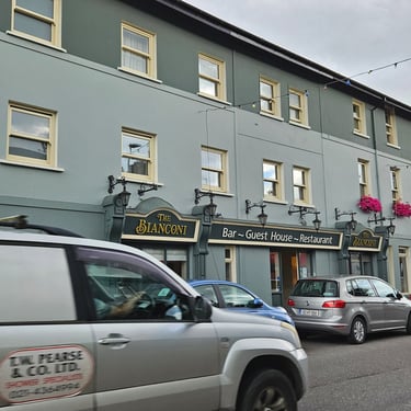
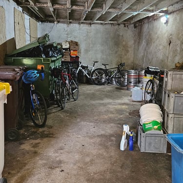
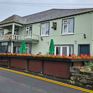
Lunch was taken at the Climbers' Inn at Glencar after which there was a favourable tailwind to Killorgin. Accommodation was at the Bianconi Inn where the staff were very helpful but the wifi connection was poor and kept dropping out. The bikes were accommodated in the store room along with the beer barrels and rubbish.

Day 3: Killorglin to Kilrush
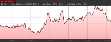
Day 3 (2nd August) Summary
Distance 65.2 miles (includes ferry): Total Ascent = 1,090m (3,576ft)*
Elapsed time = 6hr 54min: Moving time = 5hr 25min
Average moving speed = 12.0mph
*Ascent according to my Garmin Edge 1040 which usually agrees closely with Google Earth. My Edge 530 usually records about 15% less climbing which is more consistent with RWGPS. I assume that the newer hardware is more accurate.
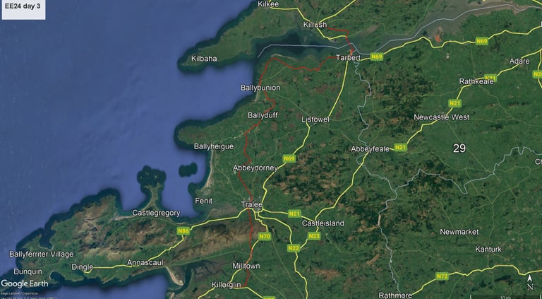
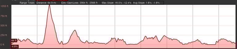

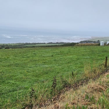
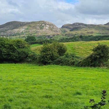
This was a longer day with over 60 miles of cycling. The weather forecast predicted rain, and was correct. Heavy rain arrived at about 09:30, reduced to drizzle at about 13:30 and finally cleared at around 3pm. The wind, from the SW, was generally favourable. There was one major climb to get over the hills south of Tralee. This comprised about two miles averaging 10% to ascent about 300m (1,00ft) and was the high point (topographically) of the whole tour.
Some riders stopped for refreshment on Tralee which I considered to be too early on a fairly long day. I continued to Ballyduff where Nick, who was just ahead of me, was waiting outside a community cafe. The staff were very welcoming and even gave us towels to get ourselves drier. I went to the door to shake water off my jacket and was just in time to stop Colin and Isabel who were also looking for refuge from the weather. One of the locals took one look at Colin, who was heavily clad in waterproofs, and asked if Luke Skywalker had walked in. We spent the better part of an hour there sheltering from the weather before, reluctantly, getting back on the bikes.
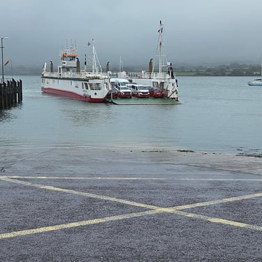
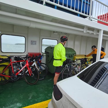
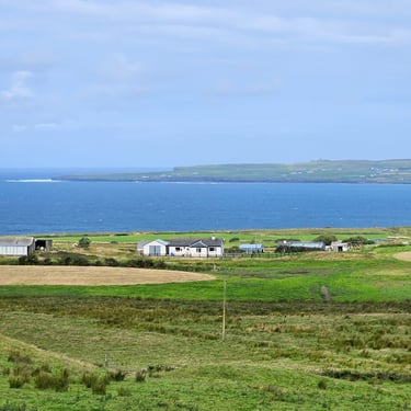
Some riders stopped at Ballybunion for lunch but I opted to keep moving to Tarbet where we has to use a ferry to cross the Shannon estuary. The timetable had indicated that departures from Tarbet were on the half hour and, if a second ferry was in service, also on the hour. A favourable wind helped me reach the terminal just before 2:30pm where several others were waiting and a ferry was approaching. After unloading and reloading it departed at about 2:45. We didn't see a second ferry but there was no view from the cubby hole which served as the bike parking on the ferry. Others reported catching a ferry about half an hour later.
The rain had eased off by the time we left the ferry and the remaining six miles to the accommodation started to dry us out. Accommodation for most was at the Zoe Bistro and Accommodation. This comprised two fairly large adjacent terraced houses which had been tastefully improved. Some bicycles were parked in a corridor while others were under cover in the back yard. A table had been booked at the Oileen Bar where we were served a fixed price three course menu costing €45 per head. That was more than I would normally eat or pay, but I was hungry.
Day 4: Kilrush to Ballyvaughan
Day 4 (3rd August) Summary
Distance 54.9 miles: Total Ascent = 1,155m (3,790ft)*
Elapsed time = 6hr 32min: Moving time = 4hr 33min
Average moving speed = 12.1mph
*Ascent according to my Garmin Edge 1040 which usually agrees closely with Google Earth. My Edge 530 usually records about 15% less climbing which is more consistent with RWGPS. I assume that the newer hardware is more accurate.
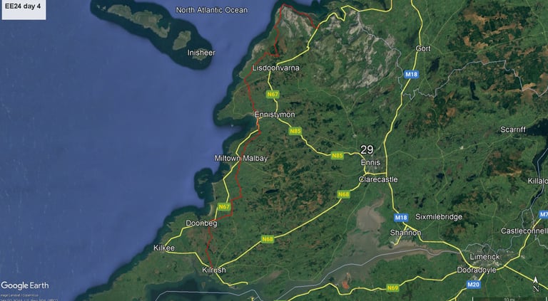
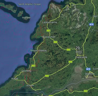
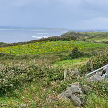
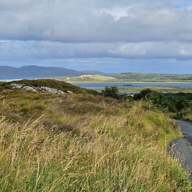
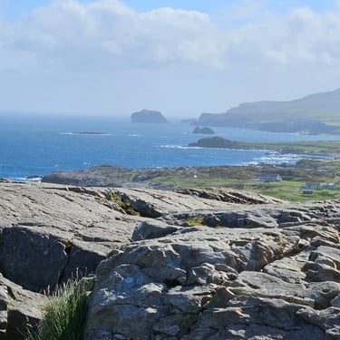
This was a medium length (55 miles) and potentially scenic day which resulted in more photographs than usual. The weather forecast suggested that we might get showers. Breakfast was an unusual combination of food already on the table and a limited menu cooked to order. There was no sign of the muesli I like for starting the day. The upside was that the meal was completed quite quick.
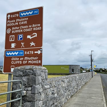
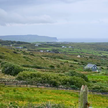
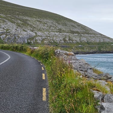
There was a substantial shower about half an hour after starting and other brief spells of dampness. I was wearing my wet weather jacket and good water-repellant shorts so I didn't need to stop. I kept this jacket on all day for the warmth. There were three significant hills of progressively increasing severity. While there were no more significant showers, the cloudy weather didn't properly clear so the distant view of the Cliffs of Moher was hazy.
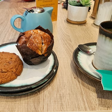
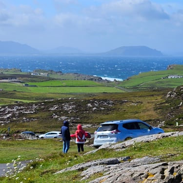
Some people made a stop at Miltown Malbay but I opted for a refreshment stop at Doolin (33 miles) which was more than half way and just before the final and longest climb. I refuelled with a muffin and a very large chocolate chip cookie washed down by a mug of peppermint tea. Calories took precedence over a healthy diet. Other riders arrived while I was indulging while a couple of energetic riders went to the Cliffs of Moher viewpoint to discover that it was heaving with tourists (this being an Irish holiday weekend could be a factor).
The third main hill of the day continued for about 7 miles from Doolin to the summit. It was a bit of a wonky staircase ascent with bits of often steep upwards, flat section and sometimes short descents with the overall upward trend. The subsequent descent was a mixture of pleasant downward cruising and nasty bends needing heavy use of brakes. There were, however, some good views of the coast.
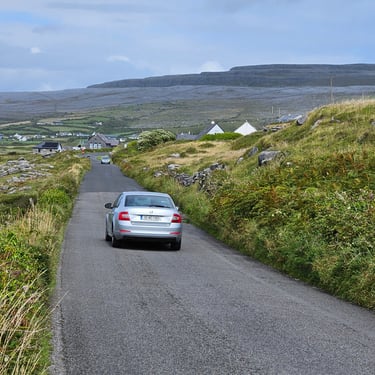
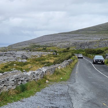
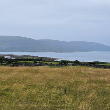
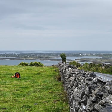
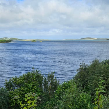
The trip around Black Head was memorable although spoiled by the traffic. After this there a diversion off the main road along some very poor quality lanes and added an extra mile. There has to be a balance between avoiding the main roads and sending the cyclists onto rough surfaces.
Accommodation was at the Hylands Burren Hotel which claimed to have a long history and was very busy. Bicycles went into a shed in the car park. The shed lock had a default combination number which we felt wasn't very secure. Fortunately, all the bikes were still there in the morning, perhaps helped by someone parking close to the shed door so it was difficult to get the bikes out.

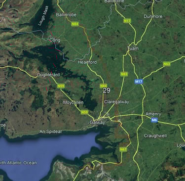
Day 5: Ballyvaughan to Ballinrobe
Day 5 (4th August) Summary
Distance 62.3 miles: Total Ascent = 644m (2,110ft)*
Elapsed time = 6hr 22min: Moving time = 4hr 36min
Average moving speed = 13.5mph
*Ascent according to my Garmin Edge 1040 which usually agrees closely with Google Earth. My Edge 530 usually records about 15% less climbing which is more consistent with RWGPS. I assume that the newer hardware is more accurate.
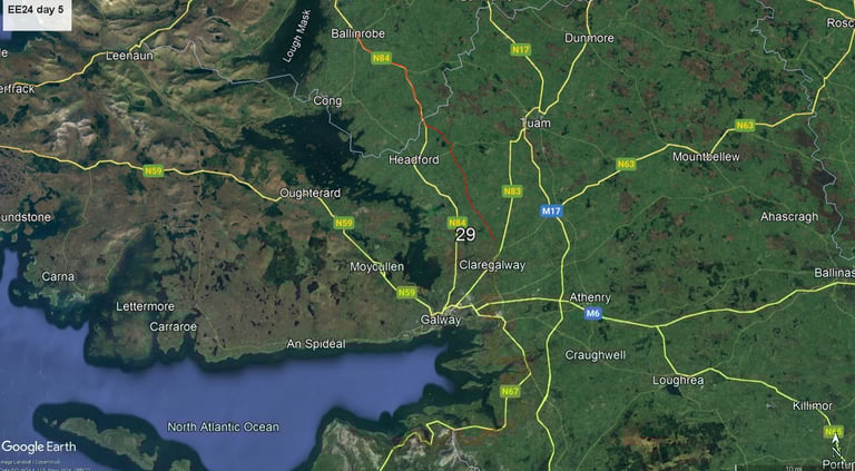
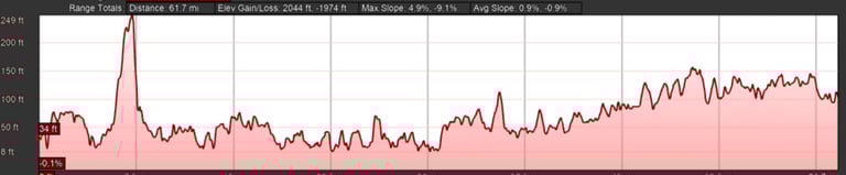
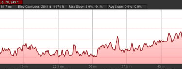
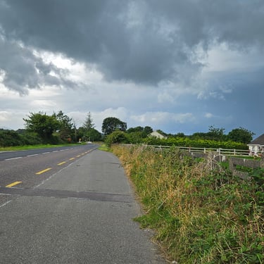
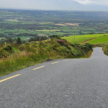
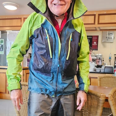
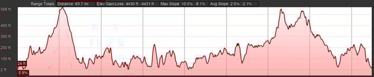
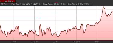
This was a slightly longer but less hilly day. While the profile shows a big hill near the start, that's due to the auto-scaling of the profile. The weather forecast warned us to expect wind and rain and the forecast was correct. The onset of heavy rain, at about 11:30, was later than forecast but thereafter it was very wet and everyone's waterproof clothing was thoroughly tested. The combination is what I decided to call the "Full Irish" rain. Few photographs were taken. We were starting to think there was a pattern to the weather. Andy would be driving the van on odd-numbered days while Dominic was getting wet on his bike. We had been forewarned that the roads around Galway could be busy. This added to the unpleasantness of that section of the journey.
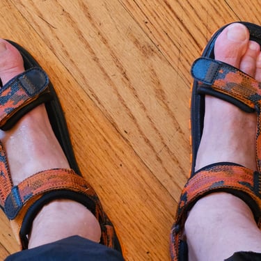
My waterproof jacket performed well but would have been even better if an inch longer at the front where there is insufficient overlap between the jacket and my overshorts, particularly when the rain is coming at an angle. Once the heavy rain had arrived the roads were also sodden which added to the overall wetness. It's Ireland so rain is to expected but we were told that this day was unusually wet. I think I was the only person to arrive with dry socks (I wasn't wearing any after realising several years that sandal's don't fill up with water).
A first stop was made at the Roots cafe at Kilcolgan (22 miles). The rain arrived shortly after moving on. I didn't need to stop as I was already in my waterproofs. A further stop was made at Peggy's Bar (41 miles). Most of the group stopped there although not all at the same time. We were lucky to get space on what was a busy day due the Bank holiday and the staff were very accommodating although they had to keep mopping up the big puddles of water that had dripped off the soggy cyclists.
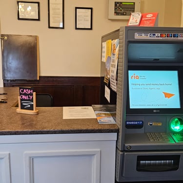
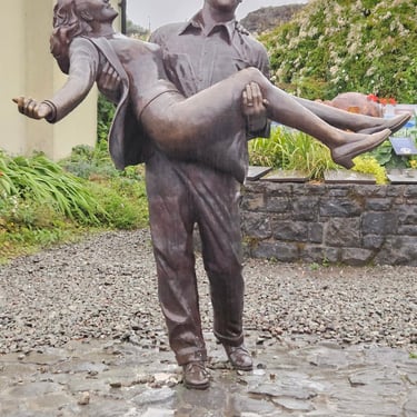
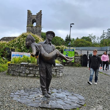
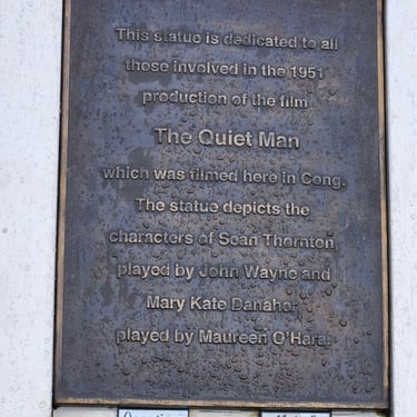
After that stop it was a matter of getting to the end as quickly as possible to minimise the time in the foul weather. The SW wind was between a crosswind and tailwind. I helped progress but with the hazard of occasional gusts of crosswind through gaps. There was a shortage of accommodation in Ballinrobe and five of the group (including myself) were taken on the van to Cong which continues to make money from John Wayne featuring in a film made there in 1951. We stayed at the Danaghers hotel which said that it did not accept card payments but had an ATM built into the reception desk!
Day 6: Ballinrobe to Sligo
Day 6 (5th August) Summary
Distance 68.2 miles: Total Ascent = 1,014m (3,3300ft)*
Elapsed time = 5hr 50min: Moving time = 4hr 58min
Average moving speed = 13.7mph
*Ascent according to my Garmin Edge 1040 which usually agrees closely with Google Earth. My Edge 530 usually records about 15% less climbing which is more consistent with RWGPS. I assume that the newer hardware is more accurate.
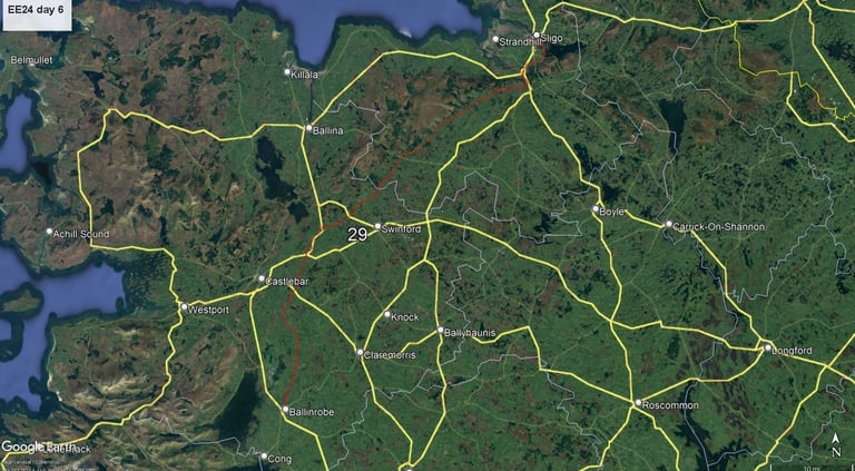
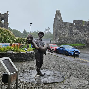
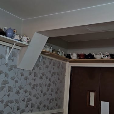
This was a much better day for cycling, perhaps because it was Andy's turn to cycle. After breakfast (where there were dozens of teapots on a shelf around the top of the wall) I was able to take a dry look at the John Wayne statue before the van came to return us to Ballinrobe to be reunited with our bikes.
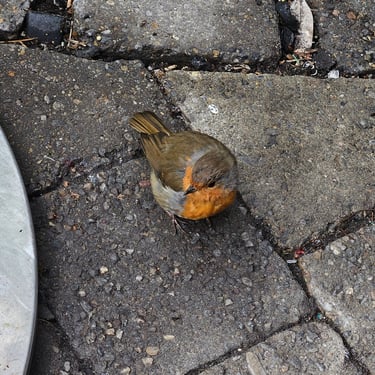
After returning to Ballinrobe I was accosted by a friend robin wishing me good luck. It was 68 miles to Sligo, the wind was helpful, the rain had cleared through and was followed by some welcome sunshine. Good progress was made, partly because it was an Irish bank holiday Monday and most places were shut.
However, good progress was needed as it was a late start on the saddle due to breakfasts being served later than normal and the need for some participants to be transported back from Cong to Ballinrobe. I cycled almost 29 miles in the first two hours which, by my normal standards, is speeding. A assistive wind and some relatively flat terrain makes cycling pleasant and put a smile on my face (unlike some days). Conditions got hiller and slower later on.
Refreshment was a snack taken at about 39 miles in the car park of the Ox Mountain cafe. A sign by the road said that the cafe was open every day, but this was bank holiday Monday so it wasn't. The van had procured some snacks from one of the few open convenience stores to supplement the emergency rations carried by the cyclists. A helpful local lady pointed out that the toilets on the side of the cafe building were open, which was much appreciated.
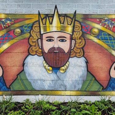
The afternoon's cycling was more undulating including narrow lanes where care was needed to steer a path between vegetation overhanging from sides and the wide strip of grass in the middle. There were also the now-familiar nasty little hills. The final approach into Sligo was made more pleasant by some large murals painted on the roadside retaining wall.
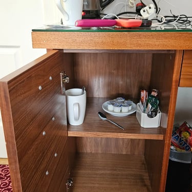
Accommodation was at the Sligo Southern Hotel with the bikes in the ballroom. My room was well-equipped but I was surprised to see no tea-making equipment. Then I pulled on the handle of the top drawer of a rather petite desk to discover a cupboard which had four drawer handles on the front. This contained the much-needed equipment. I need several mugs of tea at the end of a long day before I contemplate any stronger drink.

Day 7: Sligo to Killybegs
Day 7 (6th August) Summary
Distance 70.8 miles: Total Ascent = 1,615m (5,300ft)*
Elapsed time = 7hr 18min: Moving time = 6hr 04min
Average moving speed = 11.7mph
*Ascent according to my Garmin Edge 1040 which usually agrees closely with Google Earth. My Edge 530 usually records about 15% less climbing which is more consistent with RWGPS. I assume that the newer hardware is more accurate.
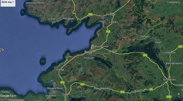
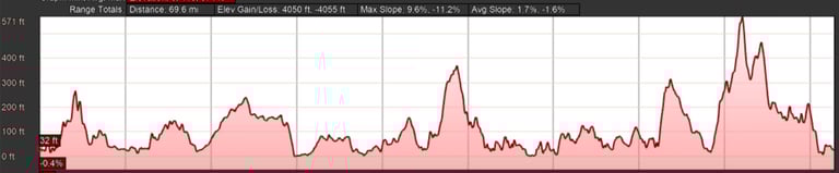
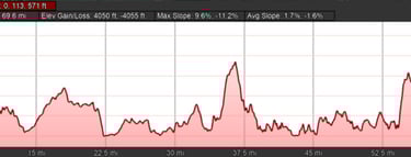
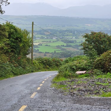
This was going to be a long day of just over 70 miles with more hill climbing than the previous day so I was on the bike before 9am. This was Dominic's turn to cycle so the weather forecast predicted a moderate SW wind with some potentially heavy showers. Theses showers duly arrived and while, not torrential, combined with the wind they made cycling very unpleasant at times with care needed during the afternoon to avoid being blown off course by crosswind gusts. The final part of the ride was into the wind.
The ride profile showed a significant climb late in the ride with numerous other shorter, but often steeper, hills which became tedious, particularly when followed by steep but short descents in narrow lanes. The overall route appeared to have been planned by someone who had consumed too many pints of Guiness as it went in every direction possible. That said, we were occasionally rewarded by some good views which wouldn't be seen from the main road. The wiggly route resulted in the occasional tailwind, sometimes a full headwind and often a crosswind. Killybegs is only 25 miles from Sligo in a straight line (although there's water to cross).
A stop was made at the Buoys and Gulls cafe in Bundoran which served very large and tasty flapjacks. One of these helped me on my way. I opted to not stop in Donegal which suffered from severe congestion and I was aware that it would be a slow day and finishing would be further delayed by a cafe stop. However, I stopped under a tree just after the town to shelter from a shower and eat a couple of bars from my bag to supplement the energy provided by the flapjack.
There were many more ups and downs (the climb into Mountcharles was particularly nasty) before reaching the main hill of the day. A stop at the top was shortened by the arrival of a shower whereupon I headed downhill as fast as I felt was safe (about 30mph) as the road was straight although not very smooth. Overall, my average moving speed was 11.7mph, some two mph slower than the previous day which had a more favourable wind direction and generally better roads.
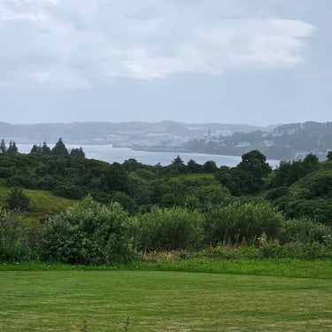
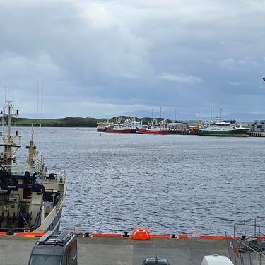
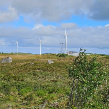
When I checked into the Tara hotel the receptionist asked how I was feeling. After a short pause, I replied "knackered". The hotel overlooked what appeared to be primarily a fishing port although a stack of wind turbine blades was visible in the distance. The bikes slept at one side of the ballroom.

Day 8: Killybegs to Dunfanaghy
Day 8 (7th August) Summary
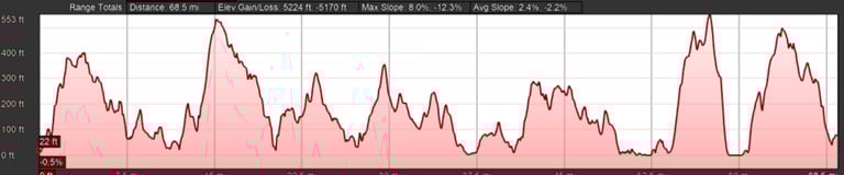
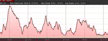
Distance 64.6 miles: Total Ascent = 1,762m (5,780ft)*
Elapsed time = 7hr 07min: Moving time = 5hr 37min
Average moving speed = 11.5mph
*Ascent according to my Garmin Edge 1040 which usually agrees closely with Google Earth. My Edge 530 usually records about 15% less climbing which is more consistent with RWGPS. I assume that the newer hardware is more accurate.
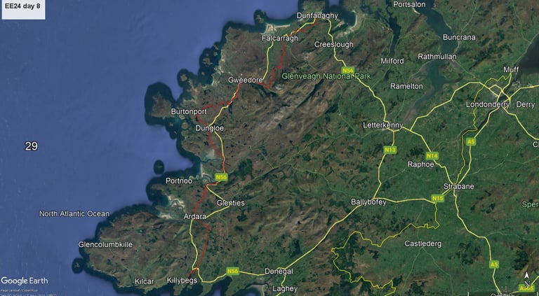
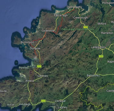
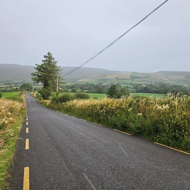
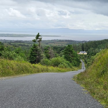
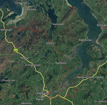
The weather started damp but gradually dried out except for occasional showers. There was a strong, cool, westerly wind with occasional glimpses of sunshine. A fairly long day awaited so I was on the bike at 8:30am. Overall, the route cut across the north west corner of Ireland and was particularly exposed to the wind. The first 5 miles were spent in retracing the previous day's route. This section was part of a fairly steady climb to the first summit at 9 miles.
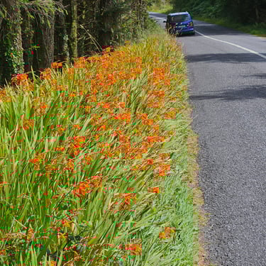
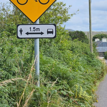
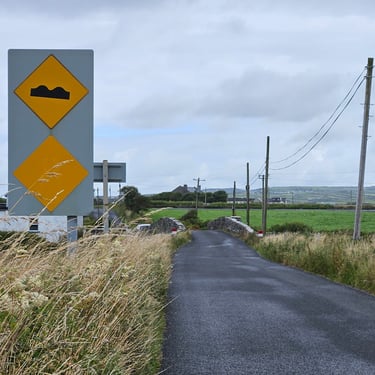
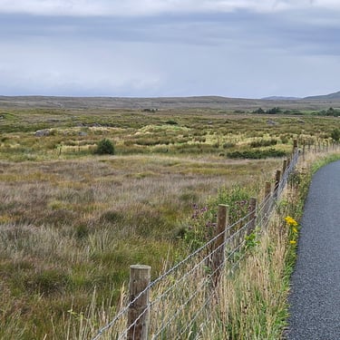
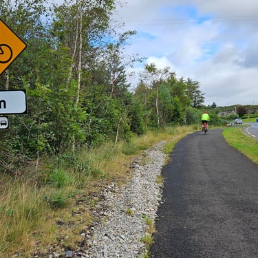
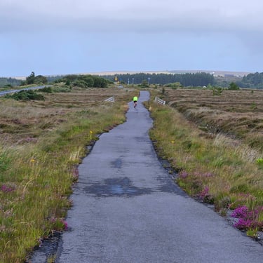
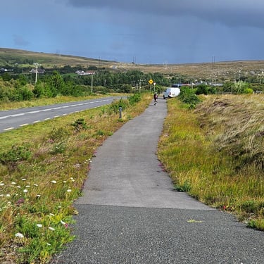
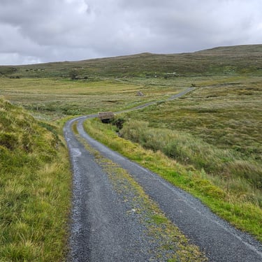
One highlight of the day was a section of segregated cycle track/footpath parallel to the N56 road. This delight (apart from a short narrow section with a loose gravel surface) lasted about 6.5 miles. It was part of Euro Velo 1 where there was no easy alternative along minor roads and money must have been found to build this segregated track rather than use a fairly busy road.
A late morning cafe stop was made in Dungloe, some 29 miles into the ride. The route, following EV1, then crossed an area of open moorland and included two miles along the long-closed Letterkenny & Burtonport Extension Railway. Unfortunately, the surface had deteriorated which made it an uncomfortable, but nonetheless pleasant, alternative to being on a road.
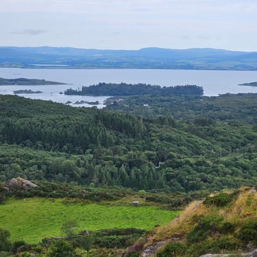
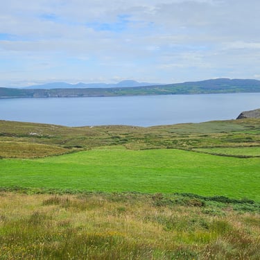
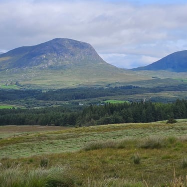
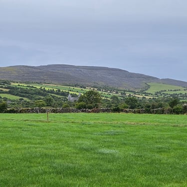
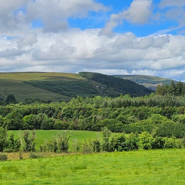
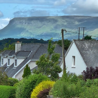
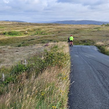
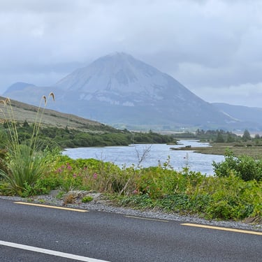
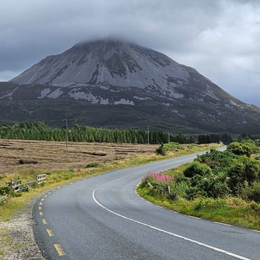
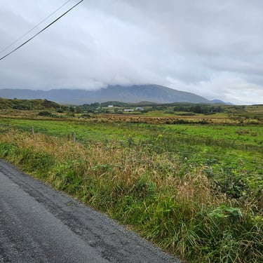
Later on, after several miles actually on the N56 road, a rocky mountain called Errigal started to dominate the skyline ahead and appeared to be the shape of a volcano. Errigal is the highest of a range called the Seven Sisters. The route then passed through an extensive area of undulating open moorland which felt that it was in the middle of nowhere although the main road was only a few miles away. Two of Errigal's siblings came into view. With about 15 miles remaining I found somewhere out of the chill wind (which was very noticeable on the open moorland) to park my bike and eat some snacks from my bag. However, I was keen to reach the end and get refuge from the wind.
The weather turned brighter towards the end of the ride. Perhaps this was due to having some shelter from the weather carried in on the wind. The Arnolds Hotel in Dunfanaghy overlooked the bay which was soggy sand when I arrived but the tide came in later on. The bike store was a locked container in the car park. My room was adequate but my disabled-friendly bathroom was capacious. The WiFi signal was very weak (a common problem in the older hotels) and just usable if I sat close to the door of my room.
Day 9: Dunfanaghy to Buncrana
Day 9 (8th August) Summary
Distance 70.0 miles: Total Ascent = 1,906m (6,250ft)*
Elapsed time = 7hr 21min: Moving time = 6hr 27min
Average moving speed = 10.9mph
*Ascent according to my Garmin Edge 1040 which usually agrees closely with Google Earth. My Edge 530 usually records about 15% less climbing which is more consistent with RWGPS. I assume that the newer hardware is more accurate.
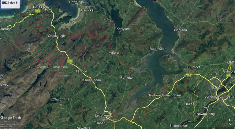
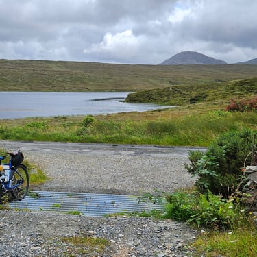
Another rainy day with a strong SW breeze was forecast. The rain was expected to be fairly heavy from mid-morning to mid-afternoon. Riders had the choice of a short (31 miles) day by using the ferry from Rathmullan to Buncrana or a somewhat more challenging and fairly hilly 70 mile journey around the south end of the water. Only three brave souls (myself included) opted for the latter. A few others said the weather forecast put them off. I felt that with my London - Venice trip getting closer I needed the challenging exercise.
Given the long day I was on the bike soon after 8:30am. The other two left a few minutes earlier and I never saw them again. I was keen to get as far as possible before the rain arrived. In reality, although there was some early drizzle, the real rain did not arrive until just before 2pm. The cycling tour leader would be with the main group so I set up my phone to share my location on WhatsApp so they could track my progress. The van would come to our help if necessary.
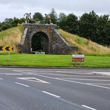
My legs were feeling tired after several days of hard work and I approached each hill with dread. There were the usual short and steep ups and downs as well as the main hills. There was a long and steady climb between 13.5 and 15 miles with a gradient between 5 and 10% - typical of the Alpine passes was was expecting to encounter later in the month. I had identifed a cafe in Ramelton (28 miles) as a possible refreshment stop. Unfortunately, the main menu was a full breakfast so I got back on the bike and continued. I saw no further cafes but didn't go out of my way to seek any. There should have been something in Letterkenny but I was conscious that my progress was slow and I needed to minimise stoppage time so, after gettng through the town (with its memorable Dry Arch roundabout), I stopped where I could lean my bike against a gate and munch a few snacks from my bag.
On paper, there should have been a modest tailwind once I had passed Letterkenny and the route trended northwards but it wasn't noticeable. Then the rain started but the lack of wind meant I wasn't getting pressure-washed from the side. From 40 to 59 miles the route wiggled around trying to follow the N13 road but not using it. This resulted in five crossings of the same, fairly busy, main road. Two of the crossings were half a mile apart in Newtown Cunningham. It would have been much easier to have use the main road for this short distance. The last ten miles involved another minor road trip over a substantial hill instead of using the relatively flat and not very busy R238.
I finally reached the middle of Buncrana which the track on my Garmin said was the end of the ride. There was no hotel to be seen! Where was it and how do I get there? I spent about ten minutes in the rain trying to figure this out (touchscreen devices don't like rain and there was no convenient shelter) and was approaching having a plan when my name was called out. Dominic had arrived with the van. He and Andy had been following my progress, wondered why I had stopped and then realised that I had reached the end of the provided track. He wondered where the other two cyclists were, and so did I. Anyway, my bike went into the back of the van and I was taken to the hotel where the bike storage was in a glazed corridor (useful for getting the bike dry). It also stopped raining. Dominic went back to my pick-up point to wait for the other two who soon arrived (they had suffered a navigation glitch early on which put them behind me). My room in the Inishowen Gateway Hotel was comfortable and included a very welcome bathtub. A good soak was needed after a long and wet day.
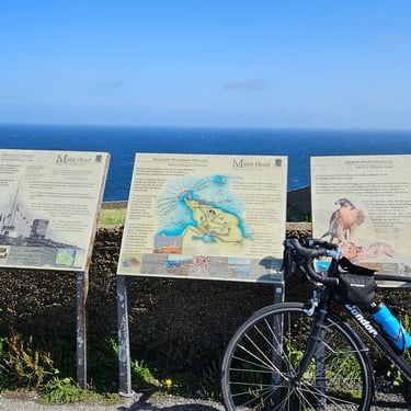
Day 10: Buncrana to Malin Head
Day 10 (9th August) Summary
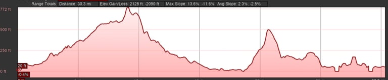
Distance 30.5 miles: Total Ascent = 815m (2,670ft)*
Elapsed time = 3hr 07min: Moving time = 2hr 41min
Average moving speed = 11.4mph
*Ascent according to my Garmin Edge 1040 which usually agrees closely with Google Earth. My Edge 530 usually records about 15% less climbing which is more consistent with RWGPS. I assume that the newer hardware is more accurate.
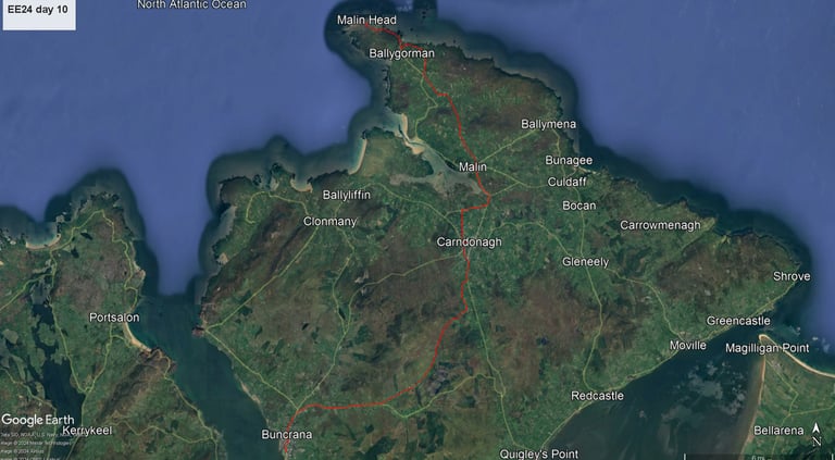
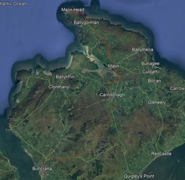
The weather forecast indicated a strong SW wind with the risk of showers. We were asked to try to reach Malin Head by 11:45 so that, after a few photos, we could backtrack 3 miles to the Seaview Tavern where we would have lunch prior to being picked up by a bus for transport to Derry (while in Ireland, Londonderry once over the border).
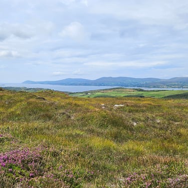
The route contained one larger hill and one medium one together with the usual lesser undulations. The large hill proved to be very easy, largely due to a strong tailwind although there was a steep section just before the top. Once over the summit there was about half of mile of relatively flat road where the wind assistance meant I cruised at 20mph without pedalling. On reaching Carndonagh I came across Dominic who pointed out that there was a cafe a short distance off-route. Given the wind-assisted good progress I decided that there was some time to spare and joined some others taking refreshment.
At the bottom of the medium hill I overtook two younger men with bikes well-loaded with panniers. Overall, this hill was harder work than the first, with more steep sections. The route gradually turned westwards as it approached Malin Head and the nice tailwind became a nasty headwind. About two miles from the head I approached a T-junction just in time to see the same pair of cyclists pass ahead of me. They had evidently chosen a path of lower resistance. I was behind them to the end and amazed that they managed to cycle up the hills and into the headwind. So did I, but I resorted to bottom gear and wasn't carrying a load of baggage.
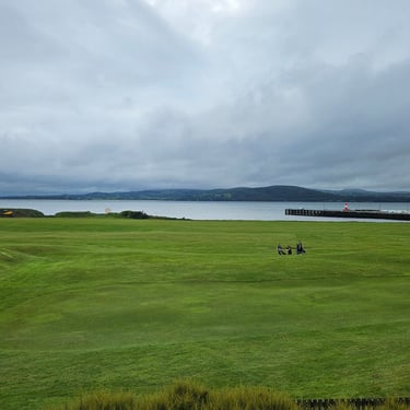
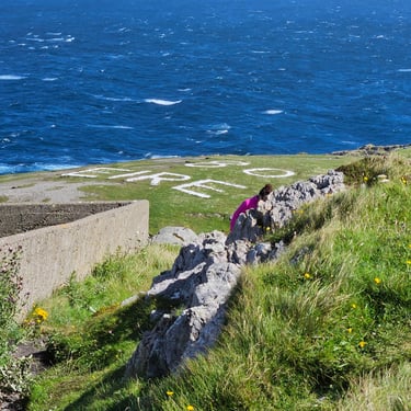
It was blowing a gale at Malin Head and I couldn't stand upright for fear of being blown over. Fortunately, the weather stayed dry. Various photos were taken although none of the full group as we had arrived at different times. Dominic handed out Malin Head fridge magnets to serve as our certificates for completing the ride. Nobody fell off and there were, to my knowledge, only two punctures.
We then escaped to the relative tranquality of the Seaview Tavern where Dominic paid for a round of drinks before we settled in to some lunch. As 2pm approached we discovered that Dominic and Andy were busy taking front wheels off bikes so that they could be packed into the van sideways as tightly as possible. The bus was coming with a trailer but it was sufficient only carry the bags, not the bikes.
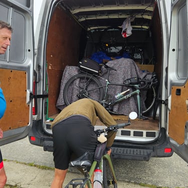
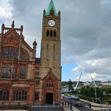
The journey to (London)derry was uneventful. The border was noticeable only for the road signage and speed limits changing from km to miles and prices from Euros to Pounds. I saw a petol station close to the border which had signs showing prices in both currencies. On arrival at our accommodation, the delightfully named Serendpidity House (actually two large terrace houses joined together) the first task was to get bikes into boxes ready to go home. I only removed my pedals and mirrors which went into my saddle bag along with spare emergency rations as the bike would stay with Dominic ready for its next adventure that was schedules to start in just over a week.
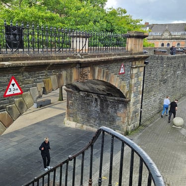
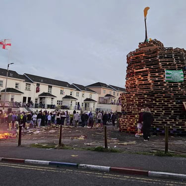
As evening approached we visited a little of the city and looked for somewhere to eat. We ended up in the Ulster equivalent of Wetherspoons which was busy and served generous portions of food. It was dark when we emerged and we had to figure out how to get back to our accommodation. The locals were getting ready for some celebrations as they had a small bonfire. A monster stack of pallets was a potential bigger bonfire (probably on 15th August).
Getting Home
Getting home was relatively easy. I, along with three others, had booked the 10:45 Loganair flight from Londonderry to Heathrow and would be taken to the airport on the van. We had been forewarned that some city centre roads would be closed from 9am onwards due to planned marches so a continental breakfast was served at 7.30am with the objective of moving by 08:15. We were a little later in departing due to waiting for the bus, which was taking the others to Belfast, arrive and get loaded.
Nonetheless, we were at the airport by 9am and had to wait for the check-in desk to open. Once checked-in an through security we had some refreshments in the departure lounge while waiting for the plane to appear. Eventually a very clean looking Loganair Embraer 145 parked outside the terminal. We were late boarding and taking off but the pilot then announced that we would arrive on time as there was a tailwind. He was correct.
At Heathrow we parked on the apron near Terminal 2 and a bus shuttled us to the bowels of the terminal. A short walk took us to our baggage reclaim (not the main baggage reclaim area) and then it was another short walk to a door into the arrivals hall. No passport control and no customs to potentially add delays so I was out of the terminal withn 25 minutes of landing. If only the international arrival experience was so smooth!
The next challenge was to find which of the numerous bus stops was used by the RailAir link to Reading. Once found, and large and empty bus arrived within a few minutes. A further three people were picked up at terminal 5 after which we headed down the motorway to Reading. Then it was the next train to Swindon and the next bus to my local area so I was home at 3pm.
The sting in the tail was that a couple of days after getting home I started to feel off-colour and two days later I decided to do a covid test: Very positive. Where did it come from? Someone on the plane/train/bus? Or maybe the youngest member of our cycling group whom I had sat with at breakfast on the departure day and who had said he was feeling off-colour. Whatever the source, this had implications for a timely start to my next trip, but that's another story.