
London to Venice 2024
Contents
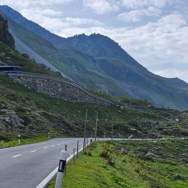
This tour has been a long-standing trip in the Bike Adventures list but only takes place every few years. After my short encounter with the Alps in 2023 by cycling up the 600m climb from the Presta Hotel to the top of the Oberalp Pass, I rashly decided that I should take on a bigger Alpine challenge before I became too decrepit to consider it.
Getting to the Start
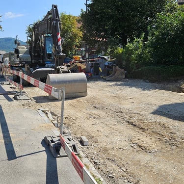
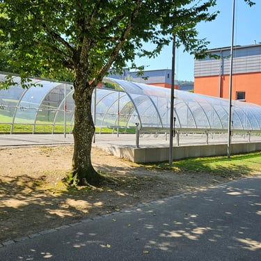
Once the trip was confirmed I had booked a room at the Clapham Premier Inn which is about a mile from the designated starting point at the Windmill Hotel on Clapham Common. I also bought a train ticket from Swindon to Wandsworth Road station (not far from the Premier Inn), The Sunday afternoon travel pricing towards London was extremely reasonable (about £12).
Alas, the expenditure was wasted as I was at home after reporting a positive covid test result the Wednesday before the trip was due to start. Bike Adventures required a negative covid test result before I could join the group in case I passed on the bug. There was, however, no similar testing requirement for other participants to see if they might be covid carriers and the current NHS guidance is to assume that it is safe to mix with other people five days after a positive test and if feeling OK.
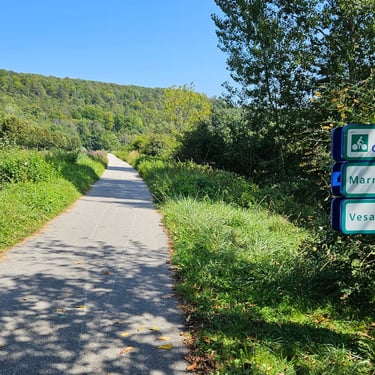
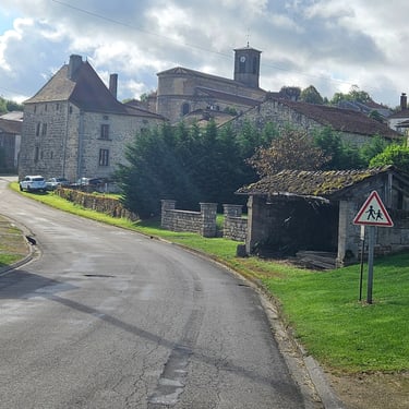
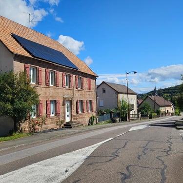
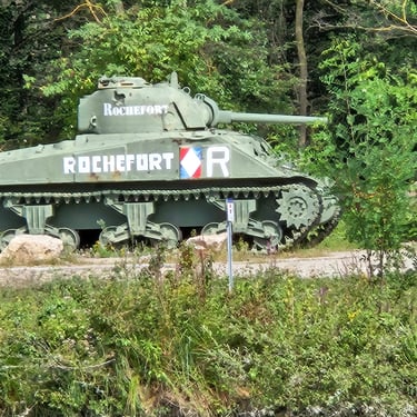
Day 1: London to Lewes
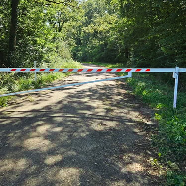
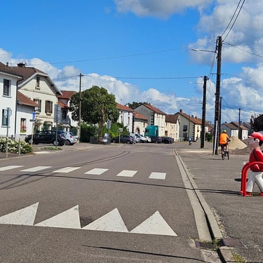
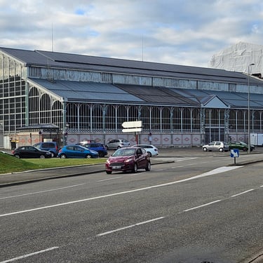
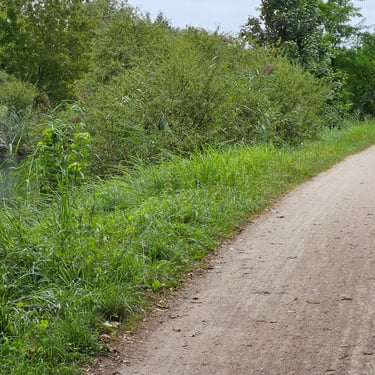
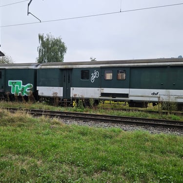
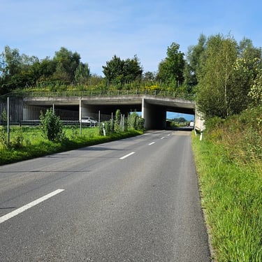
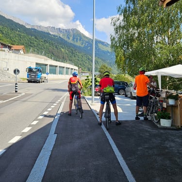
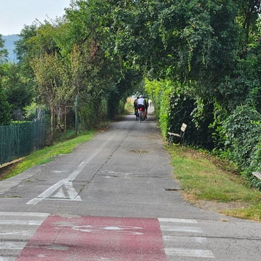
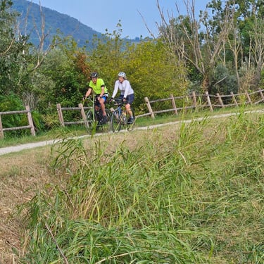
19th August: The distance was a nominal 60 miles starting at the Windmill Hotel on Clapham Common. I understand that the day was uneventful.
I was still waiting at home waiting for a negative covid test result.
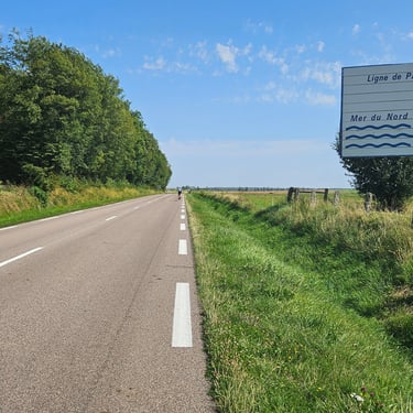
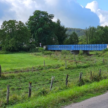
Day 2: Lewes to Gourney-en-Bray
20th August: The distance was a nominal 57 miles but was effectively a long day with departure from Lewes at 7am after a rushed Premier Inn breakfast to ensure being at the Newhaven ferry terminal by 8am. Then, after landing in Dieppe in the afternoon there was another 48 miles through some heavy rain to the hotel. I was happy to miss this!
I was still at home waiting for a negative covid test result and was quite happy to miss this day with it's very early start and wet weather. My covid test, however, was only slightly positive, which was promising, so I went out for a 23 mile bike ride at home to get my legs working again after a week of idleness.
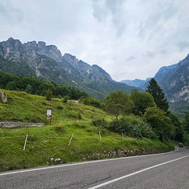
Day 3: Gourney-en-Bray to St Witz
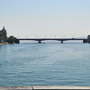
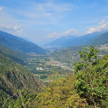
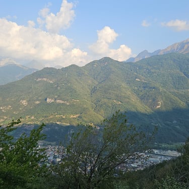
21st August: The distance was a nominal 68 miles to reach the edge of Paris.
I did a covid test before breakfast and was pleased to get a negative result as I could now plan to join the group. Unfortunately, the Easyjet flight from Bristol to Paris that afternoon, which had space the previous evening, was now full. This was most inconvenient as the group would be near Paris CDG that evening. I therefore booked the flight next day and would have the unwelcome challenge of getting from CDG to Provins or somewhere nearby from where I could be collected. I then went for a 45 mile bike ride and took 10 minutes longer than before covid struck.
Day 4: St Witz to Provins
22nd August: The distance was a nominal 67 miles but I wasn't there.
While the group was enjoying a sunny day of cycling, I had to get myself from Swindon to Provins. First a local bus to the railway station, then a train to Bristol Temple Meads (fortunately running to time), then the airport bus to Bristol airport to check in for the 12:15 flight to Paris. The plane was running to time but, most inconveniently, boarding coincided with rain arriving so I got a bit damp on the walk across the tarmac and up the steps. The plane landed ahead of schedule, passport control was fairly efficient and my bag was waiting on the carousel.
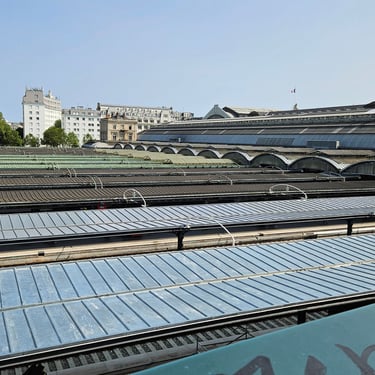
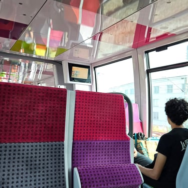
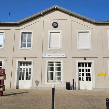
Now the big challenge started: Finding my way to Provins. My research showed that I needed the metro from the airport to Gare du Nord, walk a few minutes to Gare de l'Est and find a train to Longueville, a few miles, from Provins, where I would be collected by the van. The bigger challenge was getting tickets. Someone pointed out the ticket machines at the airport for the metro and, €11.80 poorer, I had a ticket in my hand and could get through the barrier. After about 10 stops I was in the bowels of Gare due Nord. This station, I discovered, was a cross between a maze and a rabbit warren. I needed the exit to Rue du Dunkerque and the signs pointing the way became absent as I got nearer the exit. Eventually, with guidance from the information staff, I emerged into the street.
After a short walk I reached Gare de l'Est (another enormous station) where a much bigger challenge awaited me:That of getting a ticket to Longueville. There were plenty of ticket machines. They allowed me to select Longueville but then said "no tickets available". I tried going to the main ticket office but was turned away and told to go to a different part of the station where I had already been. Eventually, a helpful information person showed me another, smaller, ticket office. I had walked passed it a couple of times without seeing it as I was looking for overhead signs. This one just had a sign over the window. After queuing for several minutes I ended up with the necessary ticket in exchange for €6 - good value for nearly an hour's travel. I think Longueville is within the Paris region and their commuter tickets are very affordable. There is a multi-storey car park next to Longueville station which suggest significant commuter traffic.
After reaching Longueville I phoned, as previously arranged, one of the tour leaders to come and collect me. Once he had arrived, he watched me take another covid test to demonstrate that I was free of infection before being allowed to get in the van and be taken to join the group in Provins.
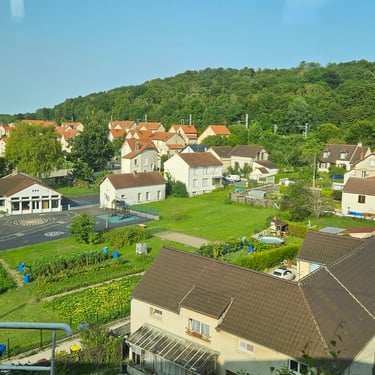
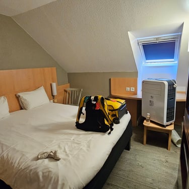
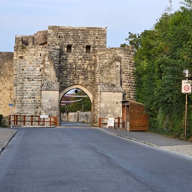
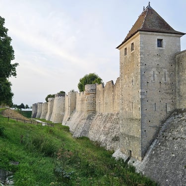
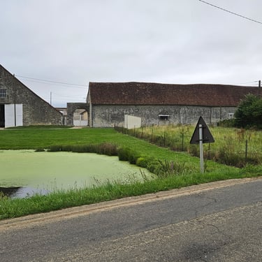
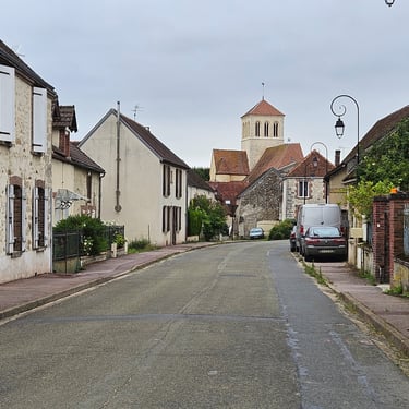
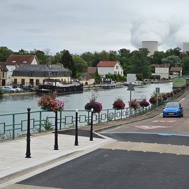
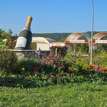
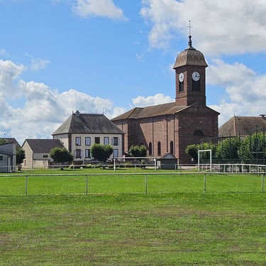
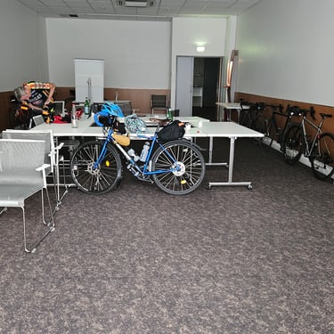
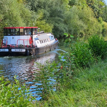
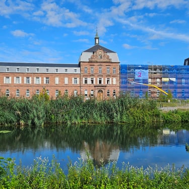
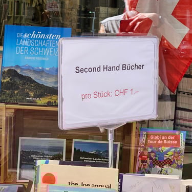
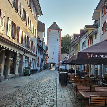
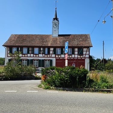
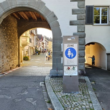
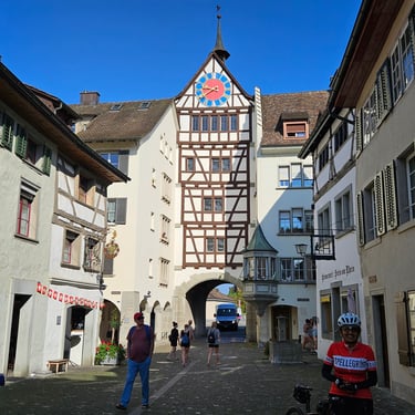
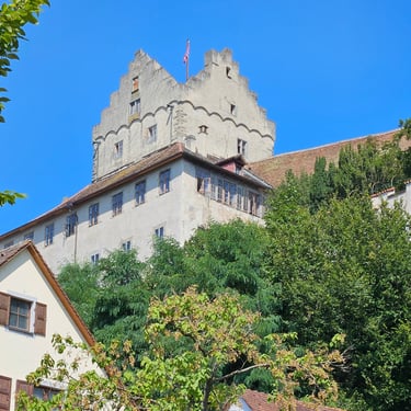
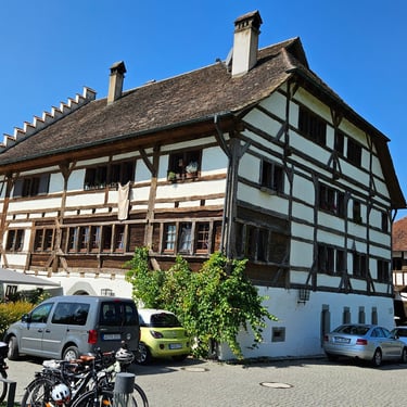
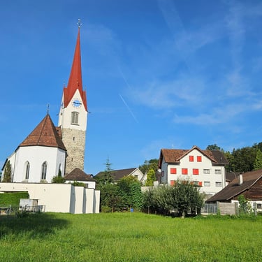
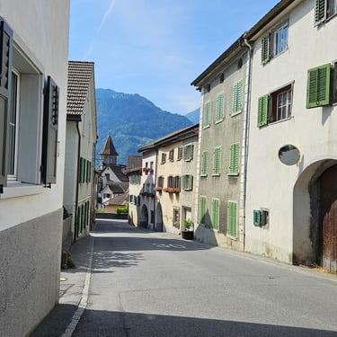
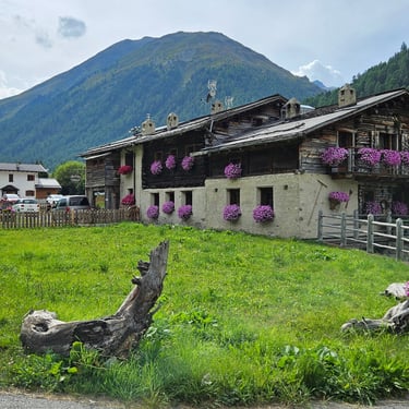
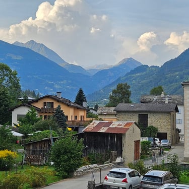
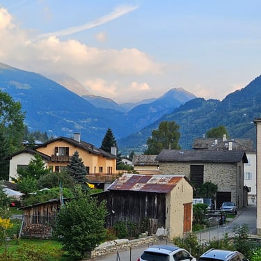
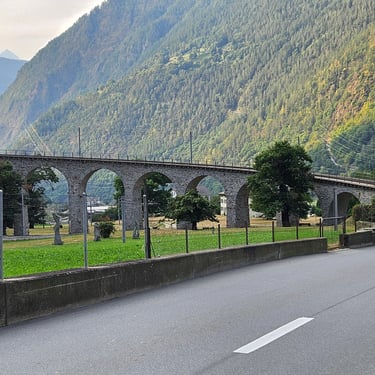
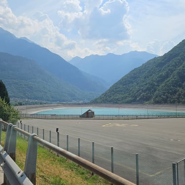
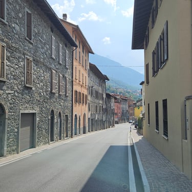
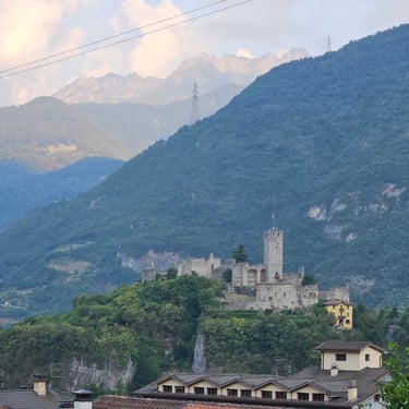
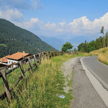
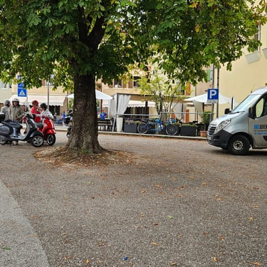
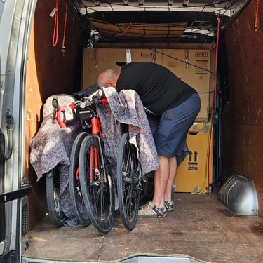
My room in the Ibis hotel in Provins was notable for its compactness. It was, effectively, a single room containing a double bed and not much space for anything else. Others, I was told, also had to fit their bikes in their rooms but my bike was still on the van. Dinner was in the centre of the town of Provins which is a UNESCO World Heritage site with some interesting historical features.
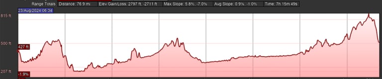
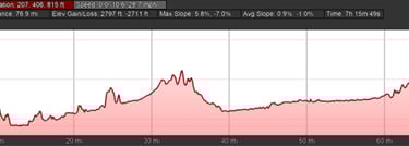
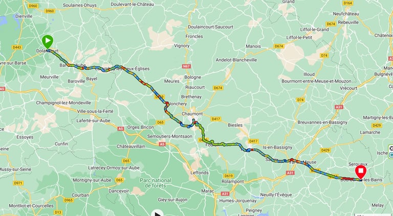
Day 5: Provins to Dolancourt
Day 5 (23rd August) Summary
Distance 77.9 miles: Total Ascent = 867m (2,840ft)*
Elapsed time = 7hr 17min: Moving time = 5hr 52min
Average moving speed = 13.3mph
*Ascent according to my Garmin Edge 1040 which usually agrees closely with Google Earth. My Edge 530 usually records about 15% less climbing which is more consistent with RWGPS. I assume that the newer hardware is more accurate.
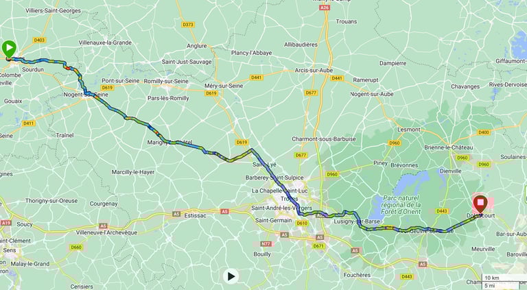
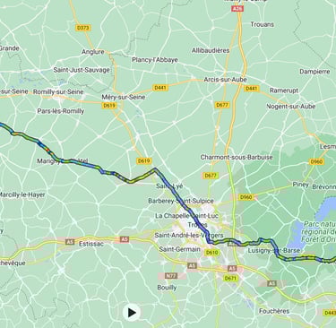
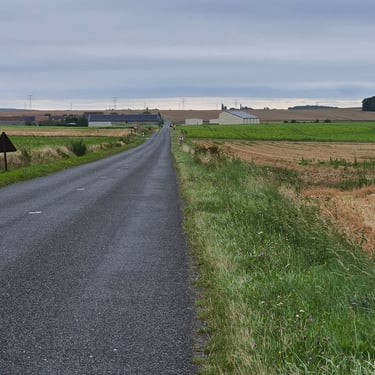
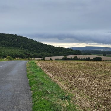
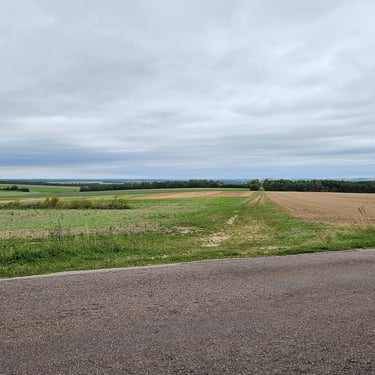
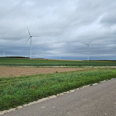
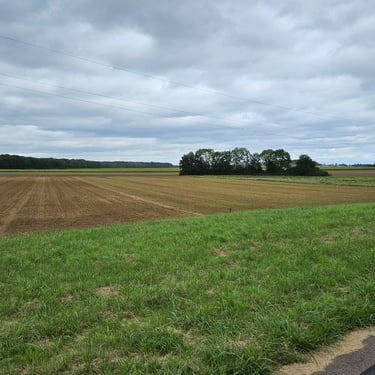
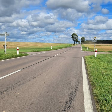
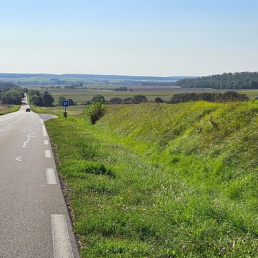
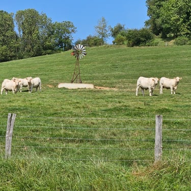
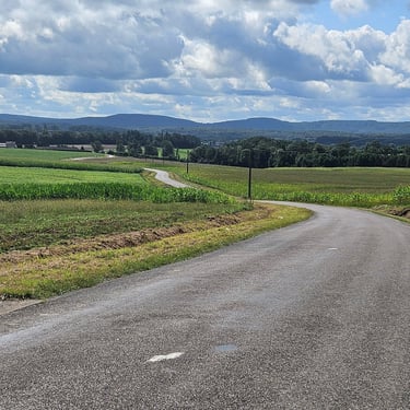
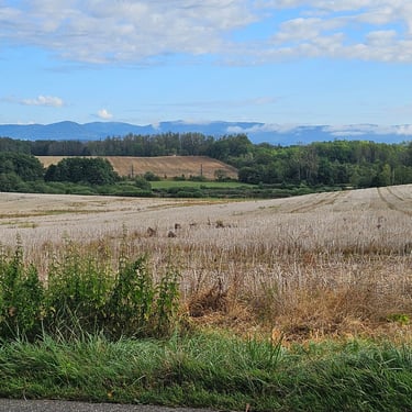
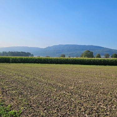
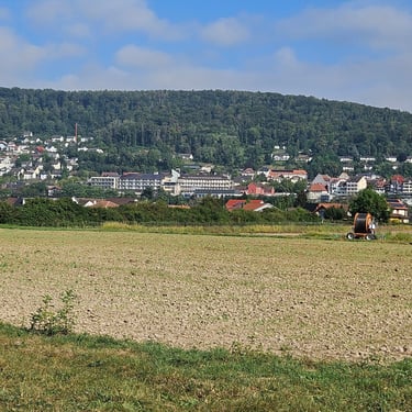
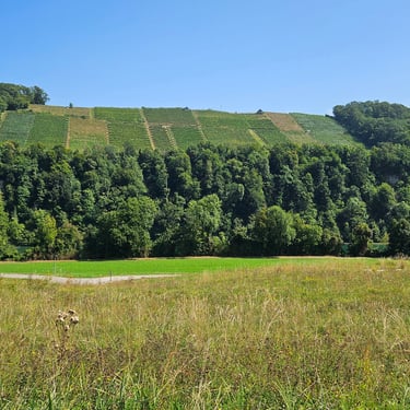
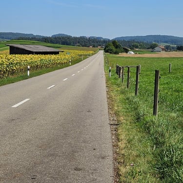
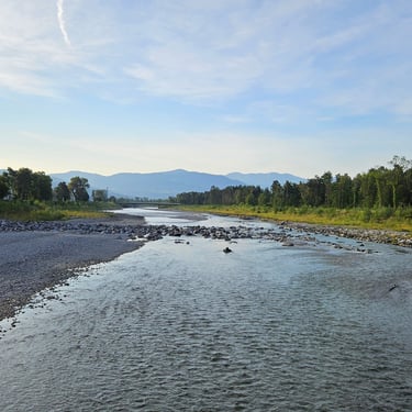
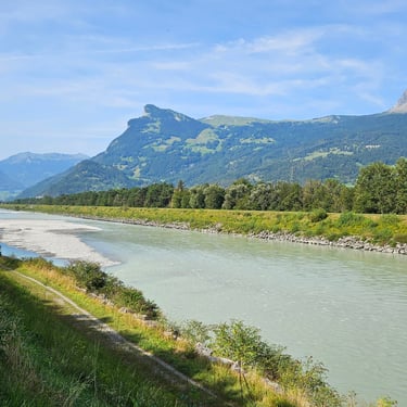
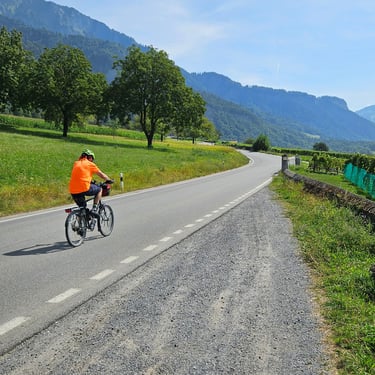
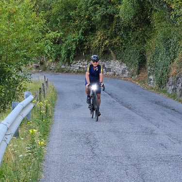
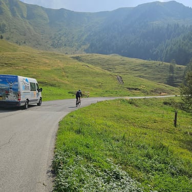
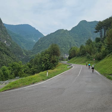
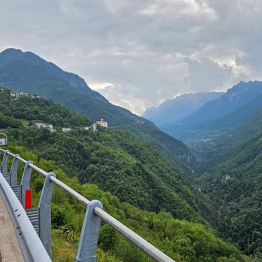
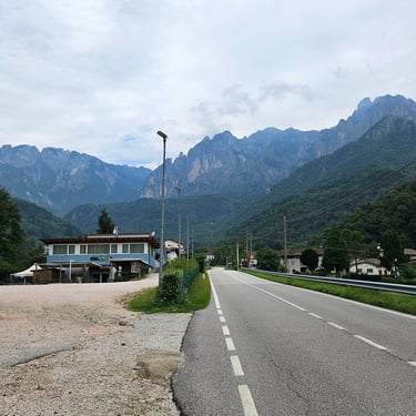
Finally I could belatedly start cycling on this trip. For me, a 77 mile ride was a potentially challenging distance (I've yet to cycle more than 78 miles in one day), but I survived and my average speed was good, by my standards. We were generally going in an east to south-east direction with a stiff south-westerly breeze which was a crosswind and added a bit of drag. The route mainly passed through open farmland which provided no shelter from this wind.
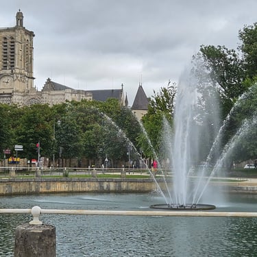
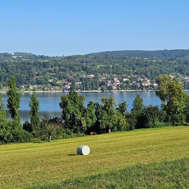
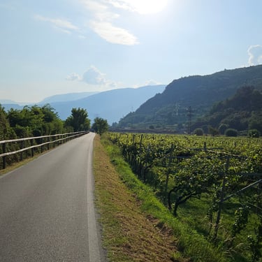
The first task of the day was to retrieve my bike from the van, refit the pedals and ensure that it was still in working order. A short trip in the hotel car park revealed that the rear derailleur cable had slipped, which was fixed very quickly. For the first few miles I followed one of the other riders in order to get myself used to cycling on the other side of the road. There was a small diversion off-route in Marigny-le-Chatel to visit a Boulangerie for some supplies although I didn't stock up as there was the suggestion of stopping in Troyes for lunch. However, I then decided to continue through Troyes after admiring the fountains in the river Seine and improvise a picnic from supplies on the bike. Fuelled by both a large breakfast and a cooked dinner, I'm not in need of a big lunch.
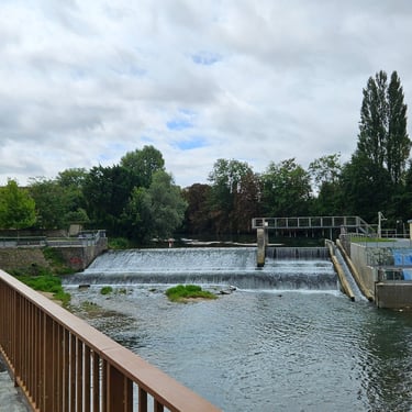
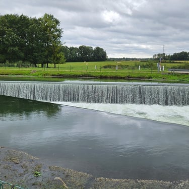
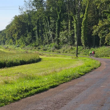
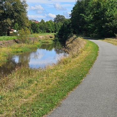
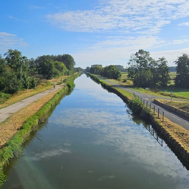
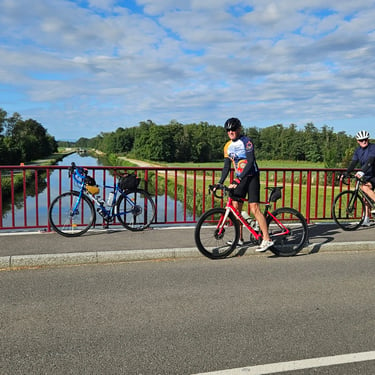
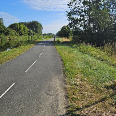
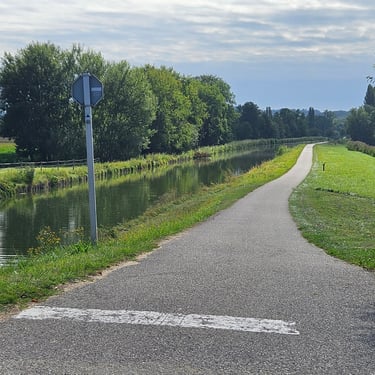
After Troyes there was a very pleasant 8 mile section on a good cycle track alongside an irrigation canal with some fine weirs and I stopped for my picnic when I came to three of the group, who were slightly ahead of me, tucking into their picnic on nice bench. After the canal there was a much less pleasant section on a fairly busy road. The roads were generally wider than at home but the traffic was moving briskly.
The day's biggest hill was towards the end of the ride, but fortunately was not very steep. The Le Moulin du Landion hotel on Dolancourt was based on an old mill with added rooms. My room was a good size and had an air conditioner. The food was good.
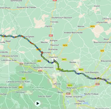
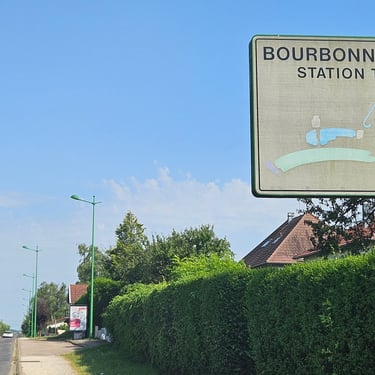
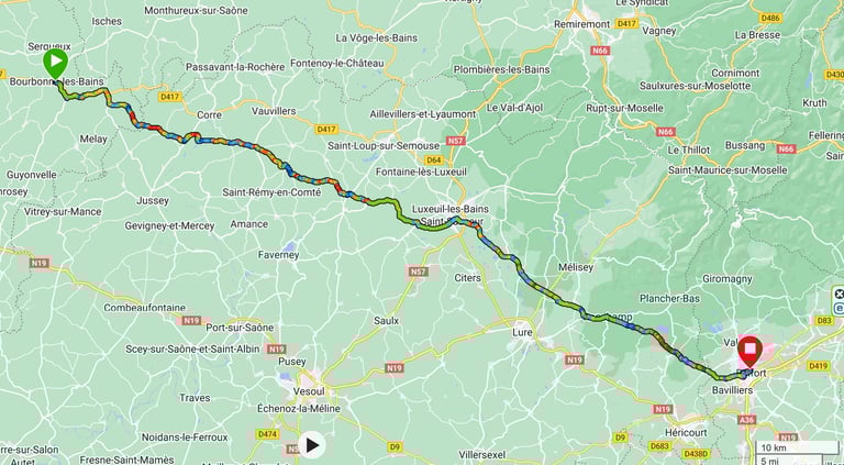
Day 6: Dolancourt to Bourbonne-les-Baines
Day 6 (24th August) Summary
Distance 68.5 miles: Total Ascent = 1,235m (4,050ft)*
Elapsed time = 7hr 25min: Moving time = 6hr 03min
Average moving speed = 11.3mph
*Ascent according to my Garmin Edge 1040 which usually agrees closely with Google Earth. My Edge 530 usually records about 15% less climbing which is more consistent with RWGPS. I assume that the newer hardware is more accurate.
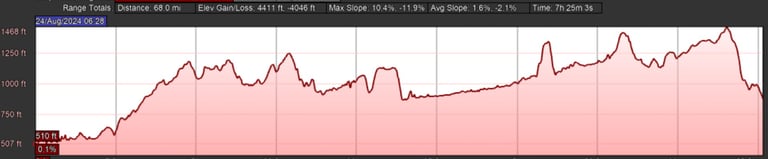
This day was a hard slog. While nearly 10 miles shorter than the previous day, it took more time. Cycling south-eastwards into a southerly headwind made it feel as if I spent the whole day cycling uphill. In addition, the temperature started off at 19C and steadily climbed to 31C (data from my Garmin Tempe sensor which is fitted under the stem and out of direct sunshine) and it will be hotter in direct sunshine. It felt very humid and it was the first time I've got through 3 bottles of water on a single day.
I noticed that I was achieving a speed up a 2.5% gradient that I would normally expect for a 5% gradient which seemed to me to be a possible way to quantify the effect of cycling into this wind. A quick calculation gives the effective ascent for 2.5% climbing over a conservative 35 miles (about half the distance - it felt like more than this was into the wind without shelter) as equivalent to extra 1,400m of climbing.
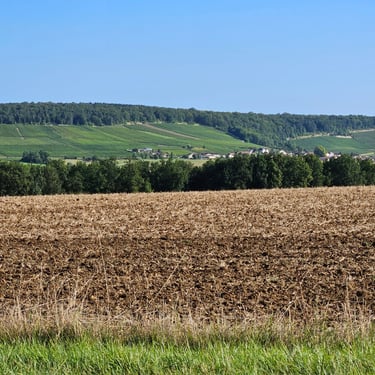
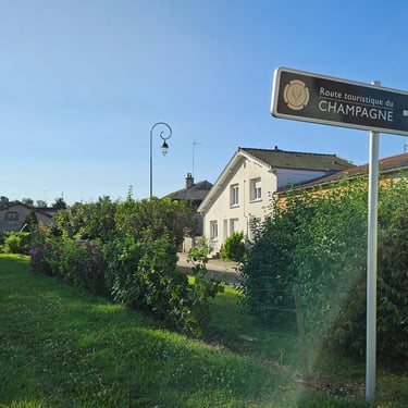
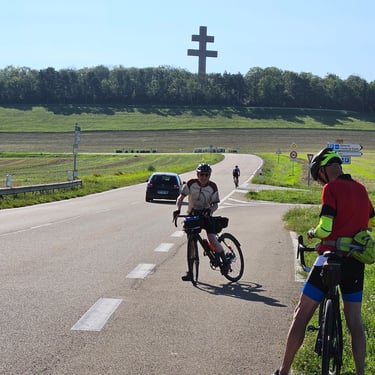
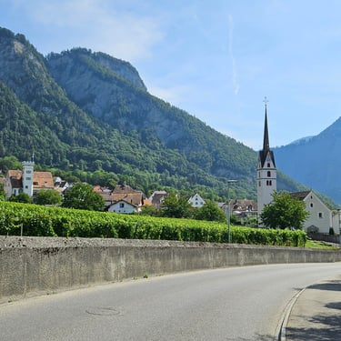
Early in the day we passed through the corner of the Champagne region and passed the monument to Charles de Gaulle. There was a good Boulangerie in Chaumont where I stocked up on food and topped-up all three water bottles on my bike. I had started with two full bottles and two were empty at the end. The route included a trip up a substantial hill, through an unmemorable village and then down to join a road which had by-passed the village and the unwelcome climb. Perhaps the course planner thought that we might need to use the non-existant facilities in the village?
I finished the ride with numerous aches. Not only were my legs hurting from spending all day pushing into the wind, but my feet were aching and I was very saddle sore. I think a combination of getting somewhat sweaty plus crouching on the drops trying to reduce the wind drag meant I spent a lot of time in a non-normal position on the saddle. A futher factor, I have concluded, is that what was a very comfortable leather saddle had gone out of shape when it had been soaked in Ireland. Towards the end I found that a more upright position with my hands on the flats changed the saddle contact points and provided some welcome relief.
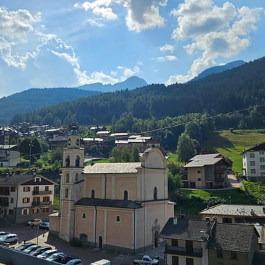
My room in the Hotel Herard in Bourbonnes-les-Baines was a reasonable size. The most notable feature of the room was the random positions of the electricity sockets. A thunderstorm during the evening made us happy that it hadn't arrived earlier and we were fortunate to be dining at the hotel.


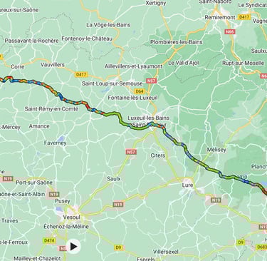
Day 7: Bourbonne-les-Baines to Belfort
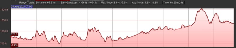
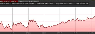
Day 7 (25th August) Summary
Distance 66.6 miles: Total Ascent = 1,258m (4,130ft)*
Elapsed time = 6hr 26min: Moving time = 5hr 37min
Average moving speed = 11.9mph
*Ascent according to my Garmin Edge 1040 which usually agrees closely with Google Earth. My Edge 530 usually records about 15% less climbing which is more consistent with RWGPS. I assume that the newer hardware is more accurate.
This was a much easier day due to a light tailwind and a more moderate temperature reaching 22C in the afternoon although 66 miles still represented a long day for me. The roads were initially damp after the previous evening's rain but soon dried out. I was consciously riding fairly slowly and trying to give my legs an easy day after the previous day's punishment. There were, however, some moderate hills to get up but nothing too challenging.
After the previous hot day when some participants struggled to find sufficient water, the van was more diligent in providing support, particularly as it was a Sunday with fewer facilities likely to be open. The van waited at about 20 miles to hand out water and bananas for those who wanted replenishment, then again at 38 miles.
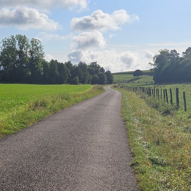
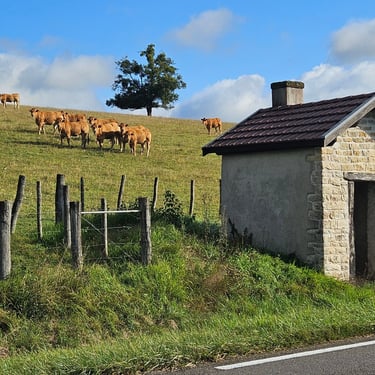
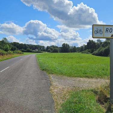
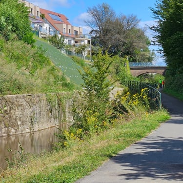
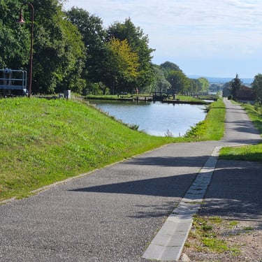
The roads were initially very quiet as it was Sunday morning but became busier later on. I proceeded at my slow pace, usually by myself, with time to study the scenery and buildings and observe some interesting roadside features. Approaching Belfort about three miles of the route followed a canal which helped with getting through part of the town although the last mile was a wiggly route following streets and urban cycle paths including a passageway through a block of flats.
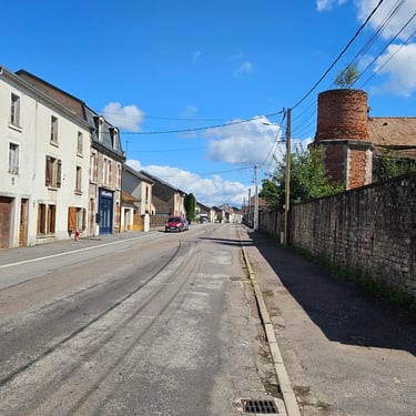
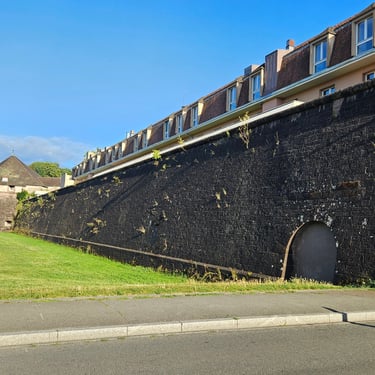
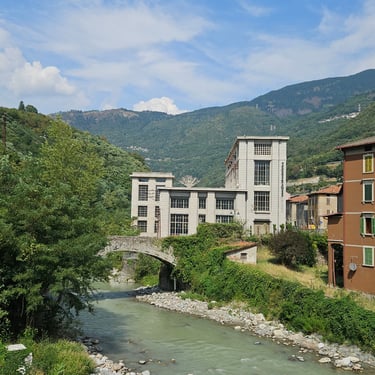
My room at the Belfort Novotel was generously sized and air-conditioned (a necessity given hotels' propensity to put thick duvets on the beds). There was plenty of space for a bicycle although the bikes had their own room in the hotel. The hotel itself was large but not very busy. It appeared to primarily cater for events. Dinner was taken in the historic part of the town which was only a short walk from the hotel and there was time to look at some of the historical buildings. Modern flats looked out of place on top of an old city wall.
Day 8: Belfort to Rheinfelden
Day 8 (26th August) Summary
Distance 71.2 miles: Total Ascent = 509m (1,670ft)*
Elapsed time = 7hr 03min: Moving time = 5hr 45min
Average moving speed = 12.4mph
*Ascent according to my Garmin Edge 1040 which usually agrees closely with Google Earth. My Edge 530 usually records about 15% less climbing which is more consistent with RWGPS. I assume that the newer hardware is more accurate.
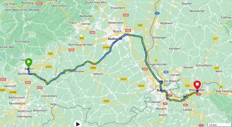
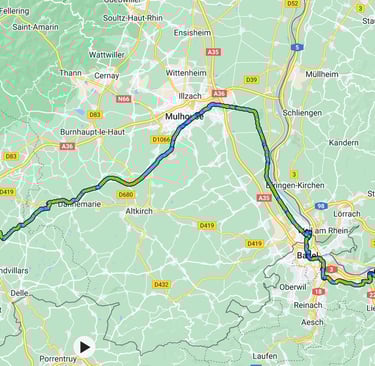
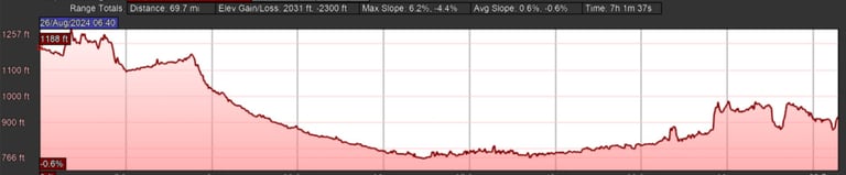
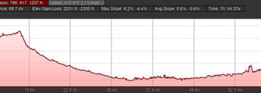
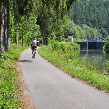
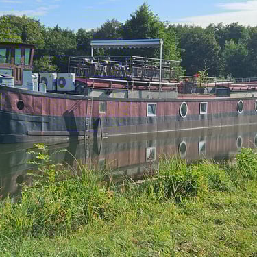
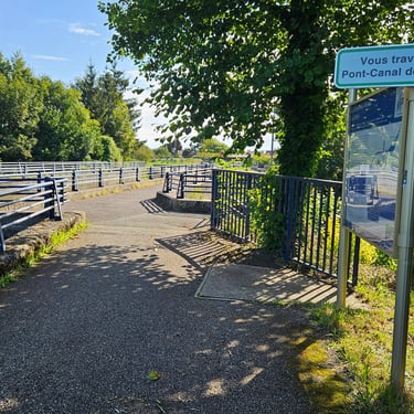
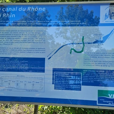
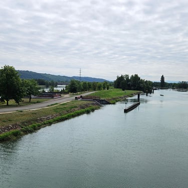
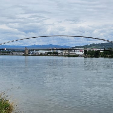
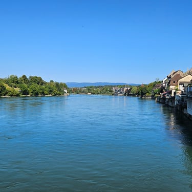
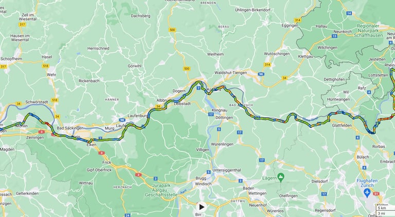
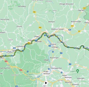
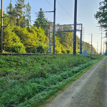
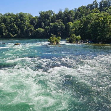
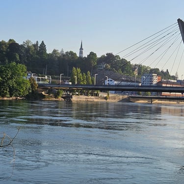
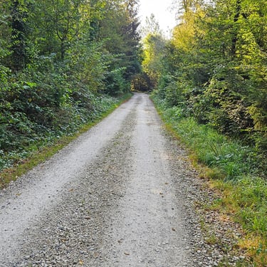
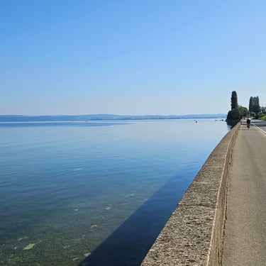
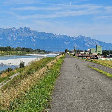
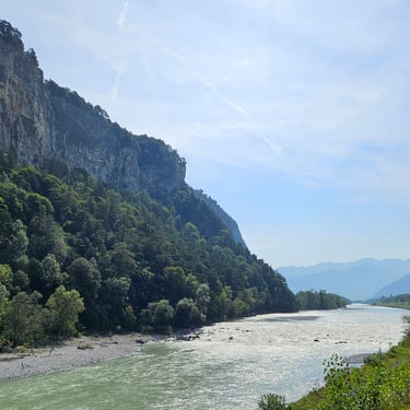
If only all cycling days were this pleasant! Just over 70 miles without a lot of effort as it was mainly downhill. The day started off a bit chilly (15C) but it was a pleasantly warm afternoon. There was an easterly breeze which created a slight but noticeable headwind when trees didn't provide shelter, which they did for much of the time. Much of the day was spent on good cycle paths alongside the Rhone - Rhine canal or the river Rhine. The latter was mainly good quality gravel which could have been messy if wet but was fortunately dry. Getting through Basel reduced the average speed.
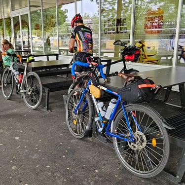
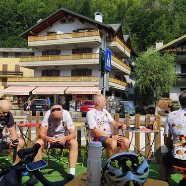
The cycle path along the Rhone-Rhine canal made getting through Mulhouse relatively easy. After the route joined the Rhine cycle path (which I had traversed last year in the opposite direction) I discovered that I was at the back with tour leader Paul and Gary (on his Thorn Nomad touring bike). We hurried (by my sedate standards) along the track to Basel where we expected to come across those in front taking a refreshment stop. However, we never saw them (they had gone off the route for refreshments) and we eventually stopped at an Aldi in Basel to buy some food and drink.
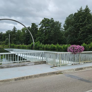
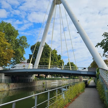
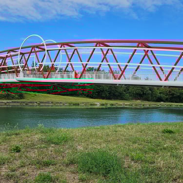
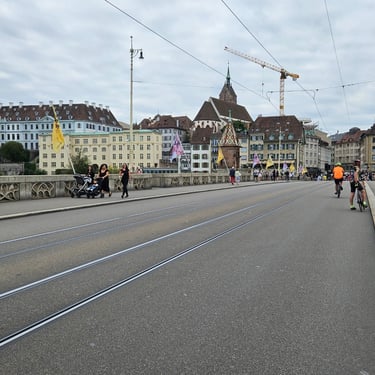
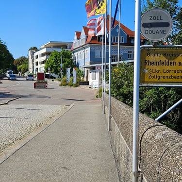
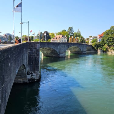
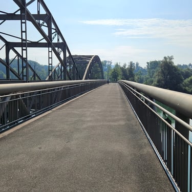
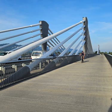
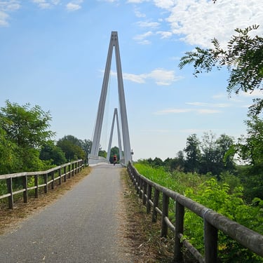
Cycling through Basel wasn't very pleasant. In some parts there were good cycle tracks plus a very nice cycling/pedestrian bridge over the river, while in other places it was through the streets (mind the tramlines). This included climbing a steep cobbled hill which I remember going down carefully in 2023. In Basel we crossed the river from France to Germany for a short distance before going into Switzerland. Officially, the city is in Switzerland but has suburbs in France and Germany. I never noticed any borders.
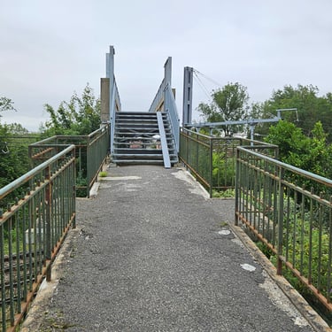
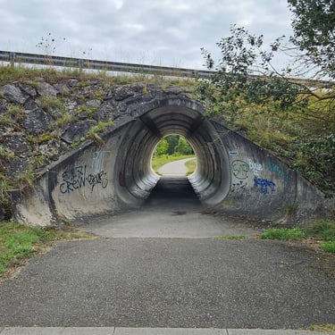
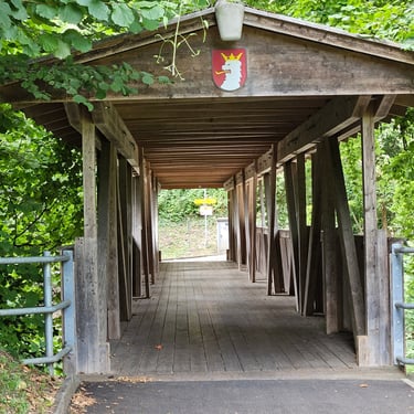
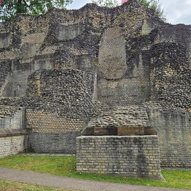
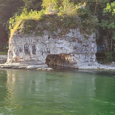
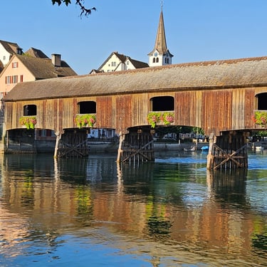
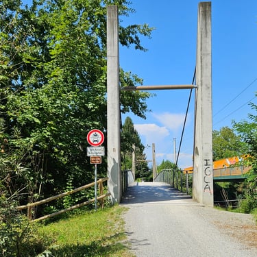
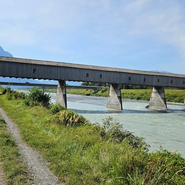
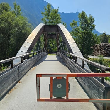
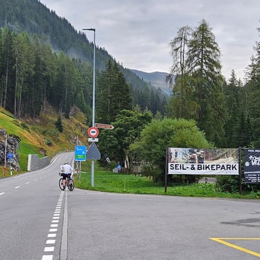
After Basel we continued through to Rheinfelden. I took few photos on this section of the ride as my companions seemed to be in a hurry to reach the hotel. I stopped, however, to photograph one of the two covered cycling/footpath bridges and also the outside of the remains of a Roman ampitheatre.
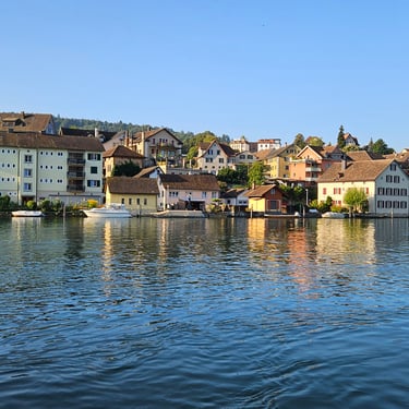
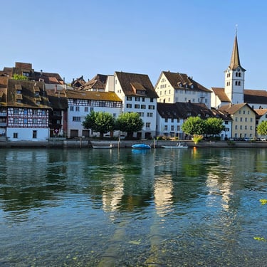
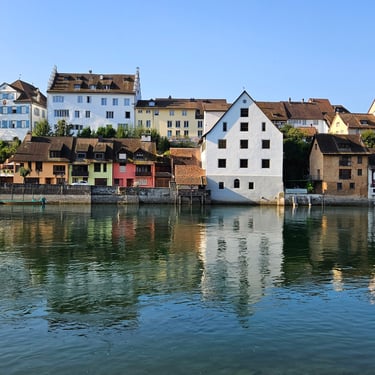
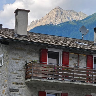
Although we had travelled through Switzerland between Basel and Rheinfelden, our accommodation in Rheinfelden at the Hotel Danner was located on the less expensive Germany side of the river. I had a remarkably poor recollection of this hotel given that I had stayed there in 2023.
Day 9: Rest day in Rheinfelden
27th August: This was a rest day so I didn't do any cycling (some others did). Instead I had four tasks on my list: (i) try to tighten my cassette lockring as I was getting a bit of transmission creaking in certain gears; (ii) try to update this blog and get it live (foiled by a slow hotel internet connection); (iii) wander over to the Swiss side of the river and get some Swiss Francs out of a machine in case I needed refreshment at somewhere that didn't take contactless payment (which happened in 2023 - fortunately someone else had some Swiss Francs); and (iv) visit the local Aldi and buy some more lunch snacks.
I also did some laundry. The room had an air conditioner which helped with drying. It was also needed to lower the temperature as the duvet was the thickest I've encountered on my recent travels and was matched with an excessively thick pillow. The hotel's electricity bill could be substantially reduced by providing thin duvets.
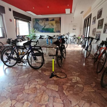
My trip to the Swiss side was with a couple of the group who were going to visit a good bike shop next to the railway station to look for some spares. It was an interesting shop with an excellent stock of parts run by someone who clearly had extensive knowledge of bicycles (and good command of English). He had several frames hanging up that belonged to a previous cycling era. A brief wander along one of the streets revealed that I could understand what was on sale in the shops.
Dinner on both evenings was taken at a good restaurant in the town which had an Italian-based menu.
Day 10: Rheinfelden to Neuhausen
Day 10 (28th August) Summary
Distance 63.5 miles: Total Ascent = 894m (2,930ft)*
Elapsed time = 6hr 46min: Moving time = 5hr 22min
Average moving speed = 11.8mph
*Ascent according to my Garmin Edge 1040 which usually agrees closely with Google Earth. My Edge 530 usually records about 15% less climbing which is more consistent with RWGPS. I assume that the newer hardware is more accurate.
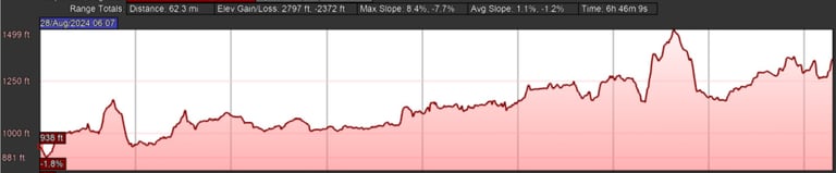
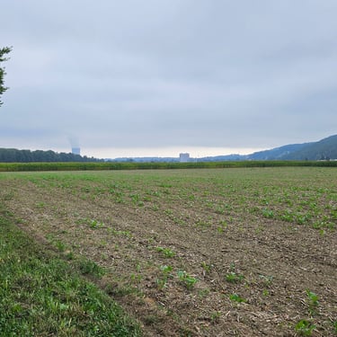
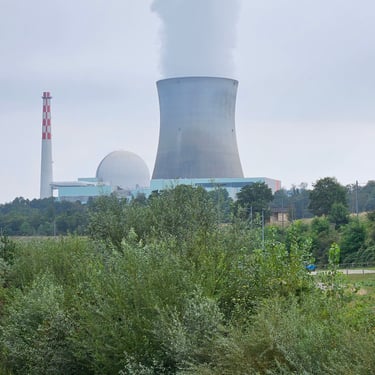
This was another relatively easy day with a light easterly breeze which was noticeable when cycling in open areas. We started in pleasantly warm sunshine but cloud appeared which lowered the temperature from comfortable to chilly. However, once we were past a nuclear power station which was producing a big cloud of water vapour from its cooling tower we were back into sunshine. Was this creating a micro-climate along the valley for several miles to its west?
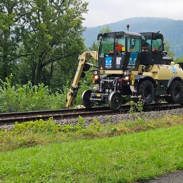
The journey started by crossing the river into Switzerland, cycling along a cobbled shopping street which was quiet due to the time of day and then following a good gravel cycle track on flat farmland. We stayed in Switzerland all day, either on mainly good cycle paths or quiet roads. I noticed that the Swiss didn't provide a fence between a cycle track and the adjacent railway (that wouldn't happen at home). At one point I stopped to watch a rail-mounted hedge trimming machine. Some of these are needed in the UK. Then it was past a parked train, which appeared to be for bike transport, a barrage across the river and the nuclear power station.
A cafe stop was made at Bad Zurzach (32 miles or about half way), a short stop to watch the Sisyphus moving sculpture and several other stops to photograph scenery and features. One such feature was a massive bike shelter in front of a school. It was empty when it reached it but the cycle track had been busy with children on wheels a few minutes earlier. A packed lunch was taken at 47 miles where there was a conveniently-located picnic bench next to the cycle track and river.
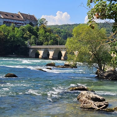
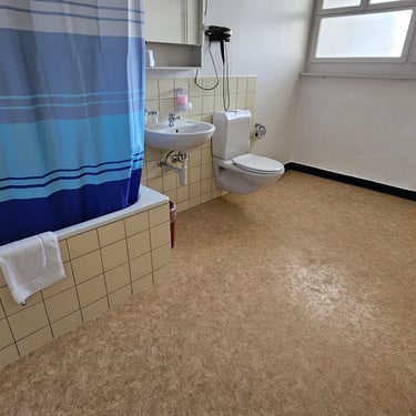
The last part of the day passed close to the Rhine Falls where the good weather had brought out crowds and I needed to get off my bike and walk. It's not possible to take bikes to the offical viewpoint so I discounted that option. The views from the path weren't very spectacular. I'm sure the falls are more impressive in the spring when fed by snow melt. My room in the fairly old hotel in Neuhausen was a family room with a bathroom that was as big as the bedroom I had in Provins.
Day 11: Neuhausen to Bregenz
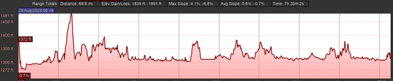
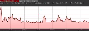
Day 11 (29th August) Summary
Distance 68.8 miles: Total Ascent = 627m (2,050ft)*
Elapsed time = 7hr 33min: Moving time = 5hr 39min
Average moving speed = 12.2mph
*Ascent according to my Garmin Edge 1040 which usually agrees closely with Google Earth. My Edge 530 usually records about 15% less climbing which is more consistent with RWGPS. I assume that the newer hardware is more accurate.
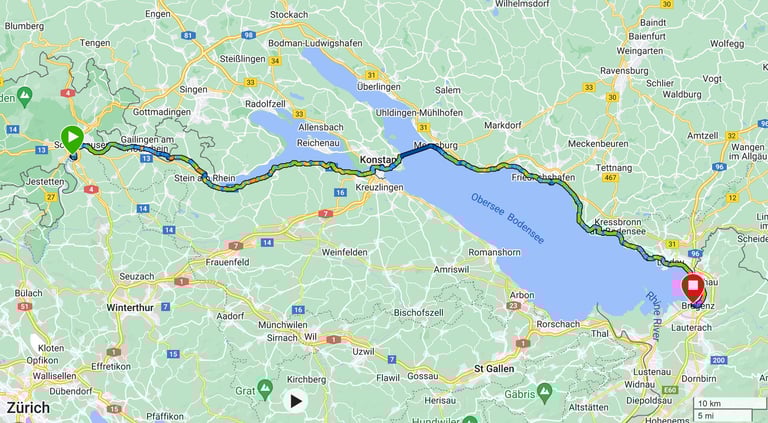
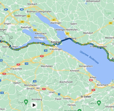
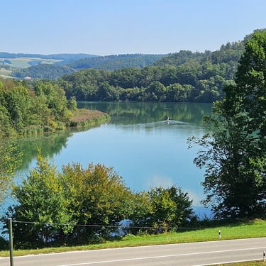
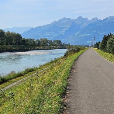
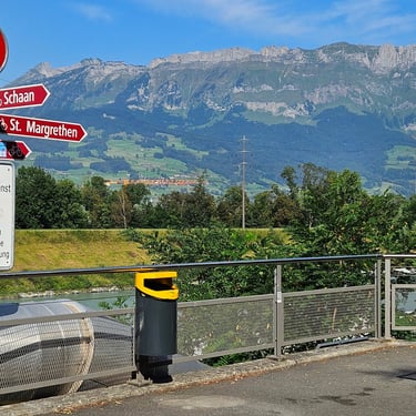
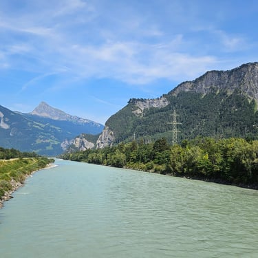
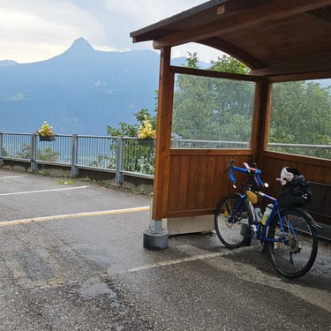
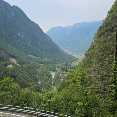
This was a relatively long day through fairly easy terrain with a ferry at about half way. I had traversed almost the same route in the opposite direction in 2023 (the hotels were different). The distance merited a fairly early start and I was on the bike soon after 8am. The temperature started at a pleasant 20C and increased as the day progressed to reach the upper 20s by mid afternoon. The morning ride involved crossing several times between Switzerland and Germany although there was never any indication of the border.
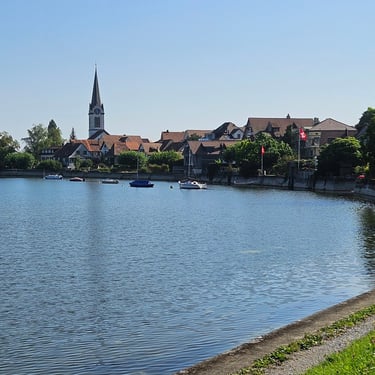
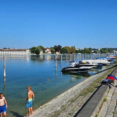
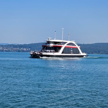
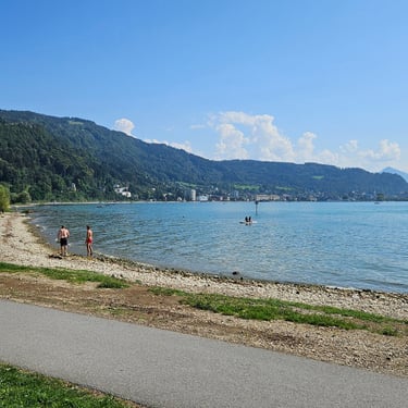
The first part of the ride was alongside the river from which could be seen interesting buildings and bridges and also included the biggest hill of the day (about 100m aboe local ground level) though woodland. Then through the old town of Stein am Rhein where the sign instructed us to get off our bikes, alongside more water and finally to the town of Konstanz where the Rhine emerges from the lake. Several ferries (cyclist fare of €6.30) were shuttling across the water between Konstanz and Meersburg where most of the group stopped for some refreshment.
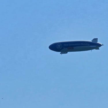
The afternoon was tedious as the warm weather had resulted in what seemed to be thousands of cyclists, most of whom were in no hurry, using the cycling route along the east side of the lake. On some sections it was a matter of moving at the speed of the slowest. In 2023 it was a wet morning and the route was pleasantly empty of other traffic. At one point I spotted an airship. Sightseeing flights can be booked at Friedrichshafen, the home of the Zeppelin airships.
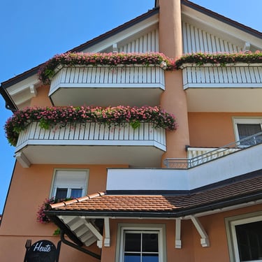
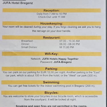
We passed Lindau, where I had stayed in 2023, and continued to Bregenz. The route took people to the Ibis hotel and an extra route had been provided for those, including myself who were staying at the JUFA hotel. I loaded this route onto my Garmin's screen and could see the track but the device didn't want to give me any navigation instructions so I just followed the line on the screen (which at one stage, confusingly, went through a supermarket car park. when I reached the JUFA hotel I realised that the route was reversed. Consequently, the Garmin would give me instructions as I had already reached the end. The JUFA hotel had fairly basis, but adequate, rooms but a memorable feature was the hotel information sheet which mentioned a penalty of €300 for lighting an open fire in my room.
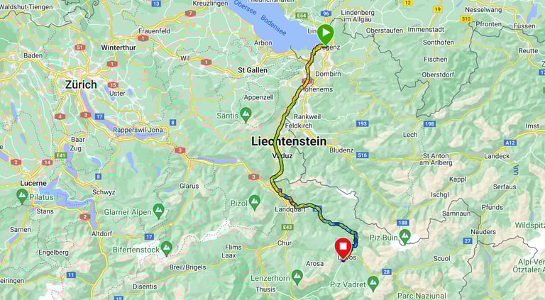
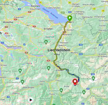
Day 12: Bregenz to Davos
Day 12 (30th August) Summary
Distance 76.4 miles: Total Ascent = 1,641m (5,380ft)*
Elapsed time = 9hr 06min: Moving time = 7hr 0min
Average moving speed = 10.9mph
*Ascent according to my Garmin Edge 1040 which usually agrees closely with Google Earth. My Edge 530 usually records about 15% less climbing which is more consistent with RWGPS. I assume that the newer hardware is more accurate.
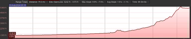
This was a day of two halves. Overall, the combination of distance, climbing and heat made it a hard day. The day started with a bewildering choise of teabags at the JUFA hotel breakfast.
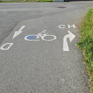
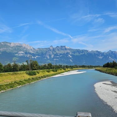
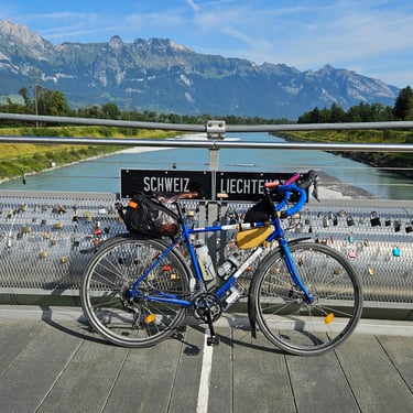
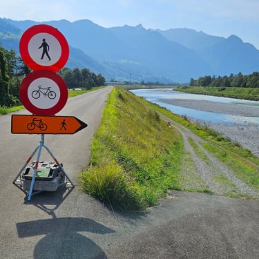
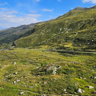
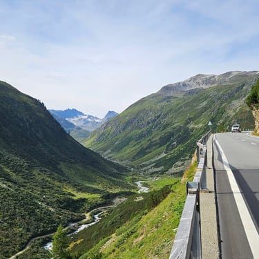
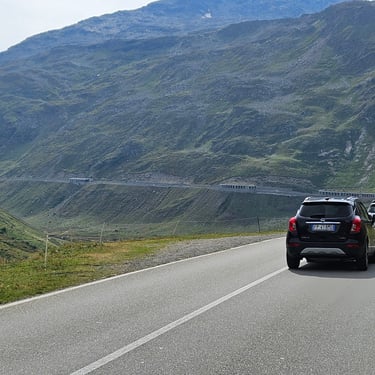
The first half of the journey was largely following the Rhine with a gently rising gradient. Navigation out of Bregenz was a simple matter of following "CH" marked on the cycle path. One hazard while cycling along the west side of the river was cycling thorugh swarms of small insects which had drifted off the river in the light easterly breeze. Keep mouth shut unless extra protein needed! There was a good variety of scenery. The route crossed over to the Lichenstein side of the river for a few miles. If nothing else this added another country to those visited but it was also free of the little insects. The van was waiting at a road junction and I took the opportunity to ensure that all my water bottles were full. At one point there was a temporary diversion onto a gravel path closer to the river. The ramp down to that path had a loose gravel surface which was a little challenging. By 11:30am the shade temperature was over 30C and remained there until mid afternoon. It was hotter in the sun.
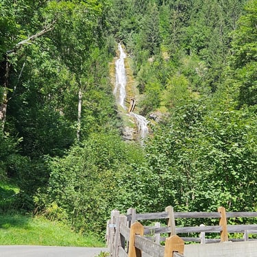
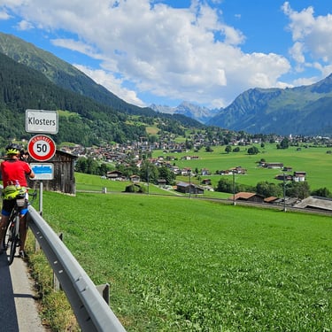
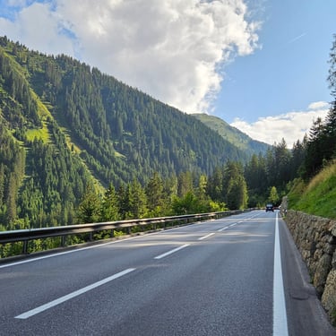
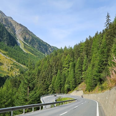
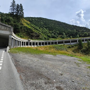
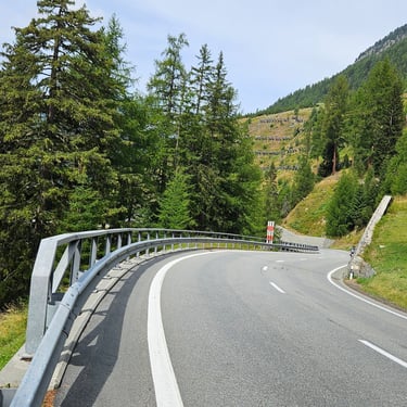
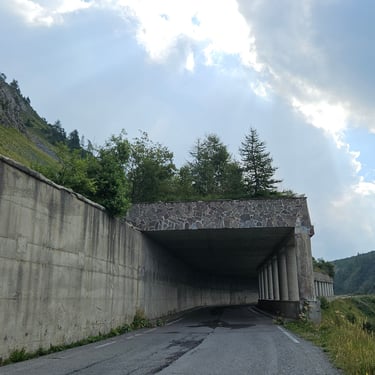
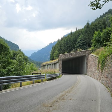
At 48.5 miles, we parted company with the route I had cycled in 2023 on day 2 of the Rhine trip and started to climb towards Davos. At first the gradient was modest and the route passed through a narrow gorge on the old main road (the traffic now uses an adjacent tunnel) but progressively became steeper. Some of the journey was on good cycle paths and some was on less busy roads. By mid-afternoon my supply of water was diminishing and I topped up my bottles with a 1.5 litre bottle from a shop. There were several roadside water troughs. While I didn't trust these for drinking water, I used them to soak my cycling cap which kept my head a bit cooler for a while. At one point I stopped on a steep section of cycle path to photograph a small waterfall but couldn't get moving again as my front wheel was lifting off the ground and I had to push the bike a short distance to flatter ground.
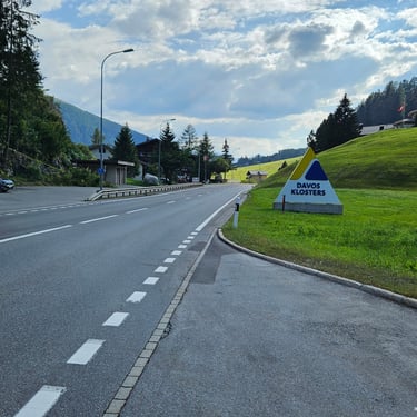
Just after leaving Klosters, there was a glimpse of snow in the distance. We then joined the main road to Davos. The climb from Klosters until about 4 miles from the end was particularly horrible. This was on a main road with, it seemed, lots of traffic wanting to get to Davos for the weekend, in an unpleasant temperature (which started to drop towards the end) and a gradient which reached 10% at times. There were plenty of close passes as drivers were more interested in getting up the hill without losing momentum than providing space for weary cyclists. Swiss drivers are usually good at allowing cyclists space, but not on this occasion.
Altogether I got through sufficient water to use five electrolyte tablets which was a clear personal record). The last was in a bottle of water after arrival as I have discovered that if I don't keep my electrolytes topped up then I can suffer cramp in the night. The only positive aspect of the day's climbing to Davos at about 1,600m altitude was that it meant less climbing the next day to the highest point on the trip.
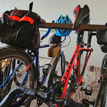
The hotel had an interesting bike rack where the bikes are parked by hitching the nose of the saddle over a steel rail. This very space efficient with bikes hung both ways round and tyre width (sometimes a problem with slot-in bike racks) is irrelevant and there's no risk of bending wheels or disc brake rotors.
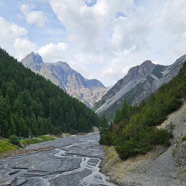
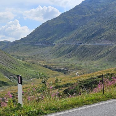
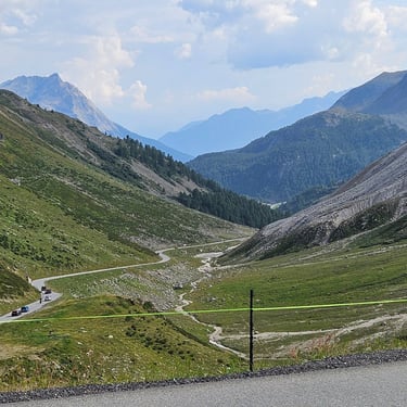
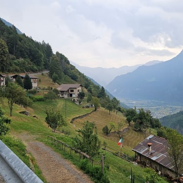
Day 13: Davos to Le Prese
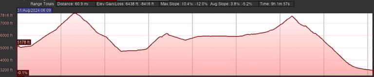
Day 13 (31st August) Summary
Distance 59.8 miles: Total Ascent = 1,879m (6,160ft)*
Elapsed time = 9hr 03min: Moving time = 5hr 59min
Average moving speed = 10.0mph
*Ascent according to my Garmin Edge 1040 which usually agrees closely with Google Earth. My Edge 530 usually records about 15% less climbing which is more consistent with RWGPS. I assume that the newer hardware is more accurate.
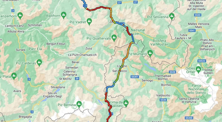
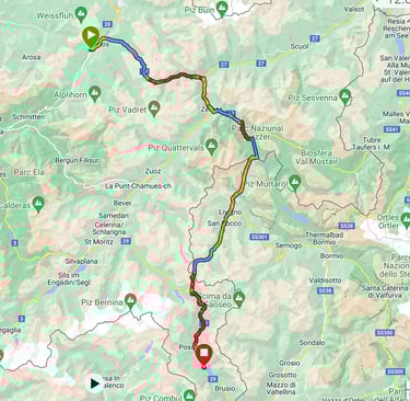
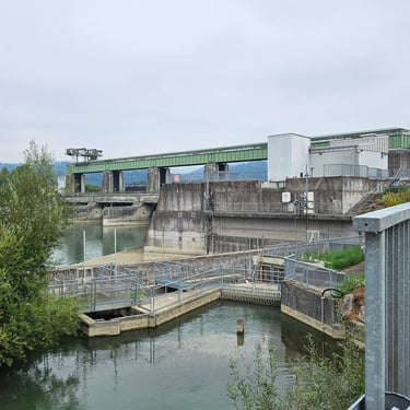
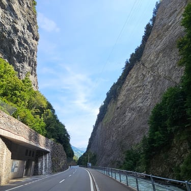
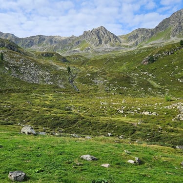
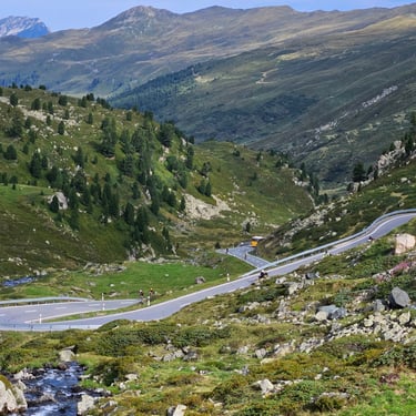
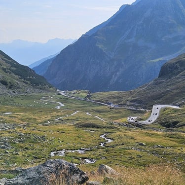
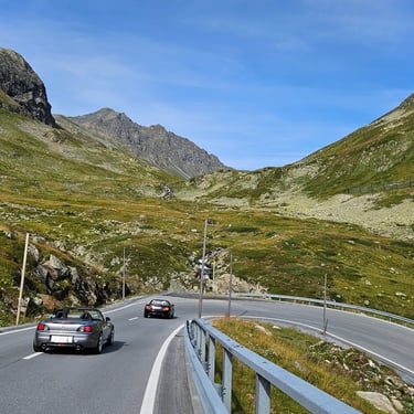
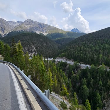
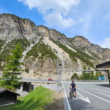
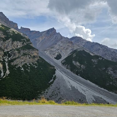
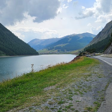
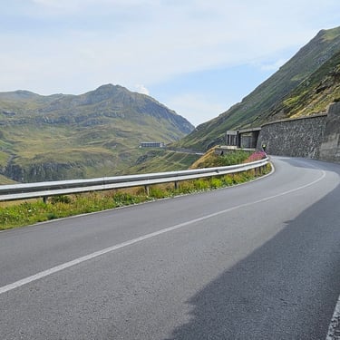
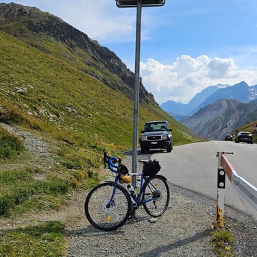
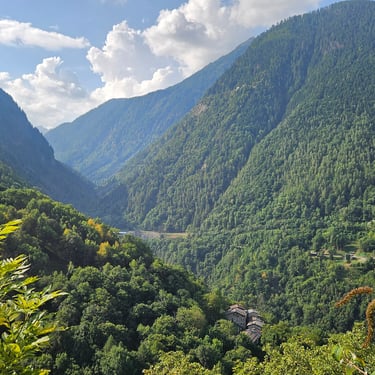
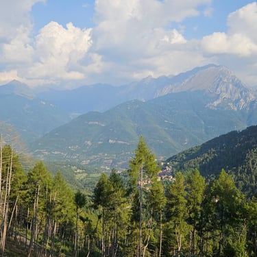
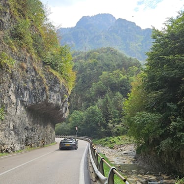
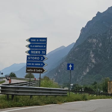
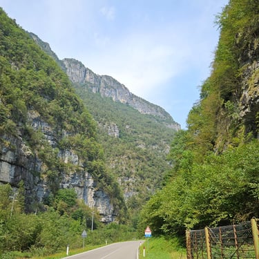
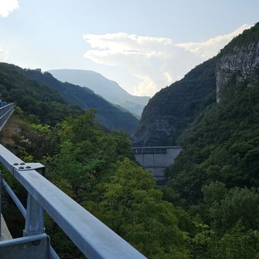
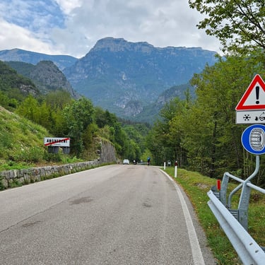
The day started cloudy and there had been some overnight rain which had lowered the temperature. There had been considerable discussion among the group about which route to follow after Zernez. The original route passed through the Munt la Schera tunnel and Livigno but there was an alternate route following highways 27 and 29 which avoided the tunnel, was slightly longer and slightly less climbing. After due deliberation I opted to use the tunnel route as it passed over a dam (always of interest to an engineer) but also the weather forecast indicated a south-westerly breeze which would be a headwind on the alternative route. Nine others opted to use the tunnel route which meant that the van would do two shuttle trips through the tunnel.
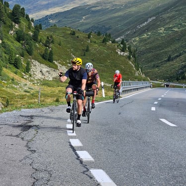
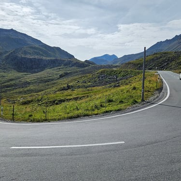
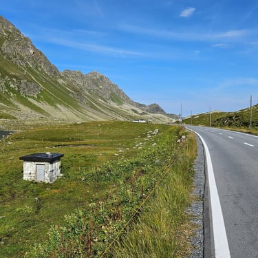
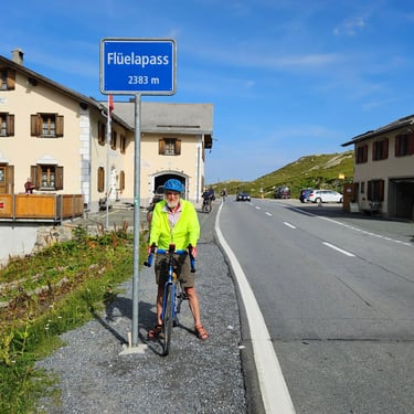
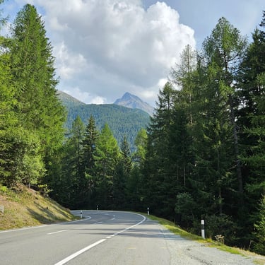
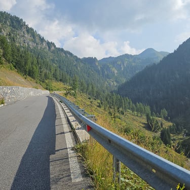
After the previous day's heat and with a hill to climb I was on the road at an early 08:10. However, and fortunately, the weather was quite chilly (only 14C for the first hour) and then gradually warmed up. The Fluella pass was, at 2,383m, the highest hill on the trip although it was not the biggest climb as Davos was above 1,500m. The gradient, at between 6% and 9% was much as I had expected after my encounter with the Oberalp pass in 2023 but this ascent was about 50% more and my legs, which hadn't recovered from the previous day's exertions, wanted more short breaks for admiring the scenery compared with the fresh legs for the Oberalp pass.
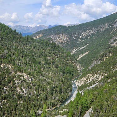
Once over this hill there was a descent where the only exercise was careful use of the brakes to manage the speed going into the bends and then an almost flat four miles to a cafe stop in Zernez. It was a pleasant cafe and I lingered for 50 minutes (too long in hindsight). The cafe location was conveniently at the junction between the two route options which enabled the leaders to be sure of the number of cyclists taking each option.
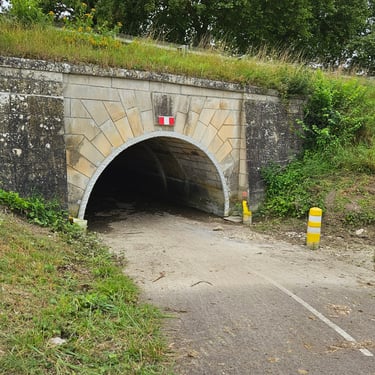
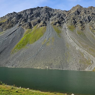
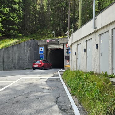
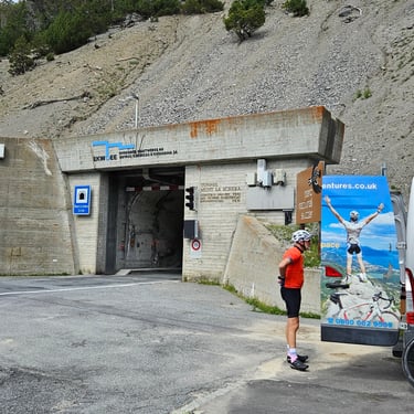
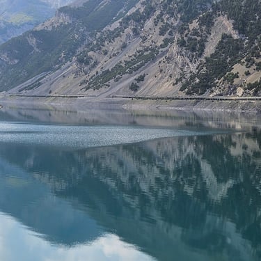
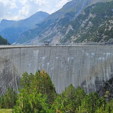
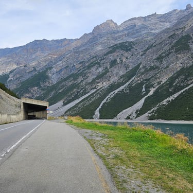
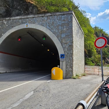
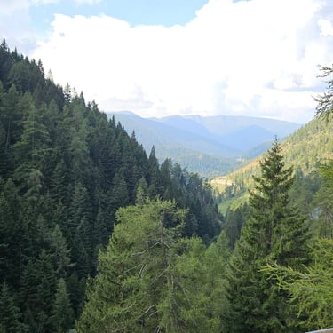
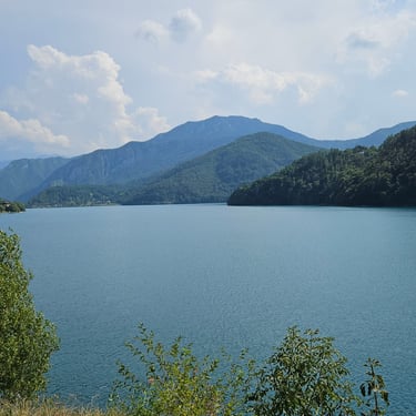
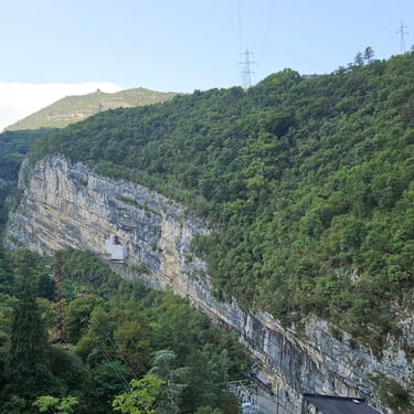
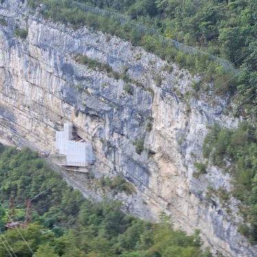
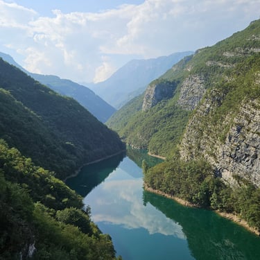
After the cafe stop there was a relatively small (400m) climb followed by a gentle descent along a very scenic valley to the mouth of the Munt la Schera tunnel. This is a single lane tunnel that was built to provide access to the dam at the ather end of the tunnel. People could cycle through the tunnel until 2008 which must have been a nerve-wracking experience. There is an official bicycle shuttle service during the summer months but, given the uncertainty about how busy this would be at a weekend, the Bike Adventures van would be our shuttle service. I arrived at the tunnel entrance just in time to see the van going into the tunnel with the first load of cyclists. There was then a wait of nearly 40 minutes for the van to return to collect the second group. Perhaps, had I been quicker leaving the cafe, I could have been nearer the front of the queue for the first van trip.
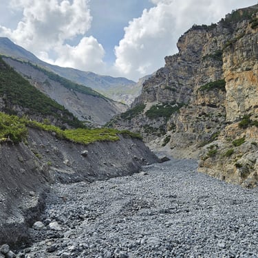
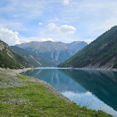
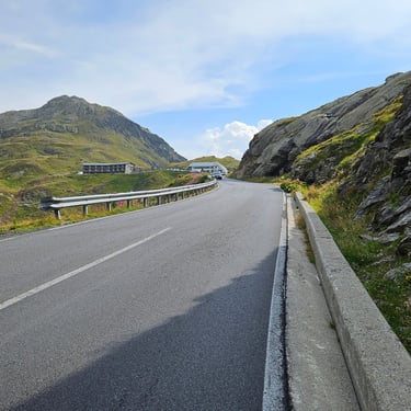
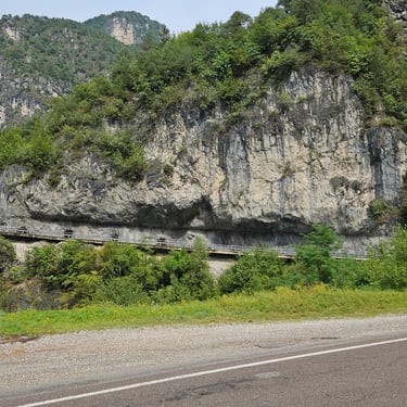
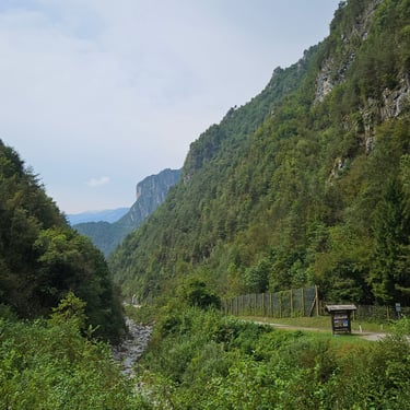
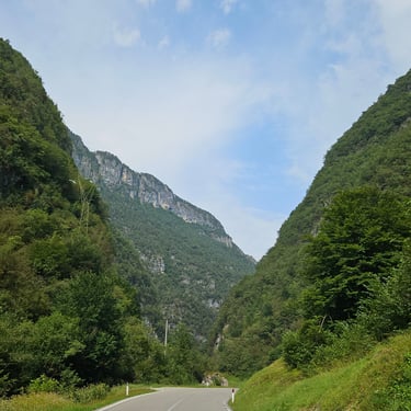
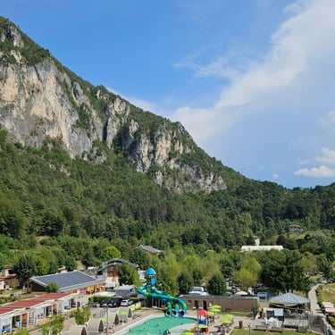
The other end of the tunnel was next to the lake which had been created by the construction of the 130m high Punt dal Gall concrete arch dam. The route crossed over the dam crest and into Italy followed about 5 miles of level cycling alongside the lake. Substantial lengths of this section were in avalanche shelters which are probably to protect against falling rocks and scree as well as snow. After the lake finished Livigno started, and so did some rain so I stopped and put on my waterproofs. Livigno is a fairly uninteresting ribbon settlement which stretched for nearly 3 miles along the gently rising road. The rain eased off and I found a bus shelter where I removed my waterproofs and also transferred some food from bag to stomach in preparation for the next hill.
The main climb was a steady grind up a steadily steepening hill, but no more than 8%. Nonetheless it was somewhat tiring and also disheartening to be able to see the top of the hill from several miles away and it was very slow in getting closer. Unlike the first hill of the day, this ascent was on the side of a valley without any hairpin bends. Eventually I arrived at the summit, Forcola di Livigno at 2,315m, after which it was downhill to the destination in Le Prese. The descent included some hairpin bends which some local cyclists were happy to take at higher speed than me. I reached Le Prese after 5pm which felt like a long day although I was only moving for 6 of the 9 hours spent on the road. Bike were securely parked in a stone outbuilding with large bolt on the door operated by an suitably large key.

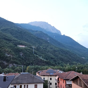
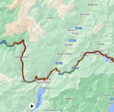
Day 14: Le Prese to Breno
Day 14 (1st September) Summary
Distance 45.5 miles: Total Ascent = 981m (3,220ft)*
Elapsed time = 5hr 26min: Moving time = 3hr 51min
Average moving speed = 11.9mph
*Ascent according to my Garmin Edge 1040 which usually agrees closely with Google Earth. My Edge 530 usually records about 15% less climbing which is more consistent with RWGPS. I assume that the newer hardware is more accurate.
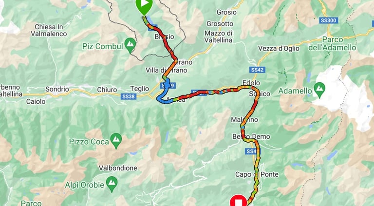
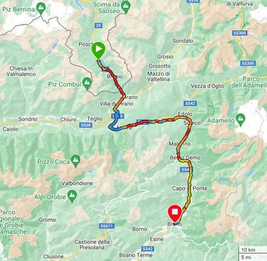
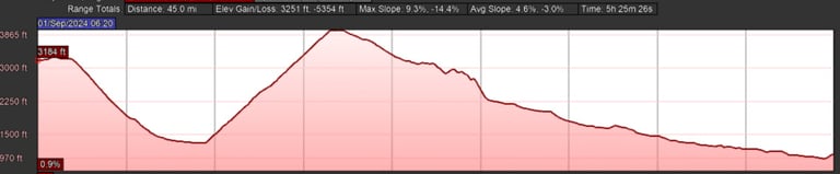
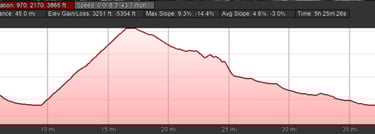
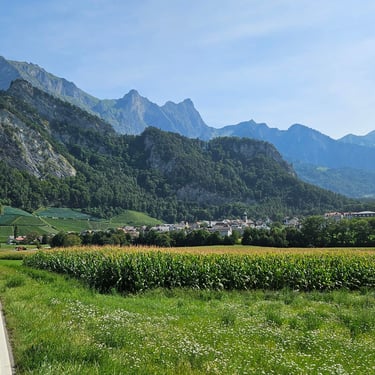
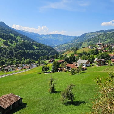
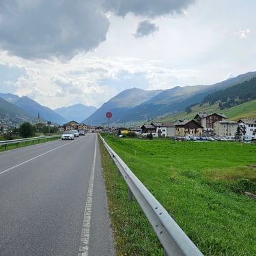
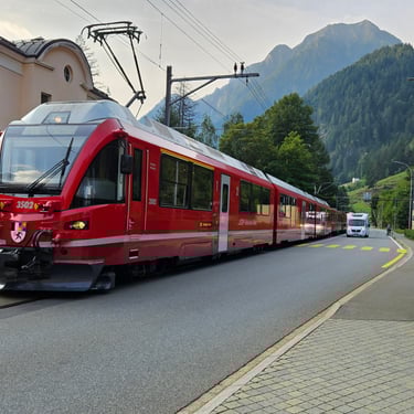
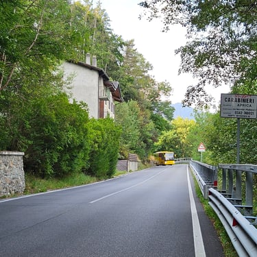
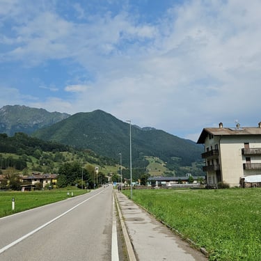
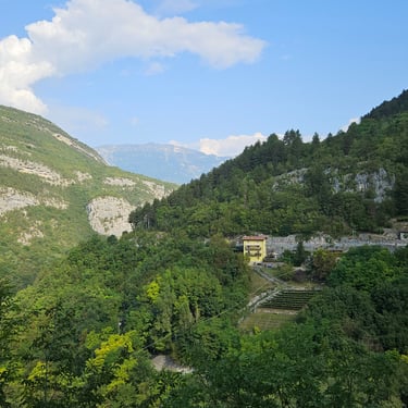
This was, in relative terms, an easy day with only 45.5 miles and one fairly big hill to climb. The weather forecast was indicatinga risk of thunder showers in the early afternoon. This provided incentive to make a fairly early start and I was on the bike at 08:20 when it was a pleasantly cool 18C. Just before setting out I discovered the source of the train whistle noise which I had intermittently heard: It was the Swiss electric train which used the main street through the town. I presume the whistle noise had been selected to stand out from the horns used by other road vehicles. The railway runs between Chur, in the upper Rhine valley in Switzerland and Torino in northern Italy.
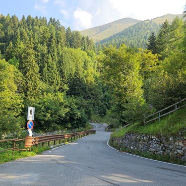
The temperature started at about 18C and steadily climbed to over 30C in the afternoon. 24C at the top of the hill was plenty warm enough. The first 9.5 miles of the ride were either downhill or roughly level. The downhill section was a wide road with sweeping bends needing minimal use of brakes and I reached 45mph at one point. I briefly stopped at Brusio to admire the curved viaduct which formed part of a spiral loop on the above-mentioned railway. After 9.5 miles and 40 minutes it was time to start the hard work of the day which was a steady uphill, but scenic, grind at between 4% and 10% gradient. Two hours and 8 miles later and 800m higher it was time to stop at a conveniently-located cafe at the top of the climb.
After 40 minutes of refreshment and recovery it was back on the bike for the downhill cruise to the end. Most of this was straightforward although about 4 miles after the cafe I went through a short tunnel and my Garmin alerted me that I was off course. So I turned around, went back through the tunnel (fortunately the road wasn't busy) and searched for the correct route. It was a narrow path on the other side of a safety barrier. This proved to be a case of following the slow and scenic route including a narrow street through a pretty village. A post mortem revealed that had I turned off the main road just after where I turned around then I would be back on route after 300m, but Garmin bike-navs don't easily provide a wider picture.
At one point I stopped with two of the other cyclists for a short refreshment and comfort break. At around 1pm there were some black clouds over the hills and thundery rumbles, indicating that the weather forecast wasn't wrong but it stayed dry for the cyclists. I reached the hotel in Breno before 2pm. Bicycles were accommodated in a generously-sized room and my own room was also very comfortable.
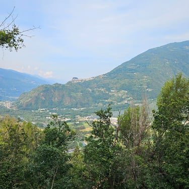
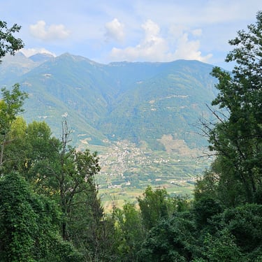
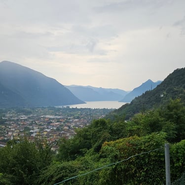
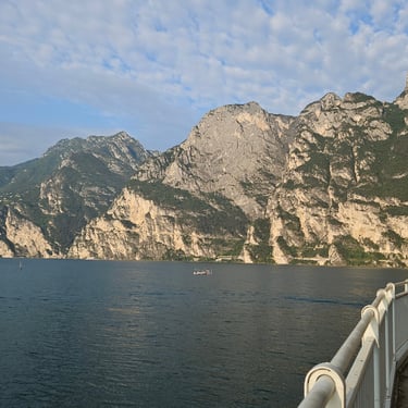
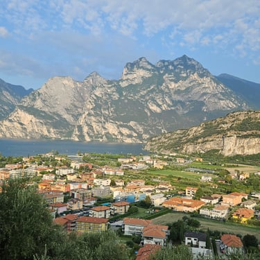
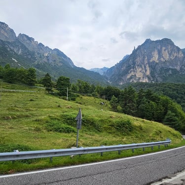
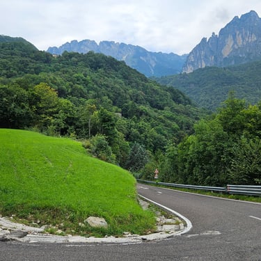
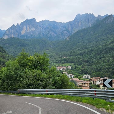
Day 15: Breno to Riva del Garda
Day 15 (2nd September) Summary
Distance 54.7 miles: Total Ascent = 2,274m (7,460ft)*
Elapsed time = 10hr 40min: Moving time = 6hr 17min
Average moving speed = 8.7mph
*Ascent according to my Garmin Edge 1040 which usually agrees closely with Google Earth. My Edge 530 usually records about 15% less climbing which is more consistent with RWGPS. I assume that the newer hardware is more accurate.
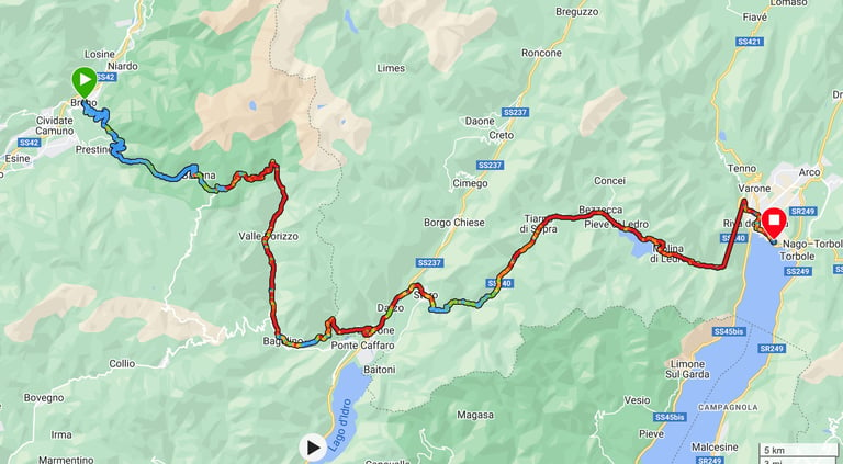
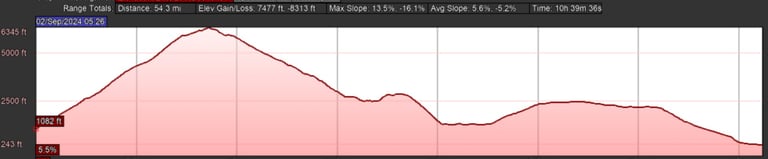
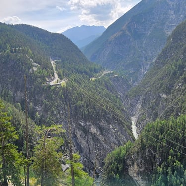
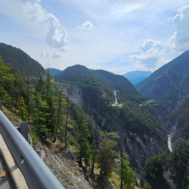
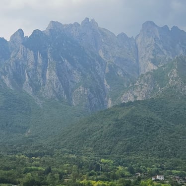
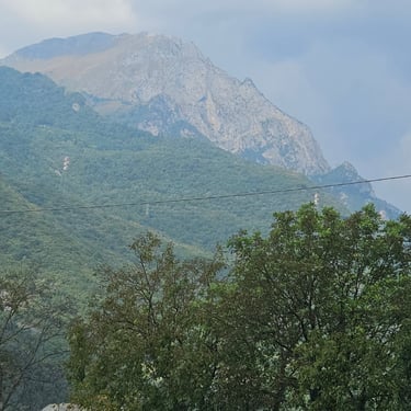
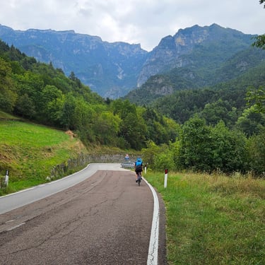
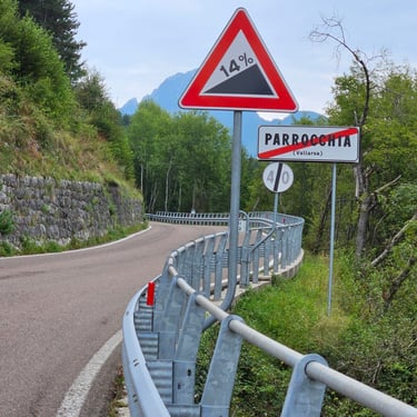
I always knew that this would be a challenging day with a very long hill to climb but that's one reason why I signed up for the adventure. Overall, this proved to be a very long day in terms of overall time and also had both the highest amount of hill climbing of any day on the trip and a new personal record for daily ascent which I'm unlikely to surpass so I finished the long day with a sense of achievement. A few in the group took advantage of an offer to be shuttled up the hill in the van. I wasn't approached as I think the leaders were aware that I had no intention of letting the hill defeat me.
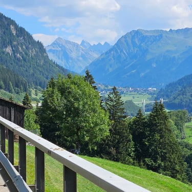
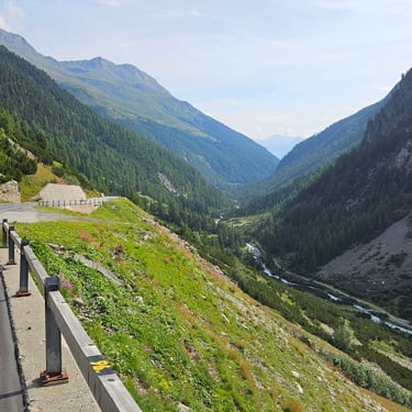
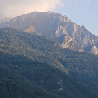
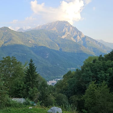
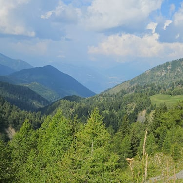
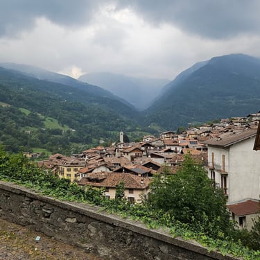
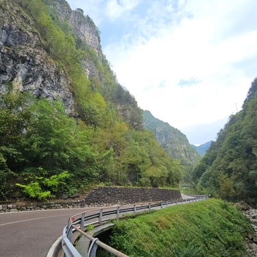
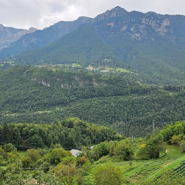
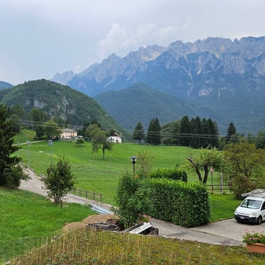
The weather forecast indicated the risk of thunderstorms after midday so I aimed to make an early start. Breakfast was served from 06.30 onwards and I was able to set out at 07.25 by which time the sun was shining on the mountain tops and the temperature was about 18C. There was 150m of flat cycling before turning left and starting the climb. Most of the climbing was between 5% and 10% gradient with some short flatter or steeper sections. While normally 2 or 3% is a noticeable hill, here it felt like flat! The first few miles contained numerous hairpin bends after which the road became relatively straight. I was always looking for potential viewpoints as locations for giving my legs a brief rest, a swig of water and, for the second half of the climb, a bite of energy bar. The terrain, trees and some clouds often provided shade from the sun so the temperature, no more than 20C, was reasonably pleasant except for some short periods when exposed to the sun.
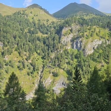
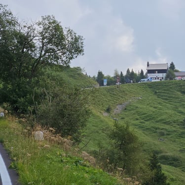
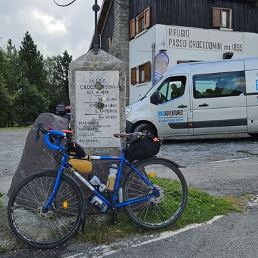
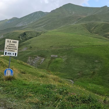
Some 3½ hours later in time with 3 hours of cycling I reached the Croce Domini cafe at an altitude of 1895m. The skies were getting darker and I opted to not stop for refreshment but try to get off the top of the hills in case the heavens opened. The cafe isn't actually at the very top which was about ½ mile further along the road and about 40m higher, which put the total climb at about 1,600m. Once at the top I put on my rain jacket to and some socks to protect against wind chill on the descent. This road has a track record for bad weather. A previous group doing this trip, a month later in the year, had to push their bikes through snow. Some caution was needed on the downhill as the surface was slightly rough in places and there were numerous bends. I think there was a provincial boundary at the cafe because the quality of the road going up the hill was somewhat better than on the descent.
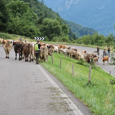
There was more interesting scenery although opportunities to appreciate this reduced as the road dropped into forest. At about 20 miles, half way down the main descent, I noticed some bovine excrement on the road and at 27 miles I came across the source: A herd of cattle walking down the road (probably being transferred from summer to winter pastures). I couldn't get past this slow-moving obstruction until a motor cyclist appeared and managed to force a path through. Soon after this the darkening skies started to rumble and eventually I was being bombarded with some large raindrops so I stopped and put on my waterproof over-shorts. After about 15 minutes of this I found a bus shelter which provided refuge from the rain and an opportunity for some food from my bag after which the rain eased off.
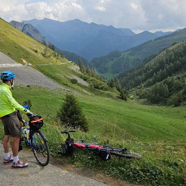
Then it was downhill, along some flat road and up another, relatively small, hill with 350m of climbing over 4 miles, some of which was through a scenic narrow valley, before going downhill for the rest of the day. Just before 3pm I reached a cafe at 46.4 miles from the start where we had been advised to wait for our van to provide a shuttle service through the tunnel alongside the lake. I realised that I was in for a long wait given that the van had passed me less than half an hour previously and I was well down the queue (the first people had arrived at lest two hours earlier. The van first had to get to our destination accommodation, off-load the bags and sort out the rooms before returning to collect batches of cyclists to shuttle through the tunnel. During this long wait there was another very heavy shower. After nearly two hours of thumb-twiddling the batch I was in decided it was time to move down the road to the designated pick-up point near the tunnel entrance where we waited another ¾ hour before going through the tunnel after which there was 2.5 miles of urban cycling to reach the accommodation at just after 6pm. It had been a long day! There was a strong feeling in the group while enduring the long wait to get through the tunnel that the logistics could have been managed better, perhaps by booking one of local bike shuttle services. One factor in the delay was that when the van was well on the way to the accommodation there was an appeal from those who hadn't taken note of the weather forcast for the van to bring their wet weather gear. This delayed the van by at least an hour but its schedule had been ambitious.
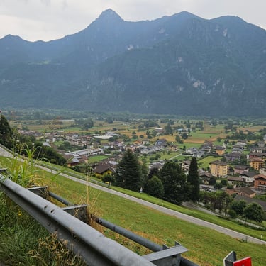
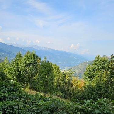
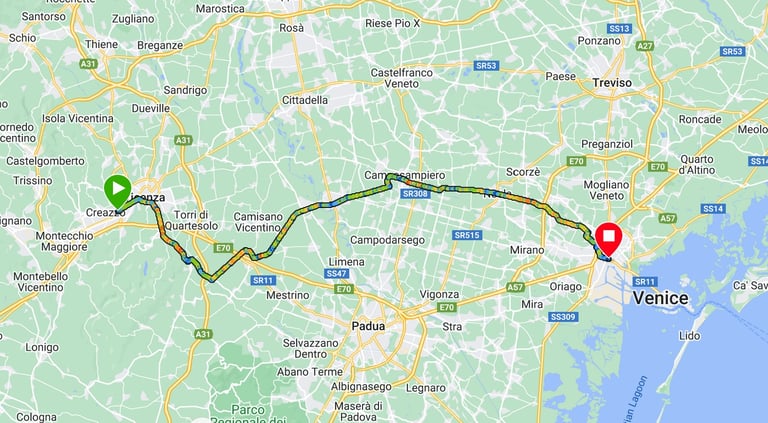
Day 16: Riva del Garda to Vicenza
Day 16 (3rd September) Summary
Distance 60.1 miles: Total Ascent = 1,560m (5,120ft)*
Elapsed time =7hr 26min: Moving time = 6hr 07min
Average moving speed = 9.8mph
*Ascent according to my Garmin Edge 1040 which usually agrees closely with Google Earth. My Edge 530 usually records about 15% less climbing which is more consistent with RWGPS. I assume that the newer hardware is more accurate.
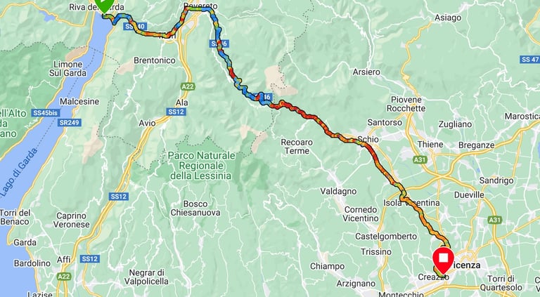
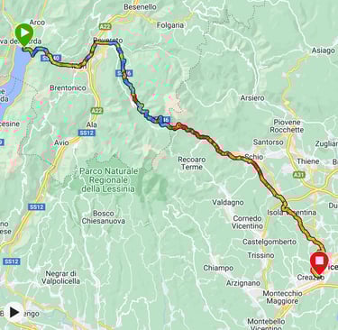
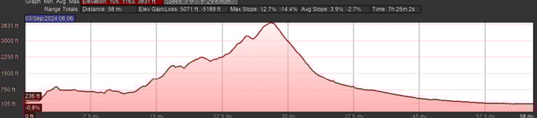
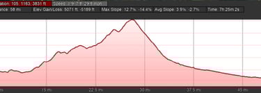
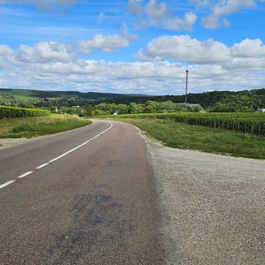
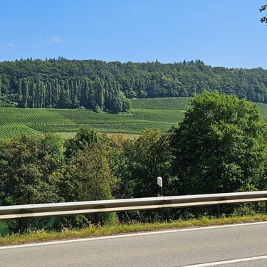
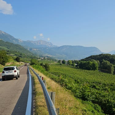
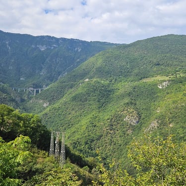
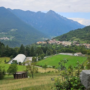
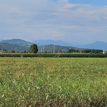
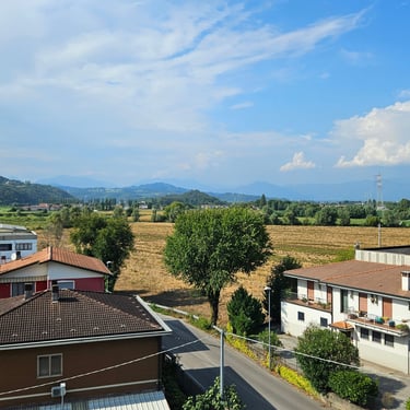
This was another challenging day with one very long hill, but the last of the trip, to climb. The day started warm with the prospect of thundery rain in the middle of the day which provided incentive for an early start. Breakfast was available from 7am and I was on the bike soon after 8am when the temperature was 24C. There as an easy 1¾ miles along the lake side after which the route went up a nasty climb (up to 14% in places) for about a mile. It provided a good view back over the city in the morning sunshine. This climb was followed by about 10 miles of undulating terrain, some of which was along quiet roads or cycle paths through vineyards.
The day's real work began at 13 miles by which time the temperature was up to 25C. Fortunately, increasing cloud and altitude resulted in a slight drop in temperature during the climb. This ascent reminded me of Ireland where many of the hills mixed in some flat sections and sometimes some short descents as part of the overall climb. I wondered if the road had been designed by an Irish engineer but more likely it was the result of the primary purpose being to connect villages rather than provide the easiest way over the hill. The vertical distance between start and end of the climb was 960m but those sections of descent would put the total climbing at well over 1000m (the total for the day was over 1500m). The climb took me 3 hours of which 2½ hours were moving and the remainder short breaks. The van had stopped about ¾ of the way up the hill so I replenished my depleted water bottle (I had three on the bike).
I refrained from stopping at the restaurant at the summit as this would increase the risk of me getting rained on should the clouds decide to dump their load. Some caution was needed on the downhill as the surface was rough in places and there were numerous bends. I think there was a provincial boundary at the cafe because the quality of the road going up the hill was somewhat better than on the descent. In 40 minutes (I have less inclination to stop for photos when going downhill) I had reached the edge of the hills and the scenery had changed from mountainous to semi-urban with agriculture. I stopped for a short comfort break and some food from my bag. The temperature had risen about 7C since leaving the summit and it was time to pack away my rain jacket which I put on in case of rain and wind chill.
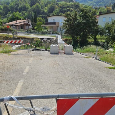
The route then carried on downwards with decreasing gradient and increasing temperature (up to an unpleasant 35C towards the end). There was one navigational challenge when the route went over a bridge that had been washed away and an alternative needed to be figured out. Otherwise it was a matter of making steady progress in the heat and wondering if my water would run out. Finally, what proved to be a good hotel came into view and there was even a sign directing the bikes to their own very spacious room.

Day 17: Vicenza to Mestre
Day 17 (4th September) Summary
Distance 47.3 miles: Total Ascent = 163m (530ft)*
Elapsed time =4hr 56min: Moving time = 3hr 58min
Average moving speed = 11.9mph
*Ascent according to my Garmin Edge 1040 which usually agrees closely with Google Earth. My Edge 530 usually records about 15% less climbing which is more consistent with RWGPS. I assume that the newer hardware is more accurate.
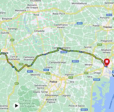
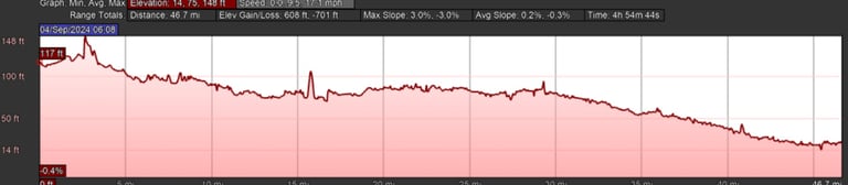
This was the final day of cycling with less than 50 miles and no hills. However, it wasn't a day for lying in bed as the bike needed to be boxed after completing the trip. Consequently cycling started soon after 8am by which time the outside temperature was a warm 25C. Although it was cloudy, there was noticeable humidity.
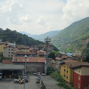
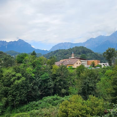
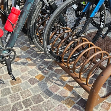
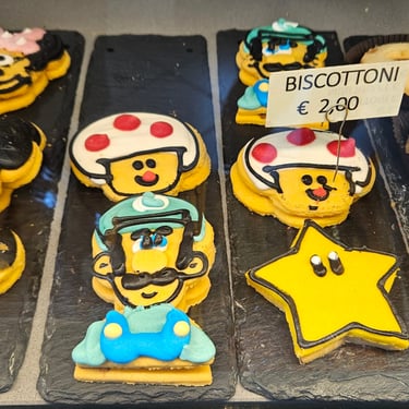
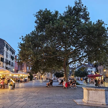
After the impressive scenery of the previous days, this day was relatively boring (hence very few photos) although there were a few features of interest. One of the most notable was an impressive tower/spire on a church. About 10 miles of the route was along an old railway which had been given a new bridge over the river Breno as part of the cycle track creation. A refreshment stop was made at a bakery at about half way where the products on offer included decorated biscuits which looked too good to eat. Outside this establishment there was an interesting bike rack created from a spiral piece of metal bar. The clouds cleared during this stop and the temperature steadily rose to an unfomfortable 33C. In Noale the route passed along an interesting street which had a big gateway at each end and, finally, I was relieved to reach the AO Hostel in Mestre, our destination (note the name hostel, not hotel - accommodation was fairly basic and clearly aimed at tourists looking for somewhere relatively cheap and close to Venice). Mestre was as close as we could reasonably get to Venice with out bikes.
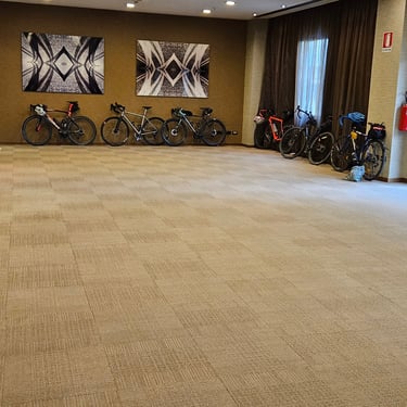
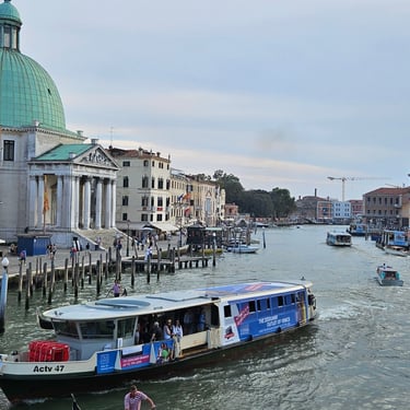
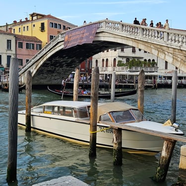
Then it was a matter of getting bike into box (no big hurry as the room was ready) and boxes packed into the van before getting a train into Venice for an evening meal.
The Journey Home
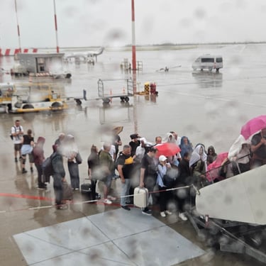
I had booked the 10:15 Easyjet flight to Gatwick which needed a prompt and quick breakfast ready for the group shuttle service to the airport leaving at 07:45. Then it was a matter of finding where to check my bag in at the airport and wait, and wait. The system was slow in showing which gate to go to. Once at the gate I could see that there was heavy rain outside. The weather god had evidently decided that it was time to clear the sky of some of the humidity. Rain doesn't deter Easyjet from getting people onto the plane. I had discovered that at Bristol in July so this time I had a rain jacket ready for the trip across the tarmac. Everyone was on the plane soon after 10:30 and then the pilot announced that we would be delayed as the plane could not be refuelled while there was a thunderstorm within 5km. Eventually the rain cleared and it was evident that we were well down the queue for the fuel tanker. We finally departed about two hours late and arrival at Gatwick was further delayed due to rain over southern England. I consequently reached home nearly three hours later than I had expected. It's less stressful being delayed going home than on the outward journey,
Concluding Remarks
I had expected some fairly tough days going through the mountains and this proved to be the case. They could have been much worse had there been a lot of unfavourable weather. Day 6, however, was unexpectedly tough due to heat and headwind as well as a fairly long distance by my standards.
My strategy for the hills was to not push myself too hard. I ended up with a guiding principle of taking a short break approximately every 100m of vertical climbing. My legs were always complaining and I felt like they never got any stronger. All those little breaks add up to significant stoppage time so I knew to try and minimise time in cafes. The faster and fitter folk were able to have two cafe stops and still finish ahead of me. I usually had one stop, and sometimes none, relying on the supplies I had on the bike. Hare and tortoise (me)?
The bike behaved itself. I had built it with low gearing (42 / 26 chainrings and 11 to 42 cassette) so that I should never run out of gears. The major climbs were usually accomplished in 3rd to 5th gear but it's comforting to know that there's something lower if needed. I did once use bottom gear - on a steep bit of cycle track on day 12. However, when I stopped to take a photo I couldn't get started again as the front wheel was lifting off the ground.
Would I recommend this trip? Yes! There were some relatively boring sections but the days through the mountains are very memorable. Helped, of course, by some good company and support although I was often cycling by myself. I wouldn't want to have tackled those hills carrying all my baggage - there would be a lot of bike-pushing.