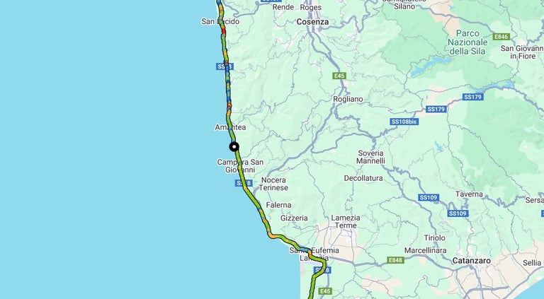
Pisa to Sicily 2025
Contents
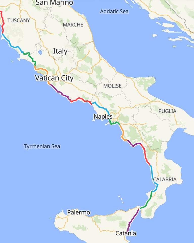
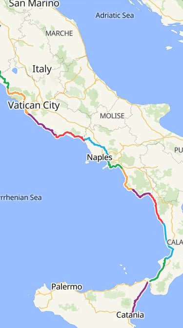
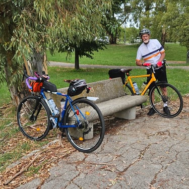
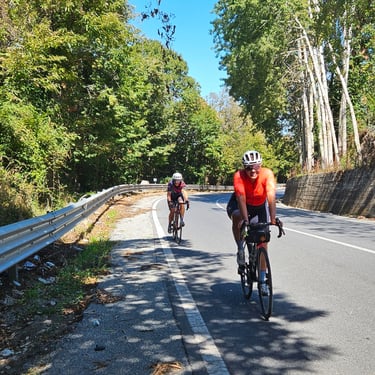
Last year's autumn ride in Portugal was spoiled by disappointing weather. When I heard that this Italian trip was going to take place I signed up. It was classified as challenging and there appear to be some days when distance and climbing fall into that category. The weather, particularly the temperature, could provide an extra challenge. My friend Richard agreed to join me and share a room as we had previously done on the Rhine and Portugal trips.
Preparations and Getting to the Start
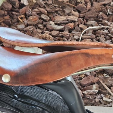
The bike being used for this trip is my Spa Cycles Aubisque which I had used on two of the 2024 trips plus my 2025 LEJOG. Well, almost the same as I'm a perpetual tinkerer. So the 650b wheels were replaced by 700c and the mudguards were changed to fit the latter. Most important, however, was that the leather saddle which caused me severe discomfort on the LEJOG (due, I suspect to getting soaked in Ireland in 2024) was replaced. After many miles of testing I opted for a Selle Anatomica NSX2 saddle which was almost new.
As on previous trips, the bike went to Bike Adventures in a box to be taken to the start on their van. The target arrival time in Pisa was the afternoon of Saturday 6th September and, after due research I concluded that the most convenient flight option would be the afternoon EasyJet flight from Gatwick which, however, was only on weekdays and not Saturdays, so I booked the Friday flight. Trains and plane ran to schedule and I reached Pisa late afternoon and checked in at the hotel.
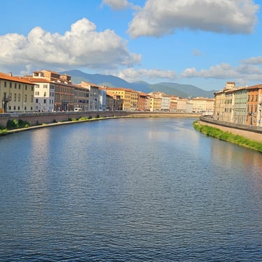
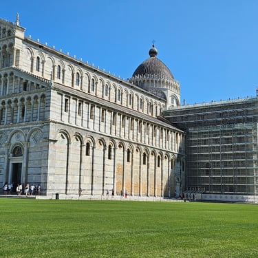
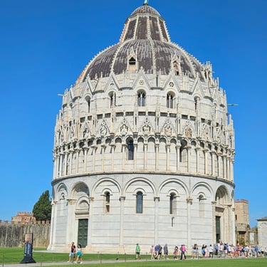
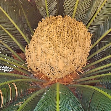
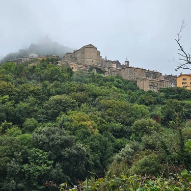
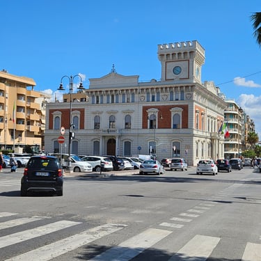
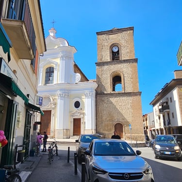
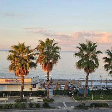
I spent Saturday morning first looking at the famous historic buildings, where there were thousands of other people, and then visiting the Botanic Gardens, which provided a quiet and shady respite, before returning to the hotel ready to be reunited with my bike and meet some other members of the group. My bike reassembly was uneventful with nothing lost or damaged in transit.
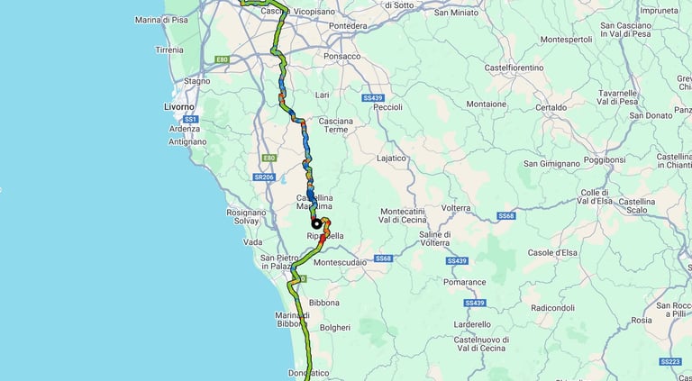
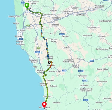
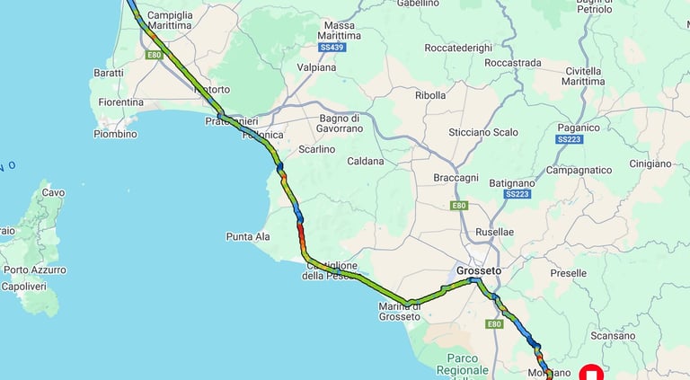
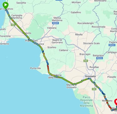
Day 1: Pisa to San Vincenzo
Day 1 (7th September) Summary
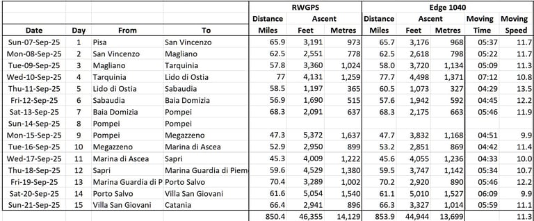
Distance 65.7 miles: Total Ascent = 968 m (3,175 ft)*
Elapsed time = 6 hrs 59 mins: Moving time = 5 hrs 37 mins
Average moving speed = 11.7 mph
*Ascent according to my Garmin Edge 1040 which usually agrees closely with Google Earth. My Edge 530 usually records about 15% less climbing which is more consistent with RWGPS. I assume that the newer hardware is more accurate.
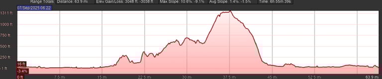
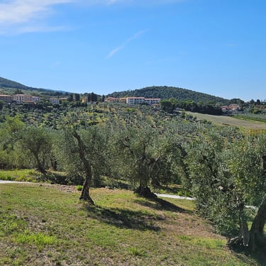
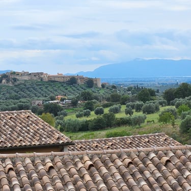
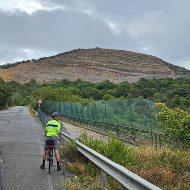
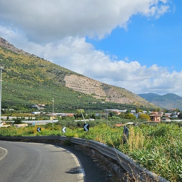
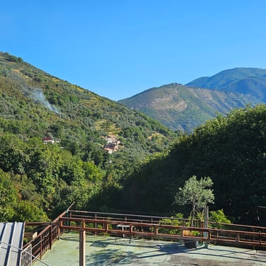
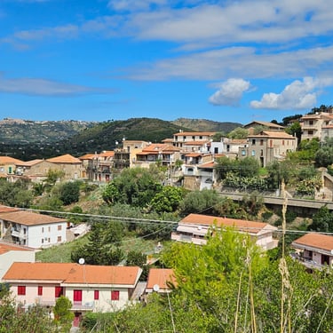
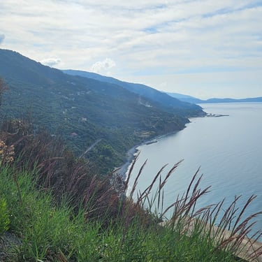
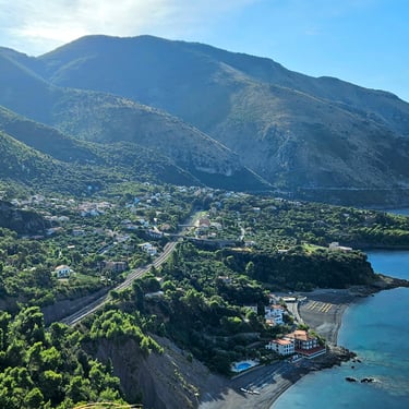
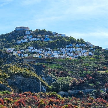
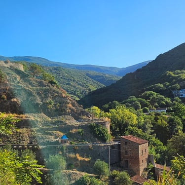
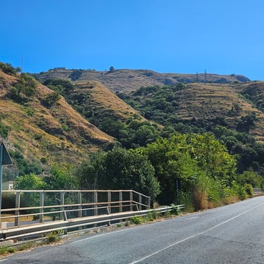
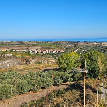
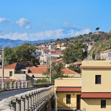
It was going to be a moderately long day with a hilly section in the middle. I have a strong memory of the discomfort of cycling up the hill to Davos on a hot and humid afternoon on day 12 of the Venice trip. Consequently I was planning on a fairly early start (breakfast time permitting) to accumulate as many miles as possible and try to get up the hill (top elevation 400m) before the weather got uncomfortably hot. I had identifed a potential refreshment stop in the town at the top of the hill.
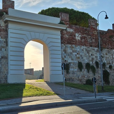
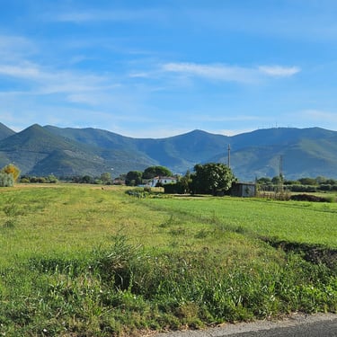
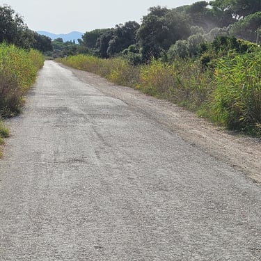
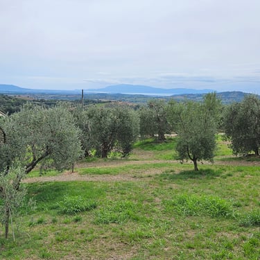
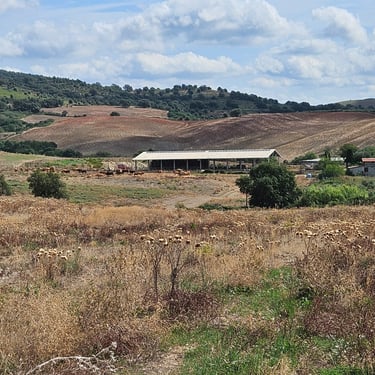
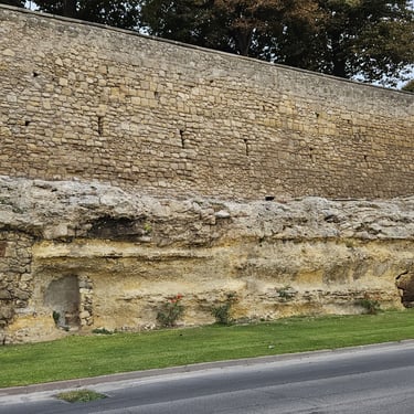
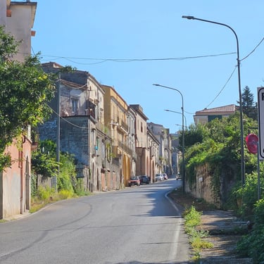
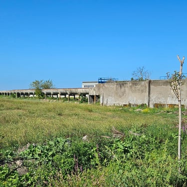
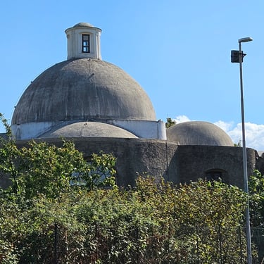
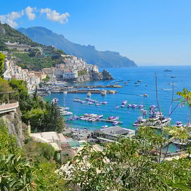
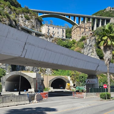
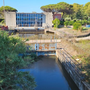
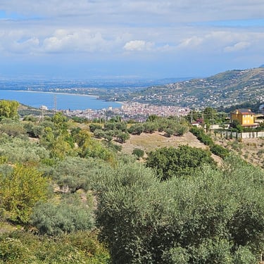
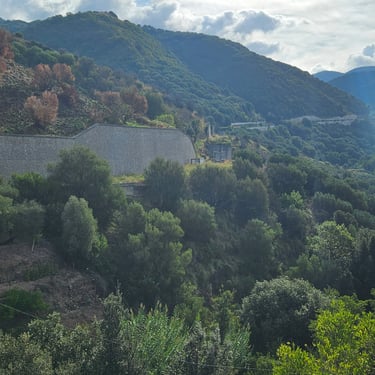
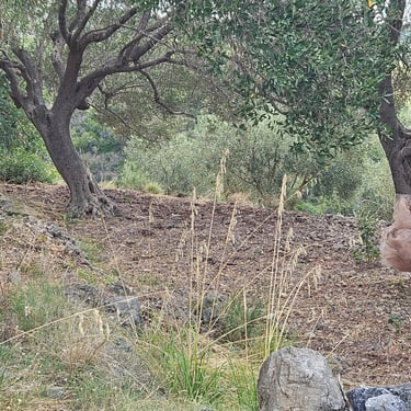
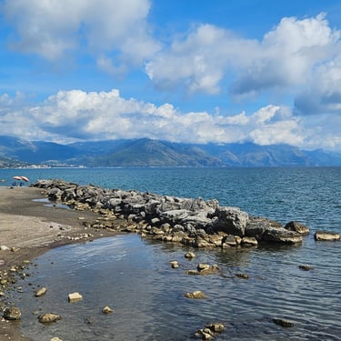
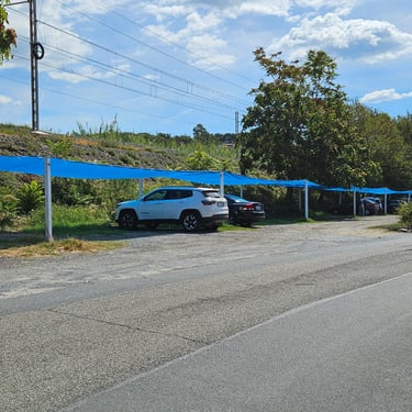
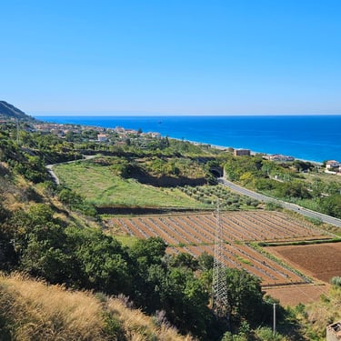
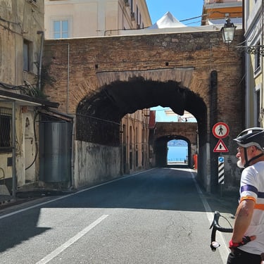
Breakfast was available from 7am and we started from the hotel at about 08:20. Breakfast was fine except that there was no sign of any tea. Sunday morning Pisa streets were fairly free of vehicles with runners and cyclists fairly numerous. I made a brief stop to photograph a section of the old city wall in which there was what appeared to be a new archway. There were then two further brief stops to make minor adjustments to my saddle orientation before we progressed from Pisa onto fairly quiet roads. One interesting feature we encountered some miles south of Pisa was a very long and low building. My best guess was that it was a cover over a conveyor belt. Subsequent research revealed that it was part of the European gravity wave detector.
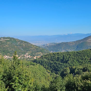
The first two hours were at a comfortable temperature but the day gradually warmed up, particularly in the strong sunshine. Shaded areas, which included parts of the main climb, were noticeably cooler. We reached the pre-identified refreshment stop in the village at the top of the climb a few minutes after 12 noon.
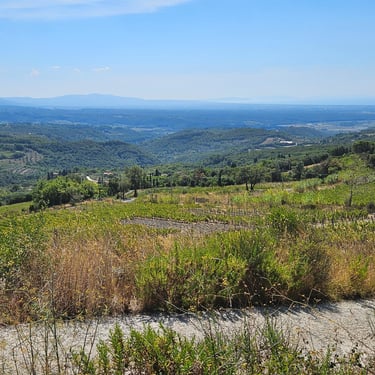
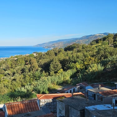
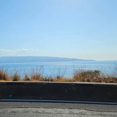
There were some good views at a few points on higher ground but we then had a long and pleasant descent down to the coastal lowlands. This was followed by nearly 20 miles of almost flat cycling along an almost straight road into a moderate SW breeze. Numerous miles cycling in the same position with constant effort become somewhat tedious and my body began to ache. The only consolation was that trees along the road provided shelter from the breeze. I kept looking for opportunities to stop and give my body a break. One stop was at a fruit stall where we bought some pears which I stowed in my bike bags, but I saw nothing which merited a photo stop.
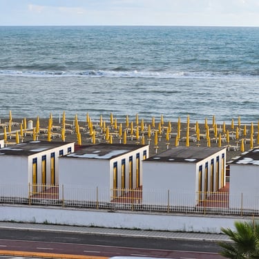
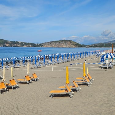
The Hotel il Delfino was next to the sea and, unusually, the balcony had a clothes airer which was useful for drying washed clothing. The room, however, had the major hazard of water dripping from the air conditioner. Spare towels were used to try to control the puddle on the floor. The dripping water problem was evidently not new as the floor tiles were starting to lift. Dinner was at a very busy pizzaria.
Day 2: San Vicenzo to Magliano
Day 2 (8th September) Summary
Distance 62.5 miles: Total Ascent = 798 m (2,620 ft)*
Elapsed time = 6 hrs 28 mins: Moving time = 5 hrs 22 mins
Average moving speed = 11.7 mph
*Ascent according to my Garmin Edge 1040 which usually agrees closely with Google Earth. My Edge 530 usually records about 15% less climbing which is more consistent with RWGPS. I assume that the newer hardware is more accurate.
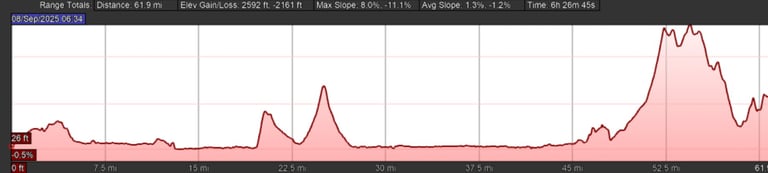

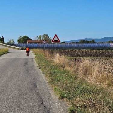
This is slightly shorter and less hilly than the first day but likely to take longer without fresh legs. Although breakfast was served from 7am we were slow in getting ready and didn't start cycling until just after 8:30. The first 20 miles were fairly level and good progress was made. One section of road was signed as bicycles only with the surface quaity the worst we had encountered so far. The first stop was at a bakery at about 31 miles after two smaller hills and we bought supplies for a picnic stop to be made further on.
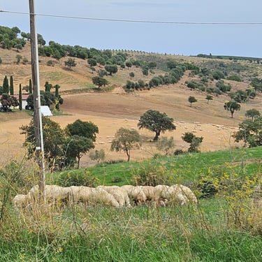
Between 38 and 43 miles we used the cycling equivalent of a motorway - smooth and generously wide (wider than many British roads). This passed to the south of a military airbase where the silence was periodically interrupted by small and noisy jet planes. We then passed through the corner of the large town of Grosetto where I spotted a bench in a park to use for the lunch stop. Soon after lunch the route started to climb to an altitude of almost 200m. Fortunately, some high cloud eased the heat. The hilly section provided a welcome change of scenery and, for the first time on the trip, we saw some sheep.
After the hilly area the route dropped to about 40m before we had to climb again to the Borgo Magliano Garden Resort which was in the hills close to Magliano. The access road to the resort contained the steepest hill of the trip so far - bottom gear was needed. The hotel was a sprawling place and our room was a bit cave-like. There was a short heavy shower late afternoon which caused a dash to rescue drying clothes. Dinner was a buffet costing €29 per person, but I refilled my plate numerous times.
Day 3: Magliano to Tarquinia
Day 3 (9th September) Summary
Distance 58.0 miles: Total Ascent = 1,134 m (3,720 ft)*
Elapsed time = 6 hrs 4 mins: Moving time = 5 hrs 9 mins
Average moving speed = 11.3 mph
*Ascent according to my Garmin Edge 1040 which usually agrees closely with Google Earth. My Edge 530 usually records about 15% less climbing which is more consistent with RWGPS. I assume that the newer hardware is more accurate.
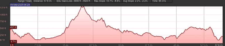
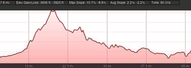
This day was slightly shorter but also slightly more hilly than the first two days and the result was a slower average speed. There was a hill at almost 400m at 20 miles. Some cloud helped to moderate the heat from the sun.
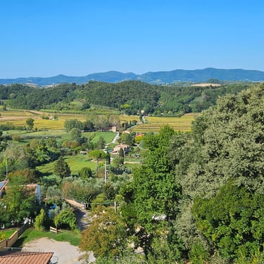
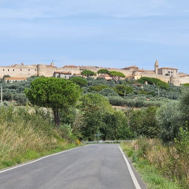
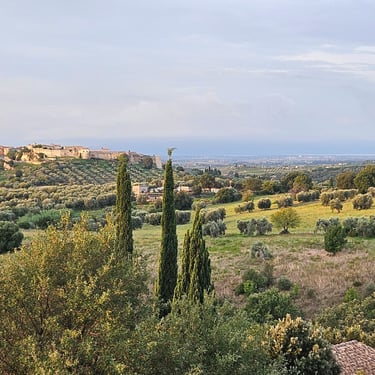
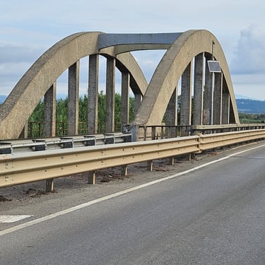
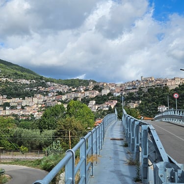
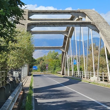
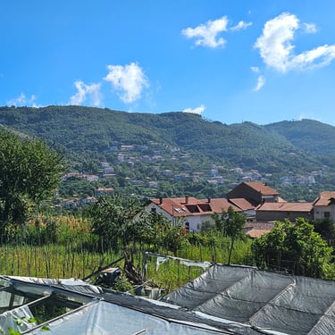
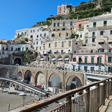
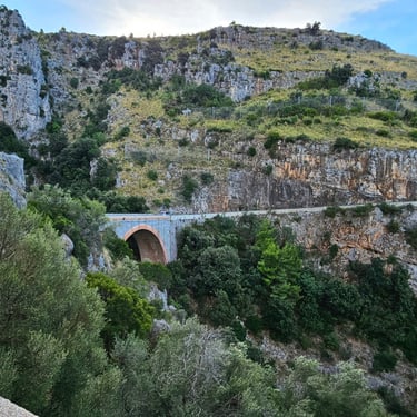
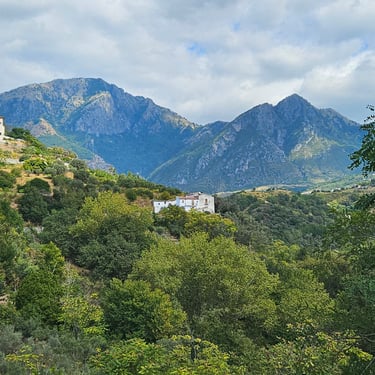
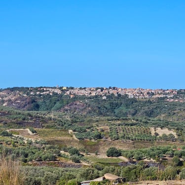
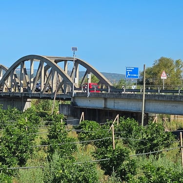
Breakfast was available from 7am (there was a good view of Magliano in the early morning sunshine) and we were on our bikes just before 8:30. After a few miles I stopped to photograph an unusual concrete bridge. Having the arches in concrete was sensible , but concrete hangers in tension was not a normal design choice (I had seen similar bridges in Eritrea which had been built by the Italians). I had identified a bakery in Manciano (at the top of the climb) where we could get some supplies for consumption later on where there were few on-route refreshment options.
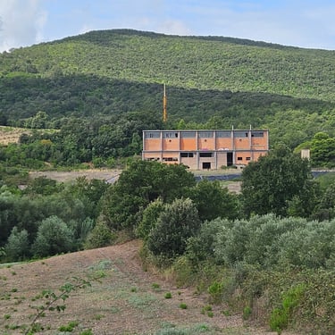
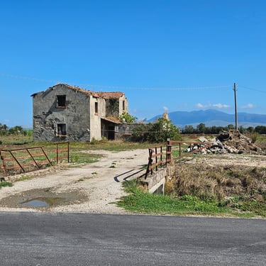
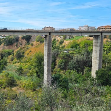
There was then about 20 miles of the route undulating but gradually dropping but progress was hampered by a noticeable southerly breeze with many sections having no trees to provide shelter. One feature which I photographed for subsequent research was a big red building (it proved to be part of an abandoned mine). Richard spotted a fine stone arch bridge which I had overlooked and had to do a U-turn to get a photograph (from what was also a fine modern concrete bridge which vegetation made impossible to photograph).
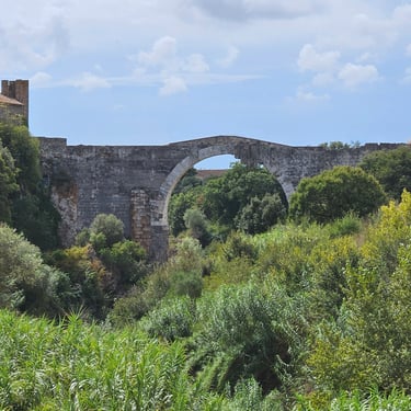
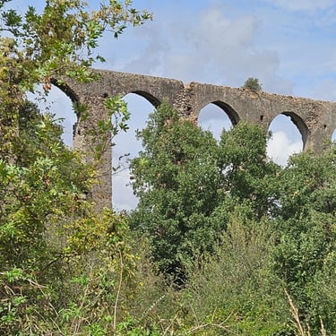
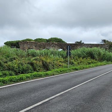
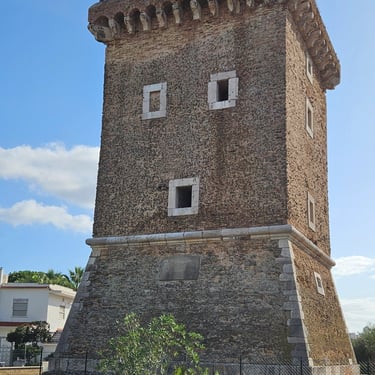
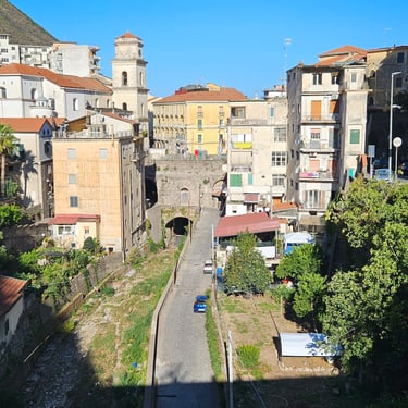
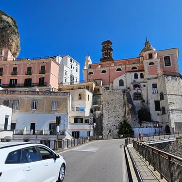
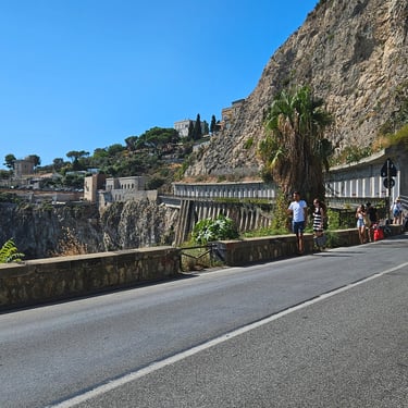
Soon after that we stopped in a gateway for our lunch then not long after that there was a ruined aqueduct on the right side of the road. Eventually the town of Tarquinia came into sight and we found the Hotel Villa Tirreno. Our room had a generous balcony which was used for bike storage (and an annoying air conditioner which would turn offf each time the door to the balcony was opened). We had been asked to pre-order our dinner at the hotel. I didn't like the look of the menu and Richard had found there was a nearby pizzaria. In early evening we walked up the hill to see the old city wall and then had a pizza.
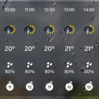
There was much discussion among the group about the weather forecast for the next day, which showed a high probability of thundery showers and triggered a visit to the railway station by some of the group to investigation travel alternatives for the next day,
Day 4: Tarquinia to Lido di Ostia
Day 4 (10th September) Summary
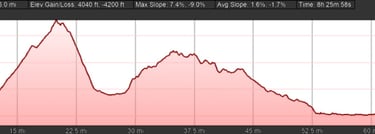
Distance 77.7 miles: Total Ascent = 1,370 m (4,500 ft)*
Elapsed time =8 hrs 27 mins: Moving time = 7 hrs 12 mins
Average moving speed = 10.8 mph
*Ascent according to my Garmin Edge 1040 which usually agrees closely with Google Earth. My Edge 530 usually records about 15% less climbing which is more consistent with RWGPS. I assume that the newer hardware is more accurate.
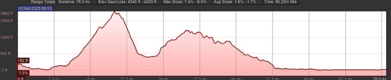
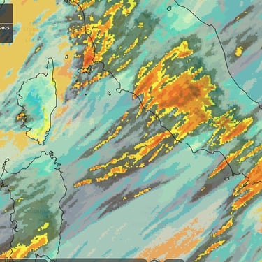
At about 77 miles this was the longest day on the trip with more hill climbing than the previous 3 days. This day is as near as we get to Rome. The weather forecast anticipated thundery showers which encouraged four of the group to travel by train. In reality the weather was damp at the start after an overnight thunderstorm, then dry for several hours until a downpour at about 1:30pm which faded to light rain until another downpour at 3pm. A consequence of the unsettled weather was much cooler temperatures not exceeding 25C. A weather map for Italy showed 24 hour cumulative rainfall up to 6pm in this area of between 50 and 100mm.
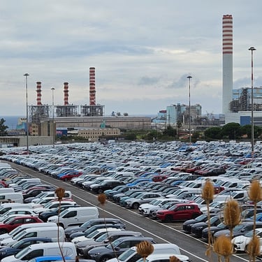
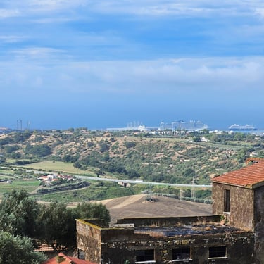
Breakfast was available from 7am and we were cycling soon after 8am in damp weather. The day included two significant hills. The summit of the first was about 525m at 20 miles and the second was 325m at about 35 miles. Consistent with my policy of trying to get through the most challenging part of the day before a proper refreshment stop I had identified a bakery in Manciano at the top of the second hill. I started the day in my waterproof jacket and overshorts but took them off after an hour as the weather had dried and the route started to climb. We had passed near the main port for the Rome area (Civitavecchia) which had a power station, imported vehicles and docked cruise liners.
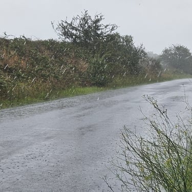
The route in the hills provided a variety of scenery including a massive quarry. After the refreshment stop we embarked on a long and undulating descent where progress was hampered by a noticeable headwind. We could see an ominous black cloud ahead but, at about 1:30pm, were surprised by heavy rain coming from our right side which triggered a dash for the shelter of a tree. We continued after putting on waterproofs and the rain moderated. I was getting a bit warm when we reached the coastal area and removed my waterproofs. However, at about 3pm we were surprised by another dose of pressure-washing and, in the absence of any shelter, opted to continue. Richard was still wearing his jacket while I had a nominally waterproof gilet. The latter was clearly not designed for this type of rain and, while my shorts had a water-repellant treatment, it became ineffective within a few seconds. The result was a soggy cyclist and a soggy saddle. My feet, however, were happy to be splashed by warm water from the large puddles.
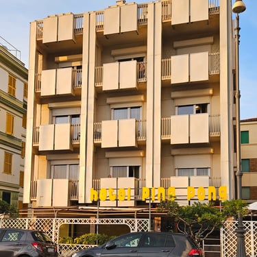
Overall, the final 1½ hours of the day's cycling was very unpleasant. In addition to the rain, there were enormous puddles and the Rome rush-hour traffic seemed to have started early. The roads up and down each side of the Tiber were also the worst encountered so far, not helped by the potholes being full of puddles. The rain was finally clearing when we reached the Hotel Ping Pong in Ostia which was quickly awarded the accolade of the worst so far on the trip (what use is a kettle without any other refreshment making equipment?). We were lucky to have a balcony where we could put soggy clothing to dry (and hope the rain had finished). A good dinner was taken at one of the nearby restaurants.
Day 5: Lido di Ostia to Sabaudia
Day 5 (11th September) Summary
Distance 60.5 miles: Total Ascent = 327 m (1,070 ft)*
Elapsed time = 6 hrs 47 mins: Moving time = 4 hrs 29 mins
Average moving speed = 13.5 mph
*Ascent according to my Garmin Edge 1040 which usually agrees closely with Google Earth. My Edge 530 usually records about 15% less climbing which is more consistent with RWGPS. I assume that the newer hardware is more accurate.
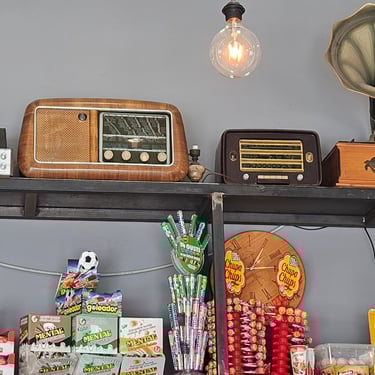
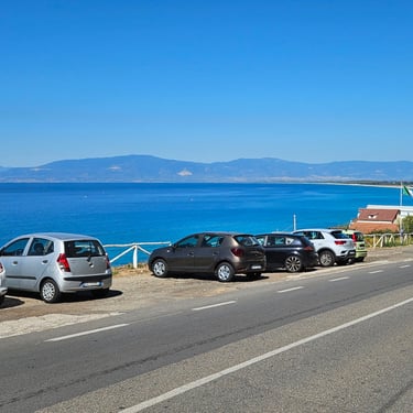
The rain had cleared and a few remaining clouds gradually disappeared. Breakfast was from 7am although we didn't get moving until 08:40. The provided route went inland of Anzio and Nettuno but, after much group discussion of the options for the day, there was consensus to follow the coast to take advantage of refreshment options in the two towns. It was a relatively easy day of cycling as nowhere on the route was higher than 40m. An unusual feature along the road out of Lido di Ostia was parking spaces in the middle of the road. We stopped at a coffee place at 20 miles and bought a couple of giant biscuits for later consumption (not a good choice as they proved to be excessively sweet). This coffee place had some interesting audio equipment.
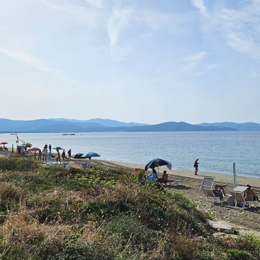
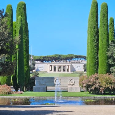
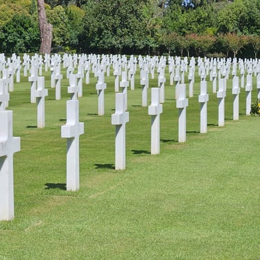
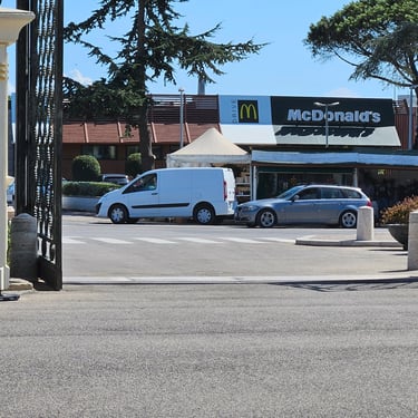
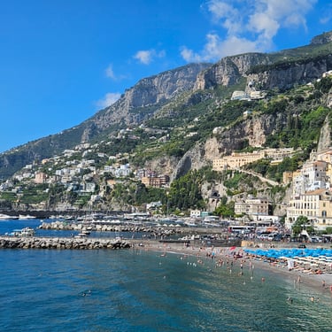
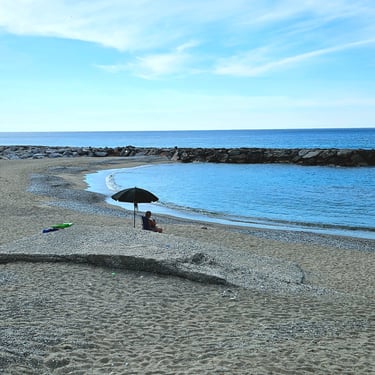
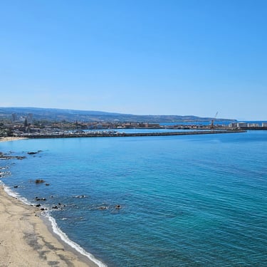
In Anzio we first stopped where there was a view of the bay and the deserted beach. We then paid a short visit to the small Anzio war museum before moving to the extensive war cemetry which is maintained by the US government. In keeping with the American theme, there's a McDonalds just outside the entrance gate. The cemetry guard required us to park our bikes in a rack just inside the entrance gate so we took turns to look at the cemetry while the other watched the bikes.
We then proceeded southwards and stopped for some food from our bags once clear of the urban area. The south-western breeze was steadily strengthening and made cycling along the coast somewhat tedious. A few miles from the end we agreed that another break was needed and stopped at one of the many roadside refreshment places for an ice cream. There were no other customers until some more of the group stopped to join us. With the holiday season now over these refreshment places will soon be closing for the winter.
Our destination was the Best Western Sabaudia Hotel which was slightly difficult to find as Best Western wasn't on the signs. The hotel was outside of the town so there were no other nearby options for dinner and we were hostage to their menu. My €25 dish of the day was a small lump of spaghetti looking lost in the middle of the plate. Not good cycling fuel!
Day 6: Sabaudia to Baia Domizia
Day 6 (12th September) Summary
Distance 57.6 miles: Total Ascent = 592 m ( 1,940ft)*
Elapsed time = 5 hrs 48 mins: Moving time = 4 hrs 45 mins
Average moving speed = 12.2 mph
*Ascent according to my Garmin Edge 1040 which usually agrees closely with Google Earth. My Edge 530 usually records about 15% less climbing which is more consistent with RWGPS. I assume that the newer hardware is more accurate.
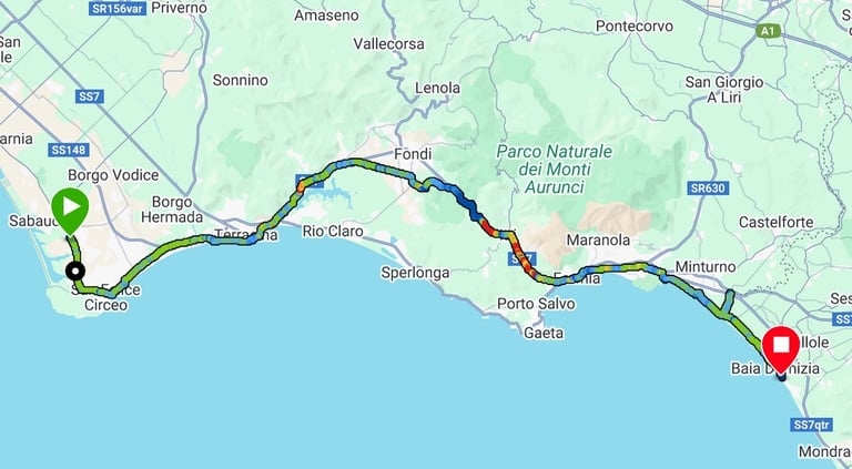
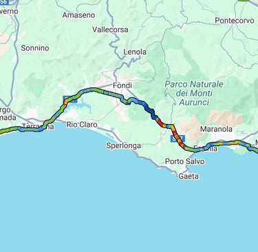
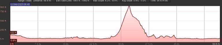
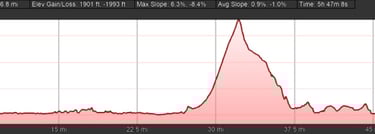
My objective of the day was to try to get over the one significant hill (summit approx 270m) before the weather got too hot. I had identified that there were several refreshment options in the town of Itri (which didn't feature in the route information sheet) which was just after the summit and was thus the suitable place for a break before continuing to the end. A 7:30 breakfast resulted in departure at about 8:50.
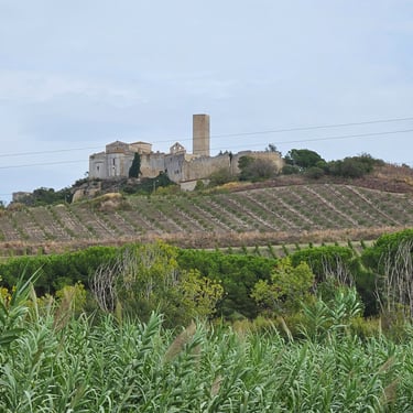
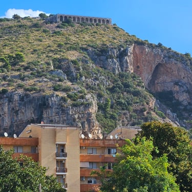
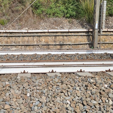
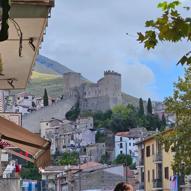
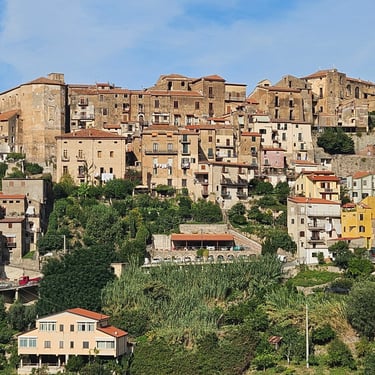
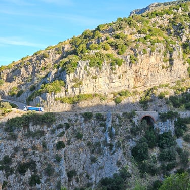
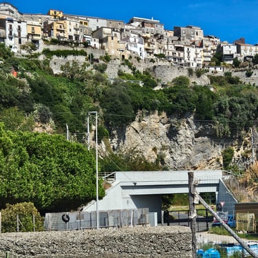
The heat from the sun was occasionally moderated by cloud. Good progress was made on a pleasant road along the coast for the first 15 miles before turning inland. At 19 miles the route then took us on some low quality, but quieter, roads of which six miles ran parallel to the railway (I noted that the Italians paint their rails white presumably to reduce heating by the sun). At 28 miles we joined a main road for the climb over the hill. It was a comfortable climb with the sunshine sometimes moderated by cloud and/or trees. The riders ahead of us had found a very good cafe in Itri where we had an early lunch of freshly made to order large cheese and ham rolls. The cafe also provided a good view of the castle on the hill.
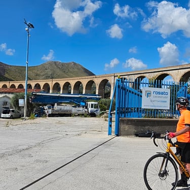
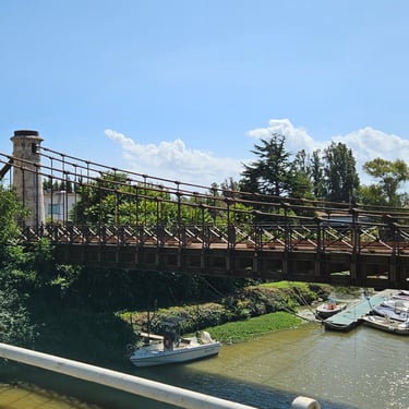
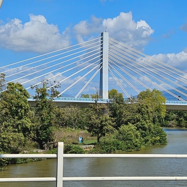
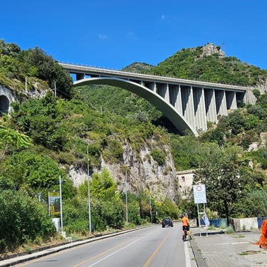
After Itri there was a pleasant descent which didn't require use of brakes to moderate speed. Part way down we passed under an impressive viaduct which research revealed used to carry a railway to the coast. Towards the end of the ride we passed over a concrete bridge of a more sensible design with steel hangers between the deck and the concrete arches. Upstream of this bridge is a modern cable-stayed bridge while downstream is dilapidated suspension bridge.
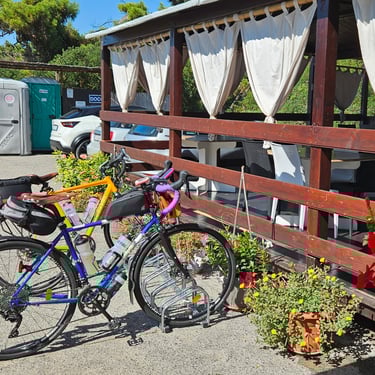
I've included a photo of my saddle which is an unusual shape but still comfortable. The deformation was present on the first three days but increased after the saddle got soaked during the fourth day's downpour.
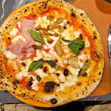
Dinner was a good pizza at a pizzaria about a 2km walk from the hotel. On the way back from dinner we stopped at a pre-identified supermarket to get some supplies for the next day. Unfortunately, after lingering over dinner we were late and the shop had just closed. No problem - the door was opened for us and we were assured that closing time was flexible.
Day 7: Baia Domizia to Pompei
Day 7 (13th September) Summary
Distance 68.3 miles: Total Ascent = 663 m (2,175 ft)*
Elapsed time = 6 hrs 52 mins: Moving time = 5 hrs 46 mins
Average moving speed = 11.9 mph
*Ascent according to my Garmin Edge 1040 which usually agrees closely with Google Earth. My Edge 530 usually records about 15% less climbing which is more consistent with RWGPS. I assume that the newer hardware is more accurate.
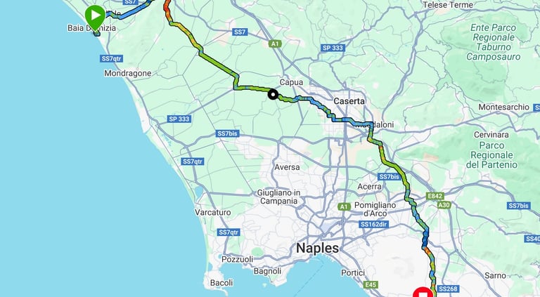
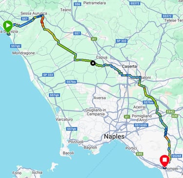
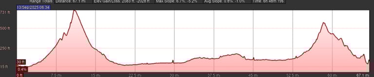
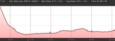
The day's route was designed to avoid Naples. It was nearly 70 miles but not too hilly (the auto-scaling profiles are deceptive). We were trying to minimise cycling in the afternoon heat (which actually started well before midday) but a 7:30 breakfast resulted in cycling starting just after 8:30 on what was a very sunny day with the distance suggesting about an extra hour of cycling compared to the previous day.
The route took us through villages and farmland. At about 44 miles and with 1pm was approaching I was watching for some off-road shade for a quick lunch stop and saw an empty chair under a tree in front of a locked walled compound. We assumed that a watchman had temporarily disappeared. After munching a cheese sandwich, we were getting ready to leave when a car stopped and a young lady in a short red dress got out and sat in the chair. Polyglot Richard overheard her listening to Russian soap opera on her phone and wished her farewell in Russian. Over the next few miles I noticed four more ladies sat in chairs at the side of the road. There seems to be a day shift for the local night life!
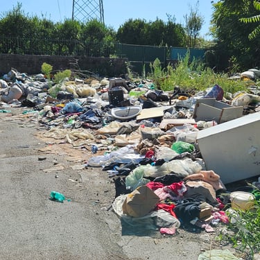
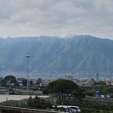
The route provided numerous views of Vesuvius and we passed by what appeared to be the best patronised fly-tipping site for Naples (the problem of fly-tipping seemed to gemerally get worse as we proceeded southwards), Near to Pompei our route appeared to be blocked by concrete walls surrounding what I assume was a construction site. Fortunately there was a gap at one side just wide enough to push a bike through. The final approach to the hotel was up a hill going the wrong way on a one-way street.
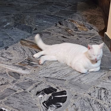
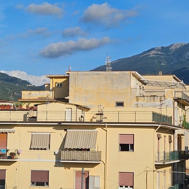
We spent many hours in a hot hotel room before figuring out by standing on a chair that the aircon was set for use with a remote control which was nowhere to be seen, probably because the aircon looked very old and most of the remotes had died. Once this setting had been changed the room temperature became much more tolerable. The room balcony overlooked the pool and was equipped with a laundry drier which was put to good use. The hotel had a friendly white cat which would keep an eye on the reception if the receptionist was absent.
Dinner was a good pizza at a restaurant about 10 minutes walk from the hotel.
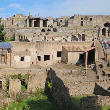
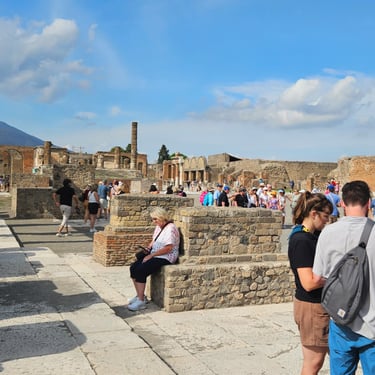
Day 8: Rest day in Pompei
14th September
There was no cycling today but there was an opportunity to discover why Pompei is famous. The day started by looking from the balcony and wondering where the next day's route was through the hills to the south of the city as there was no visible gap.
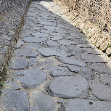
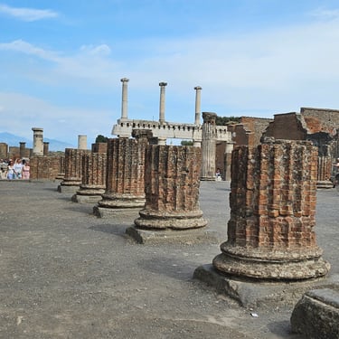
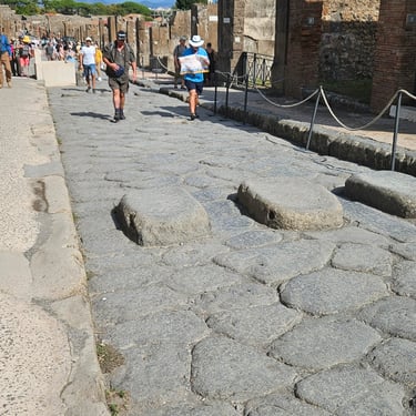
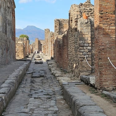
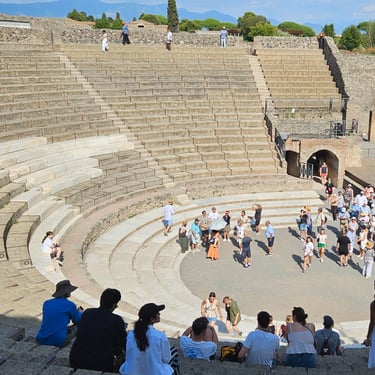
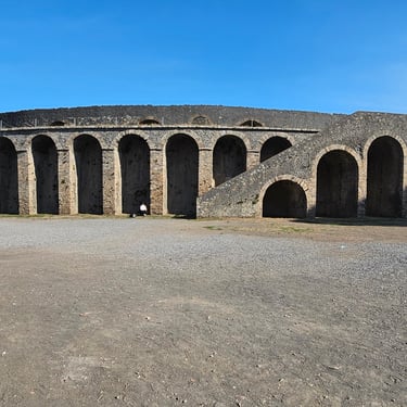
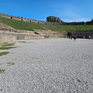
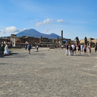
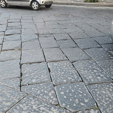
The main activity was a visit to the ruins. Thousands of other people were doing the same. and parts were fairly crowded. The stone-paved roads in the old city looked very bumpy. One interesting feature was upstanding stones which were stepping stones between the raised footpaths on each side that were substantially above road level. The wheeled vehicles must have been quite narrow for the wheels to pass through the gaps between the stones and good steering must have been needed to get wheels through the gaps. The larger features included two ampitheatres, one of which would have made a good velodrome.
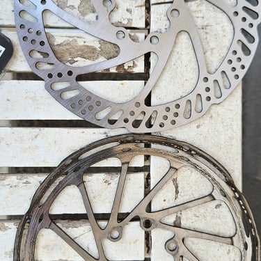
The final activity was some bike maintenance, particularly the replacement of Richard's front brake rotor which didn't look very good on one side because it had spent a few miles with a brake pad back-to-front after recent bike maintenance (we had discovered the problem when the bike was being reassembled on day 0). The new rotor had been bought at the Pompei Decathlon store which was near the hotel.
We then went for a generous bowl of pasta followed by some ice cream at the restaurant used on the previous evening.
Day 9: Pompei to Megazzeno
Day 9 (15th September) Summary
Distance 47.7 miles: Total Ascent = 1,168 m (3,830 ft)*
Elapsed time = 6 hrs 1 mins: Moving time = 4 hrs 51 mins
Average moving speed = 9.9 mph
*Ascent according to my Garmin Edge 1040 which usually agrees closely with Google Earth. My Edge 530 usually records about 15% less climbing which is more consistent with RWGPS. I assume that the newer hardware is more accurate.
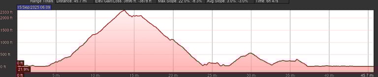
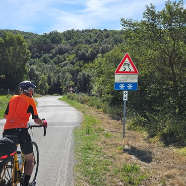
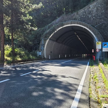
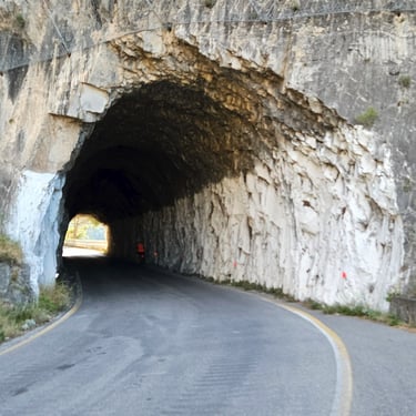
This was a relatively short day but the first 14 miles were spent going uphill with the top of the climb marked by a tunnel about 0.9 km long (bike lights recommended).
I was keen to get up the hill before it was too hot. Breakfast was available from 7am. Departure was at 08:10 and we reached the tunnel about two hours later. The first part of the journey was through the Pompei suburbs and coincided with the morning rush hour traffic and taking children to school. There was a significant section of road paved with flagstones which seem to be even bumpier than cobblestones and we had the surprise of having to carry our bikes through an underpass under a railway which had recently replaced a level crossing.
After seven miles through the suburbs and about 1/4 of the climb accomplished we joined a wider and slightly busier road which we would follow to the tunnel. The road was fairly wiggly and finally there were fewer houses and more trees, which provided some welcome shade. Eventually we reached the tunnel which was fairly well illuminated so lights were to improve our visibility to motorists rather than see our way in the dark. The exit from the tunnel, at about 2,300ft (700m) was the highest point on the whole trip. We temporarily went off course about a mile after the tunnel so that Richard could visit a post office and send some Pompei postcards.
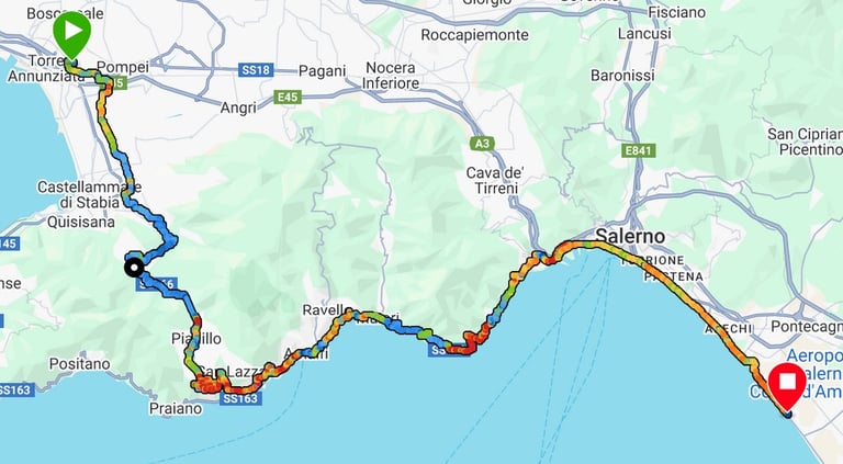
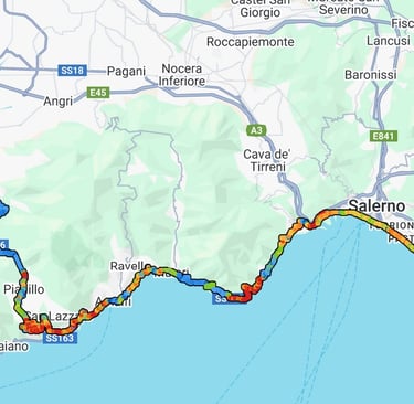
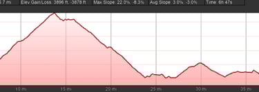
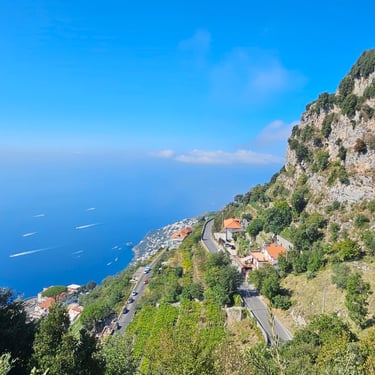
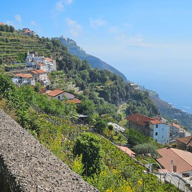
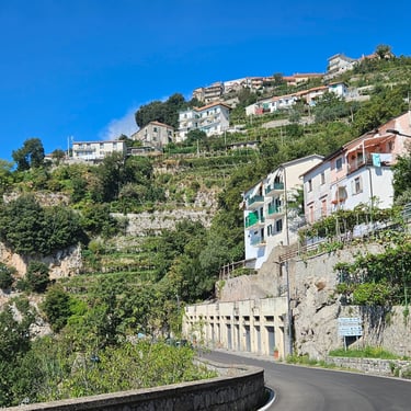
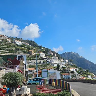
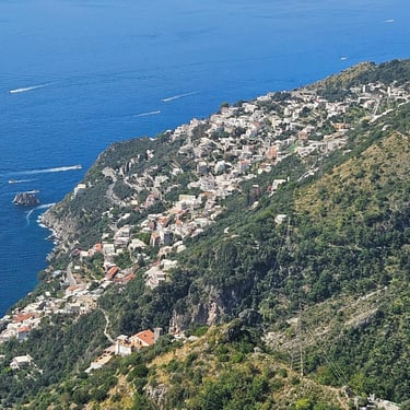
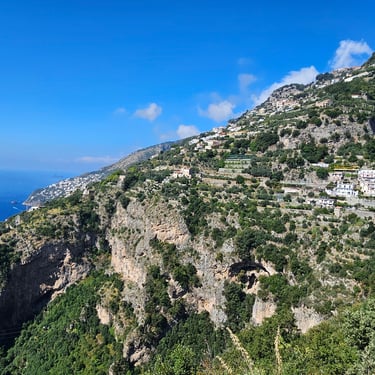
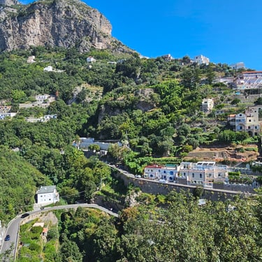
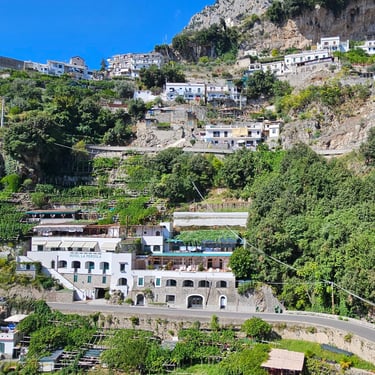
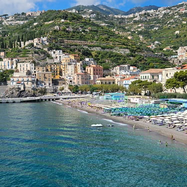
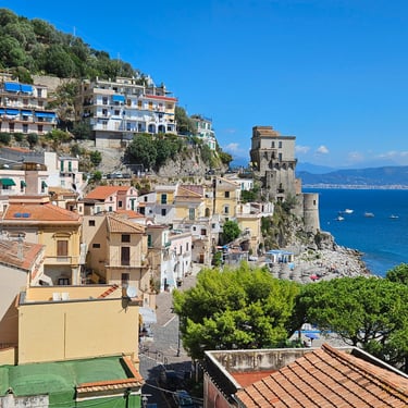
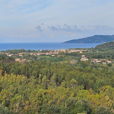
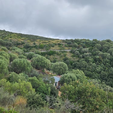
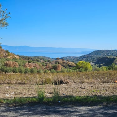
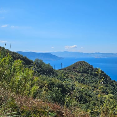
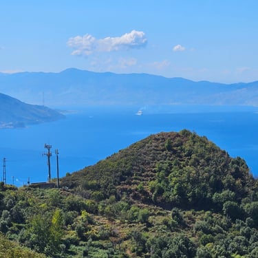
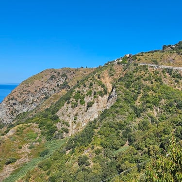
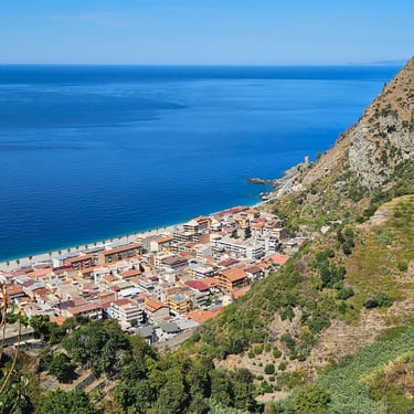
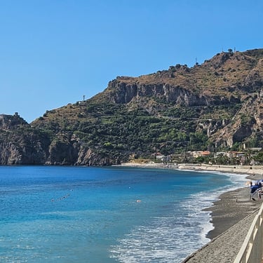
After a further mile we caught sight of the coast and started on what was one of the most scenic sections of the whole trip. The Amalfi coast is a popular tourist destination and also a World Heritage Site and cycling is a good way to appreciate it as it's usually easy to stop and appreciate the views. We could see many boats moving along the coast. I presume this is another way to appreciate the scenery. The road was reasonably quiet at the top of the descent but gradually became busier as we wiggled our way down to the coast. It also became hotter and dustier.
The centre of Amalfi was packed with tourists. Traffic flow was hampered by frequent stoppages for pedestrians to get across the road so traffic fumes added to the discomforts. A few short tunnels added to the variety. We finally got through Amalfi and the road became less busy. With 1pm approaching we stopped by the side of the road (for lack of anywhere better) for a snack from our bags. About ½ hr later we stopped in Vietre sul Mare for a drink from a shop.
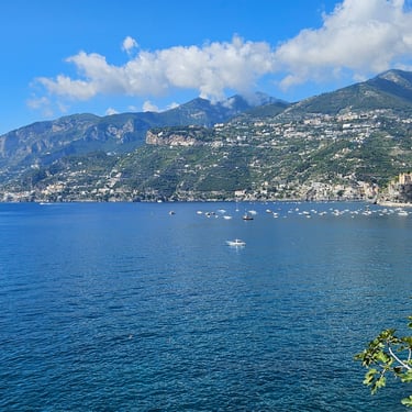
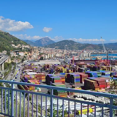
The next place of interest was Salerno, which has a big port and some fascinating infrastructure with fine bridges and tunnels (the latter seem to be still under construction with unclear purpose). Once past the port, the route through Salerno followed the seafront and was relatively easy and we stayed close to the coast for the remaining few miles to the hotel Ancora, passing some fine apartment blocks along the way.
The hotel room was overlooking the sea and the air conditioner was no match for the heat from the afternoon sun coming through a large glass door serving a small balcony. The building designers evidently didn't take this into account or they would have provided an external sun screen or provided a more potent air conditioner. The sun was appreciated for laundry drying but was otherwise unwelcome.
We weren't tempted by the hotel's dinner menu and walked nearly a mile for yet another pizza at Il Giardiniello Ristorante e Pizzeria. This was remarkably quiet, perhaps because the holiday season was drawing to a close as the space could accommodate many people. It was run by a large and friendly family and was memorable for the "metro" pizza on the menu. This, we were told, meant it was a metre in diameter. We opted for something smaller, preceded by a salad and followed by some ice cream.
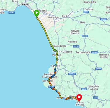
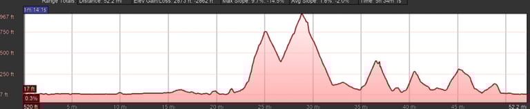
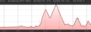
Day 10: Megazzeno to Marina di Ascea
Day 10 (16th September) Summary
Distance 53.2 miles: Total Ascent = 869 m (2,850 ft)*
Elapsed time =5 hrs 35 mins: Moving time = 4 hrs 42 mins
Average moving speed = 11.4 mph
*Ascent according to my Garmin Edge 1040 which usually agrees closely with Google Earth. My Edge 530 usually records about 15% less climbing which is more consistent with RWGPS. I assume that the newer hardware is more accurate.
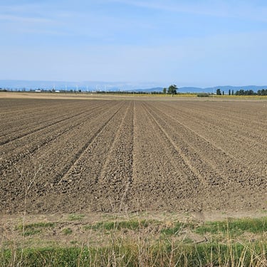
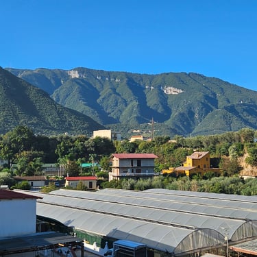
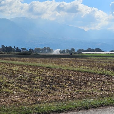
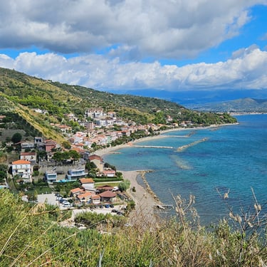
Departure was just before 08:30. The day was topographically less challenging than the preceding day and started with nearly 2 hours of almost flat cycling close to the coast when the morning breeze, fortunately not very strong, was the main impediment. One feature of interest to a retired irrigation engineer were two large drainage pumping stations. We saw some irrigation and plastic greenhouses but the full extent of this intensive agriculture only becomes evident by looking at satellite imagery.
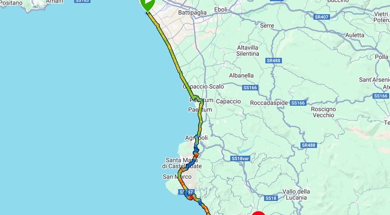
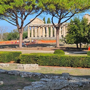
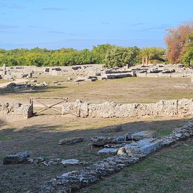
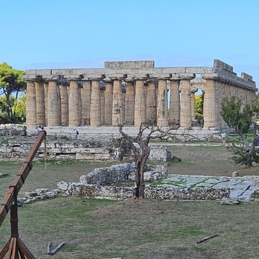
At about 13 miles the route turned inland. We assumed this would be due to a waterway ahead but the real reason became apparent when we cycled past some ancient ruins. This was the ancient Greek city of Paestum. It wasn't, however, convenient to stop and do some tourism so early in the day. There was then a short refreshment stop in Agropoli before tackling the day's hills. The gradient was a maximum 10% and usually nearer 5%.
At about 37 miles and after completing the main hills we stopped at about 12:30 for some packed lunch in a shady location off the road before resuming the cycling. The route followed the coast with some occasional good views and there were several lesser hills to climb before we reached the hotel at about 2pm. One generally good thing about the Italian hotels is that the rooms are ready for relatively early check-ins. The room was a reasonable size and the window sufficiently small that there was no risk of being cooked by the sun. There was also, unusually, a kettle and some cups.
Bikes were parked outside at the back of the hotel which we were assured would be secure as the gates were locked at night (they were still there in the morning) and some of the group took advantage of the outside location to do bike cleaning and maintenance. Dinner was at a nearby restaurant which had been booked by the leaders and we were sat at two tables. There was a little confusion when the food arrived as, when my order arrived, it was taken by one of the others and they had already started eating when their order appeared. So I had that and reckoned I had the better deal as the portions weren't particularly generous.
Day 11: Marina di Ascea to Sapri
Day 11 (17th September) Summary
Distance 45.6 miles: Total Ascent = 1,236 m (4,050 ft)*
Elapsed time = 6 hrs 21 mins: Moving time = 4 hrs 33 mins
Average moving speed = 10.0 mph
*Ascent according to my Garmin Edge 1040 which usually agrees closely with Google Earth. My Edge 530 usually records about 15% less climbing which is more consistent with RWGPS. I assume that the newer hardware is more accurate.
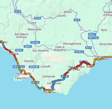
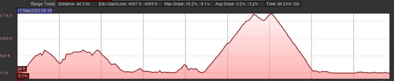
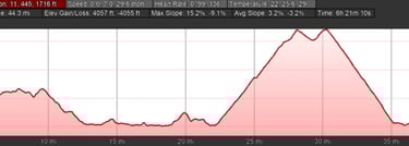
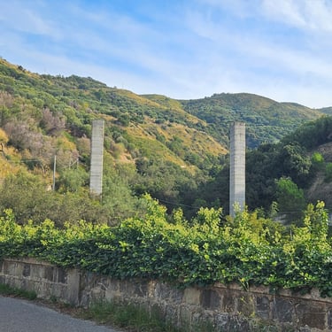
This was a much more challenging day than expected. Departure was at about 08:15 and after about 400m of flat cycling we turned left and started climbing along a fairly wiggly route with variable gradient. At 3.3 miles the road climbed steeply to a T junction and my front wheel lifted off the ground so I had to dismount and push the bike for a short distance. That behaviour was an indication of a slope of about 20% (confirmed by my Garmin data). At about 4.5 miles, on a temporary downhill section, I saw a massive concrete wall in the distance. The route took us past it so I could see it was a big retaining wall close to the road. A little further along there were some tall concrete piers indicating that a viaduct had been half built and then abandoned. I assume that changing political winds meant that funding was withdrawn for what would have been an expensive road to improve the connection between two small towns.
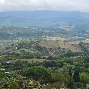
The road wiggled onwards and upwards and at about 5.7 miles we came to a shockingly steep section which was surfaced in concrete. My front wheel quickly lifted off the ground and pushing the bike up the hill was hard work. Somehow, two people managed to cycle up this hill! My Garmin data showed a 28% slope. After that the route descended towards the coast followed by about 10 miles of relatively flat cycling including some short tunnels. We made a short stop for an ice cream at one of the beach-side cafes. By 23 miles we reached the main hill of the day which was a 500m ascent over 6 miles (so averaging about 5%). The weather turned cloudy near the top of the hill which provided respite from the sun. We then stopped at a pre-identified cafe at 31 miles, just over the top of the hill and 1pm approaching as I reckoned the day was short enough to be able to afford a proper stop. The choice of food wasn't good but it was a pleasant place with a good view. Before long we were joined by mother + daughter group members who had taken a longer mid-morning cafe stop. Then the tour leader who was sweeping also arrived, having started more than two hours behind us. The resulting one hour lunch break was more than I had planned, but it was good company and, once we had descended to the coast (a pleasant long descent which rarely needed brakes) I realised it had been prudent to have the lunch break in a cooler place. Humidity added to the heat at the coast.
The final 10 miles along the coast to the hotel in Sapri wasn't memorable. There was a traditional bike shop just behind the hotel which looked as if it would have spare parts for any bike made in the past 50 years (plus new equipment). Richard got into a long conversation with the owner and bought a pair of spare brake pads. Dinner was at a very well patronised pizzaria close to the hotel. There was a brief rain shower in the evening.
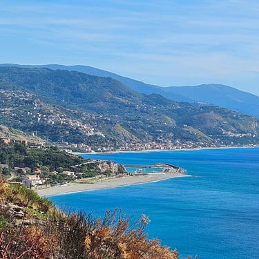
Day 12: Sapri to Marina Guardia di Piemontese
Day 12 (18th September) Summary
Distance 59.5 miles: Total Ascent = 1,142 m (3,750 ft)*
Elapsed time = 7 hrs 5 mins: Moving time = 5 hrs 34 mins
Average moving speed = 10.7 mph
*Ascent according to my Garmin Edge 1040 which usually agrees closely with Google Earth. My Edge 530 usually records about 15% less climbing which is more consistent with RWGPS. I assume that the newer hardware is more accurate.
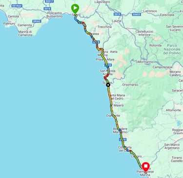
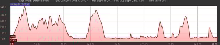
Almost 60 miles with a mixed bag of cycling, some pleasant and some not. The temperature exceeded 32C, the hottest yet, but was less humid than the previous day.
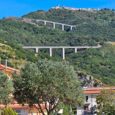
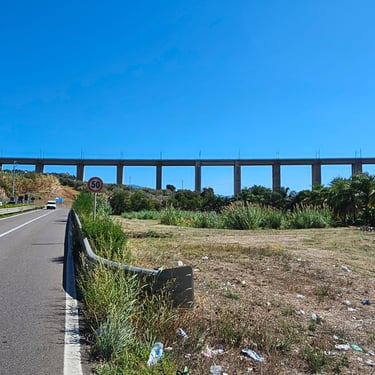
Departure was, again, at about 08:15. The whole day followed the coast but wasn't flat or straight as various headlands and valleys had to be crossed. The previous day's humidity had fortunately gone but was replaced by more wind. In the morning this was from the south east and, depending on road direction, was a very noticeable cross wind or head wind. There were several tunnels along the road with another under construction to bypass a narrow tunnel on a headland. Parts of the route were on highway SS18 and at around 23 miles we passed over two substantial viaducts which smoothed the terrain. Progress was quite slow and after 3 hours and only 26.5 miles we stopped for an ice cream.
At 41 miles it was close to 1pm so we stopped at a bar in search of refreshment. There wasn't much choice and we settled for a bottle of soft drink to wash down some food from our bags. After that it felt like more of the same mix of hills, bends and relatively flat sections. About two miles from the end I stopped to admire two viaducts on the hillside where someone had decided to build a good road to a small hilltop town. EU regional development funds?
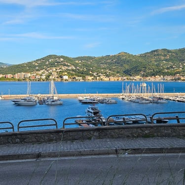
We were relieved to reach hotel Zilema which was squeezed in between hillside and coast outside of the nearest town. It was a family business who were good hosts except no one had told them that cyclists need plenty of food. The dinner portions weren't very generous and we didn't get offered desserts because the big family were tucking into their own meal. The only satisfied member of our group had opted to cycle into the town to use the facilities there. Breakfast was also lacking in quantity.
Day 13: Marina Guardia di Piemontese to Porto Salvo
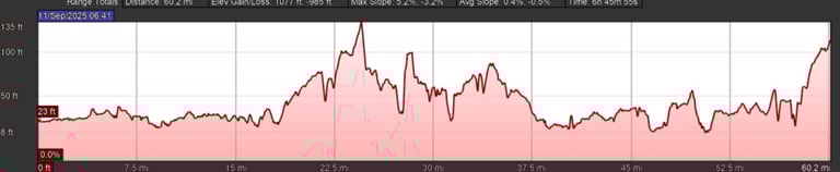
Day 13 (19th September) Summary
Distance 70.2 miles: Total Ascent = 890 m (2,900 ft)*
Elapsed time = 6 hrs 55 mins: Moving time = 5 hrs 46 mins
Average moving speed = 12.2 mph
*Ascent according to my Garmin Edge 1040 which usually agrees closely with Google Earth. My Edge 530 usually records about 15% less climbing which is more consistent with RWGPS. I assume that the newer hardware is more accurate.
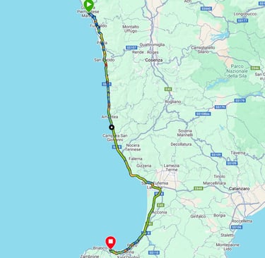
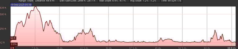
An early start was needed with 70 miles of cycling and, finally, we managed to get on our bikes before 8am (just). After 350m of flat cycling we turned left and started climbing. The slope rarely exceeded 5% with some sections of downhill on the way to the summit at 7.6 miles. At about 15 miles we joined highway SS18 whereupon my Garmin Edge showed the next turning to be after 26 miles. Yes, 26 miles along what was a fairly busy but moderately wide single carriageway road (it proved to be even more). After 16 miles we spotted a "panini" (sandwiches) sign and stopped to investigate. There were big bread rolls to which could be added a selection of fillings. We ordered two sets so we didn't have to worry about the next day. We then continued along SS18.
I struggled to keep up with Richard who was zooming along at about 15 mph while I was outside my comfort zone. After about 5 miles I shouted at him to stop where there was some shade so I could have a drink and rest my legs for a few minutes. That speeding also meant that there were no photo stops (the photos I did take all have blue sky and no cloud). The traffic became less after 37 miles when the E45 motorway became close. At nearly 45 miles I was getting hungry and spotted a car park on our side of the road so we stopped for a 20 minute refreshment break. Finally, at nearly 59 miles, we parted company with SS18 and the final 11 miles were along a fairly scenic section of coast. With 8 miles remaining we had an ice cream stop.
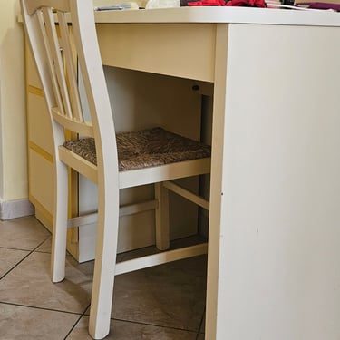
The hotel was a beach resort. The room was memorable for having a desk which was abnormally high. Dinner was just about sufficient but breakfast was inadequate.
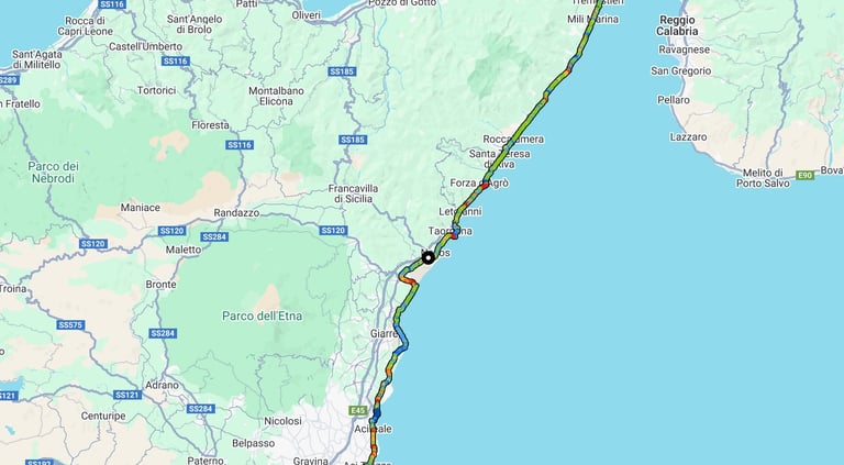
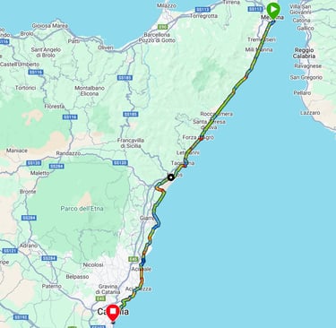
Day 14: Porto Salvo to Messina
Day 14 (20th September) Summary
Distance 61.1 miles: Total Ascent = 1,527 m (5,000 ft)*
Elapsed time = 7 hrs 55 mins: Moving time = 6 hrs 9 mins
Average moving speed = 9.9 mph
*Ascent according to my Garmin Edge 1040 which usually agrees closely with Google Earth. My Edge 530 usually records about 15% less climbing which is more consistent with RWGPS. I assume that the newer hardware is more accurate.
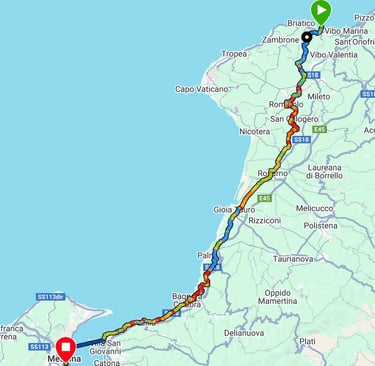
The hotel wasn't geared up for a group of hungry cyclists who wanted to make an early start as the leaders had set what was, for me, a challenging time (arrival 2.30 to 3pm) to pedal the 59 miles including two substantial hills to the terminal for the ferry to Sicily so there wouldn't be time to stop for sustenance along the way. Breakfast was slow to appear and wasn't in abundant quantity. A bowl of cornflakes is mainly air. Departure was at about 8:15am although we had hoped to leave by 8am. The first climb started almost immediately and the summit was at 9.5 miles. About a mile from the start we passed along a road with fly-tipped rubbish on each side. Perhaps runner up to the fly-tipping mountain near Naples. The temperature was over 25C within half an hour of starting with the blue sky promising worse to come.
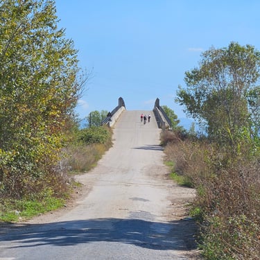
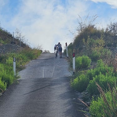
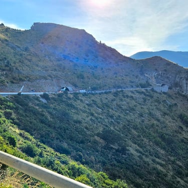
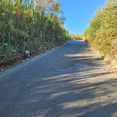
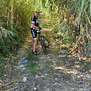
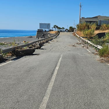
By 10am we were over the first hill (about 570m above sea level) with a reasonable descent lasting 13 miles (bar a few humps) back down to near sear level. At 21.5 miles we came across a lady in a bright yellow address sat on a chair by the road close to a road junction. Another of those Naples features that had been imported to the area? The sweeping tour leader was on the track at the other side of the junction. He was waiting to assure us that this track (see photo) was indeed the correct route so we carefully went down it and about a mile later emerged back onto tarmac. I'm sure there was an easier route. We then joined highway SS18 for the next 30 miles. At about 3½ hours from the start, 30 miles into the journey and the next hill in sight we made a short stop for some nourishment from our bags washed down by a good drink. This second hill was a 7 mile climb to 540m. It took about 1¼ hours but, in the blazing sun, it felt much longer.
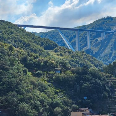
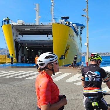
The descent from this summit was slower than the first descent, particularly as we neared the coast and the road had a lot of bends (and good views). A short refreshment stop was made at one of these bends. Looking up from near the coast I could see a big bridge in the hills (Google Earth revealed that it spanned a gap between two tunnels - expensive engineering). The final 11 miles to the port was relatively flat but much of it was urban, particularly after we left SS18, which made it slower going. We reached the van parked near the port at about 5 minutes before 3pm. We then had to wait about 20 minutes before the next crossing, which took about 30 minutes.
It was then about 2 miles of urban cycling in Messina to reach the hotel. Dinner was another pizza followed by some ice cream. One day remaining!
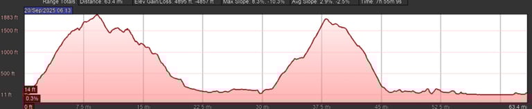
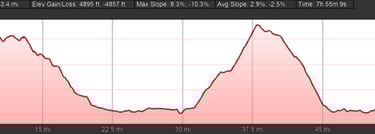
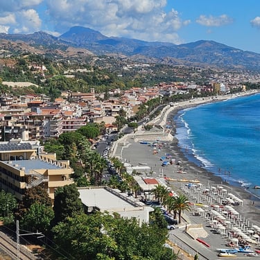
Day 15: Messina to Catania
Day 15 (21st September) Summary
Distance 66.3 miles: Total Ascent = 1,014 m (3,330 ft)*
Elapsed time = 7 hrs 7 mins: Moving time = 5 hrs 59 mins
Average moving speed = 11.1 mph
*Ascent according to my Garmin Edge 1040 which usually agrees closely with Google Earth. My Edge 530 usually records about 15% less climbing which is more consistent with RWGPS. I assume that the newer hardware is more accurate.
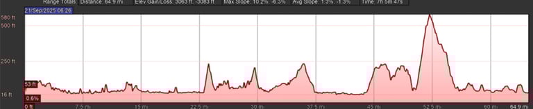
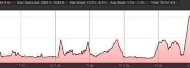
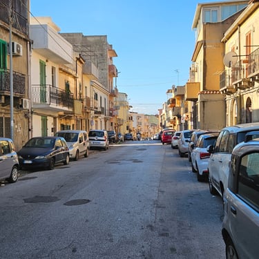
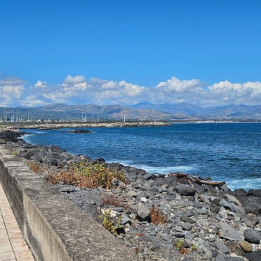
This was a more tiring day than expected. Breakfast was quieter than usual as three of the group had very disturbed nights due to gastric problems and weren't fit to cycle. Our departure was just before 08:30. The streets of Messina were pleasantly quiet as it was a Sunday morning. While there were no big hills (the highest was about 175m but towards the end of the day) there were plenty of lesser ups and downs and 66 miles was the 4th longest day of the trip. There was the usual problem of an unfavourable wind. Many sections of the route were urban cycling which is always slower, and sometimes with cobbles and flagstones plus plenty of raised pedestrian crossings and speed humps. Fortunately, the only traffic along the road was local as there is a parallel motorway. However, Sicily seems to have a bigger proportion of obese vehicles than further north. I wonder why?
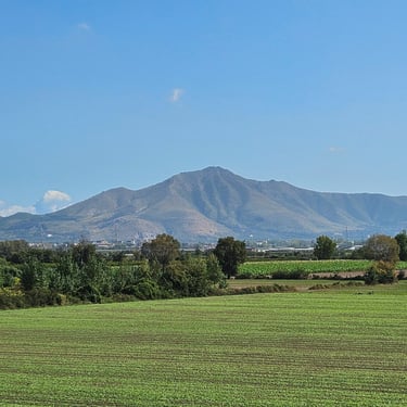
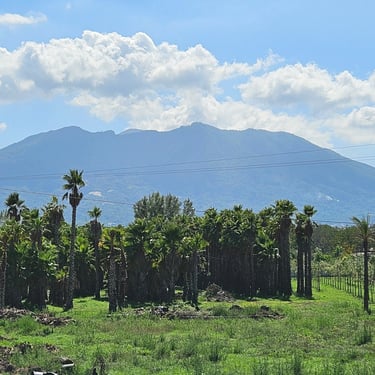
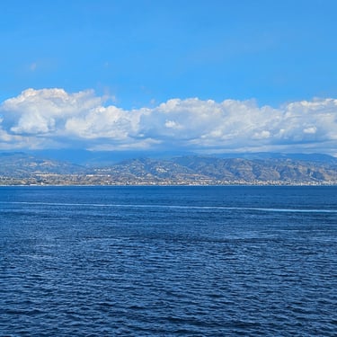
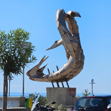
At about 15 miles there was a distant view of Etna with its head above the clouds while at nearly 19 miles there was a sandy irish bridge crossing of one of the flood channels for taking rainwater from the hills to the sea. This was soon followed by a promenade with a series of interesting sculptures. We had a 20 minutes stop at a beach-side cafe at 38 miles for an ice cream and a soft drink with surplus used to top up the bike bottles. The route along the coast felt endless although there were some deviations a short distance inland to add some variety. The hill of the day started at just over 50 miles and was nearly 2 miles of climbing with slopes, in places, approaching 10%. My legs demanded a couple of recovery stops.
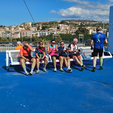
Soon after the top of the hill we found a roadside bench and stopped for a snack from the bags before the remaining 28 miles to the end. Part of the route in Catania was along a good cycle track and we eventually reached the hotel just after 3:30pm. Unusually, there was no welcoming celebratory drink. We discovered that some more of the group had resorted to the train for part of the final day and we shared their sorrow. Only half of a group making it to the end on their bikes could well be a record of the wrong type. Before we could relax, however, there was the task of getting bikes packed into their boxes.
Dinner was taken at the hotel as there wasn't much choice nearby. We seemed to be the only people in the dining room. The menu was very limited and I wasn't impressed by the burger and chips which I had ordered. Some of the others were similarly disappointed. Perhaps it was cook's night off? I then had a poor night's sleep and wondered if my stomach was going to empty itself. Coincidence? Weakened bodies are more vulnerable to any food bugs and this was a probable cause of malaise elsewhere in the group.
The Journey Home and Concluding Remarks
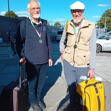
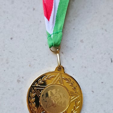
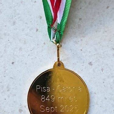
The available breakfast was a vast improvement on dinner and I could have ordered a proper cooked breakfast. However, I wasn't feeling hungry. The journey home was one of the easiest I've done after one of these cycling trips. Easyjet to Bristol was at a convenient mid-morning time after which there was a bus trip into Bristol and a train journey to Swindon. We were greeted by Richard's wife who had very thoughtfully arranged medals for us and I was conveyed home by car (although I had my bus pass ready).
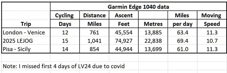
I was unusually worn out and spent the next week trying to figure out what had made this trip seem more arduous than the LEJOG although the latter was much more challenging in terms of distance and climbing. I identified several factors:
1. Temperature (which is in the daily Garmin data) was most challenging in Italy when there was only one relatively cool (~25°C) day. On many days the temperature exceeded 30°C for several hours with heat not just from the sun but also from hot tarmac. This provided the motivation to get to the end of the day as quickly as possible in order to get out of the heat. I had expected the heat but not being baked by direct sunshine which was worse as we moved southwards.
2. The wind in Italy was almost always between SE and SW with the onshore breeze strengthening from midday onwards. There were substantial sections of the route with very little cover to provide shelter from the wind.
3. Nutrition was probably a factor. Italy provided some inadequate breakfasts and sometimes insufficient dinners and our desire to complete the day and get out of the heat meant that we didn't eat much during the day. A similar strategy on the LEJOG didn't cause me problems, perhaps because breakfasts tended to be more substantial. I also wonder if I had drawn down my energy reserves during the LEJOG and they weren't fully replenished before travelling to Pisa.
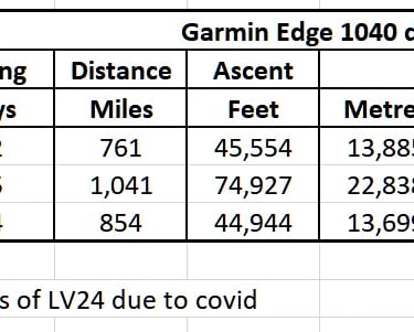
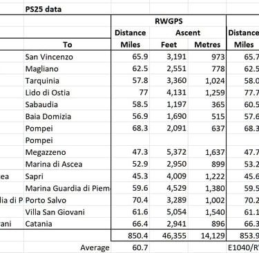
4. Type of hills could be a factor. While Italy provided few shockingly steep hills (although one reached 28%), many descents were hard on the brakes due to urban areas and bends and, sometimes, rough surfaces and therefore didn’t provide much respite from the daily effort. This trip was the first time my Garmin Edge 1040 recorded less total climbing than forecast by Ride With GPS. The latter evidently doesn't correct for bridges and tunnels.
IOverall, I concluded that, while there were some very scenic sections, much of the trip wasn't memorably enjoyable due to the desire to escape the heat. Perhaps one week later may have been slightly cooler but, from the organisers' viewpoint, some of the accommodation options were preparing to close for the winter. This 2013 Pisa to Sicily ride had taken place in early May when it would have been slightly less hot, but there were other weather challenges.