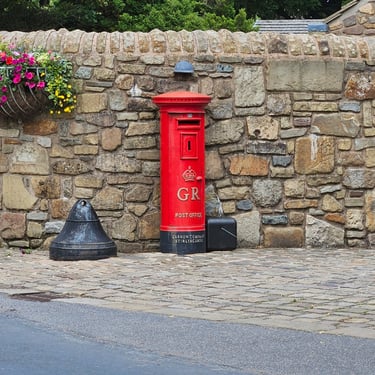
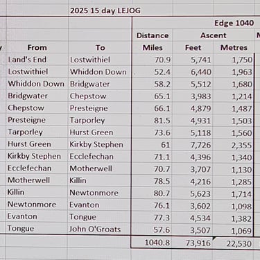
Land's End to John O' Groats 2025
Contents
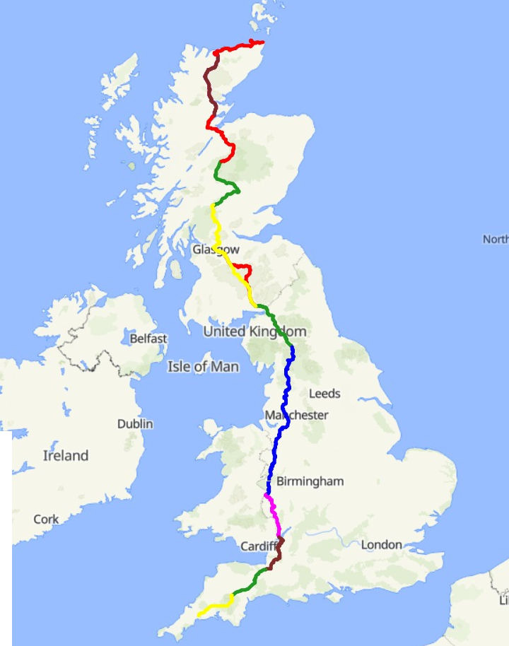
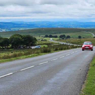
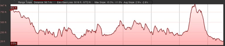
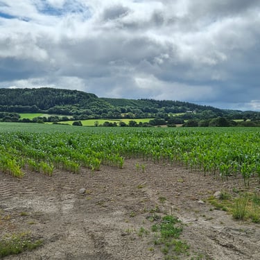
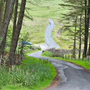
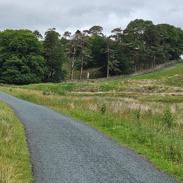
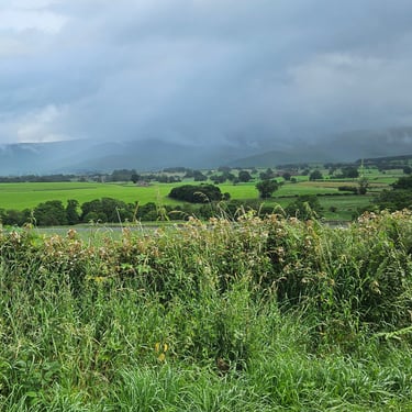
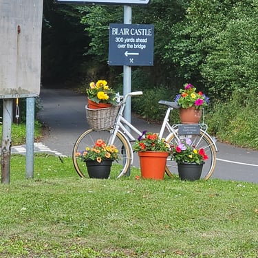
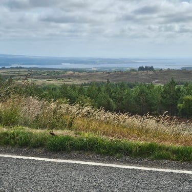
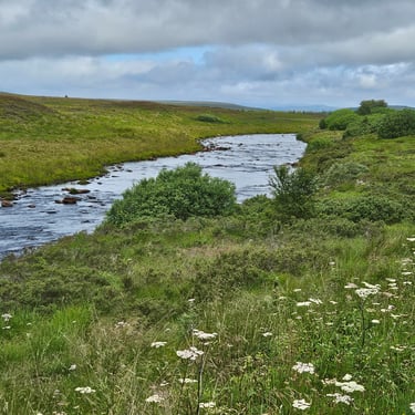
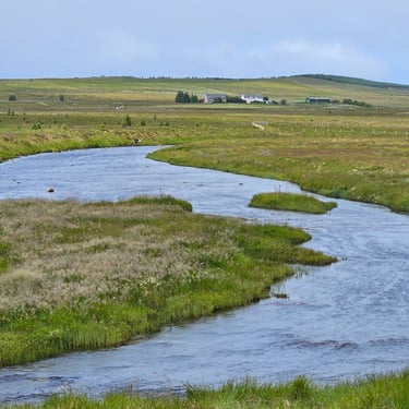
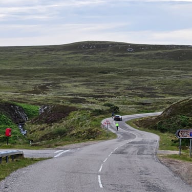
The first of my cycling trips was the Bike Adventures 21 day LEJOG in 2021 and planned to repeat the trip in the fullness of time. For the summer of 2025 I had booked the Paris - Prague trip. However, this didn't have a quorum and I noticed that the 15 day LEJOG was at the same time of year and confirmed to take place. With my ego swollen by my 2024 encounter with the Alps, I decided to do battle with the 15 day LEJOG. This would, on average, involve 30% more miles per day than the 21 day version (which included a rest day) which translates to proportionately more hours per day on the saddle and minimal time indulging in refreshment stops. Much of the route is the same as in 2021 but with 200 miles of new route through the middle of Scotland instead of touch the west coast then following the Great Glen.
Preparations
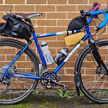
I decided to use the bike which had successfully encountered Ireland and the Alps, although with a few changess such as the steel forks being replaced by carbon/alloy forks (a useful weight reduction) and slightly higher gearing but still low by most cyclists' standards (a 28 - 42 bottom gear ie 1.5 turns of the cranks for one revolution of the back wheel).
Review of my 2021 LEJOG data revealed several days with a moving speed of less than 10mph (Mellor to Dent at 8.5mph was the worst) but the Thorn Mercury bike I used was well loaded with handlebars which prioritised comfort. The slowest daily moving speed on the 2024 Ireland trip with some terrain fairly similar to the lumpy parts of the UK was 10.9mph. However, day 15 of the Venice trip averaged 8.7mph but this involved an unrelenting 1,600m climb. These previous trips have demonstrated that my legs can handle the miles provided I don't make them work too hard. I've reached 77 miles in a day on more than one previous occasion and look forward to passing the 80 mile milestone.
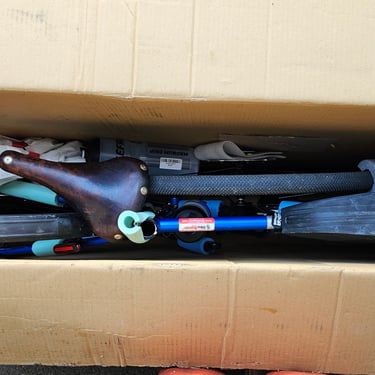
As with the previous trips the bike travelled in a box to Bike Adventures for transport to the start while I booked a train ticket to Penzance. I've never had a worse train journey! I should have reached Penzance at 15:03 to give plenty of time for building the bike. In reality, arrival was at 20:04. The main cause of the delay was the train doing an emergency stop between Bristol and Taunton due to a person on the track after which there was over three hours delay for cleaning up the mess.
Bike building was done after dinner (when I was introduced to the other 7 cyclists) and one problem was discovered: Where was the seat post clamp? This was on the frame when the bike went into the box but was nowhere to be seen when the box was emptied. I have to conclude that at some stage in the transportation the box was tipped upside down, the clamp came off the frame and then escaped through one of the hand holes in the box. Fortunately, there was a spare bike on the van with the same size clamp, but that bike is now unusable.
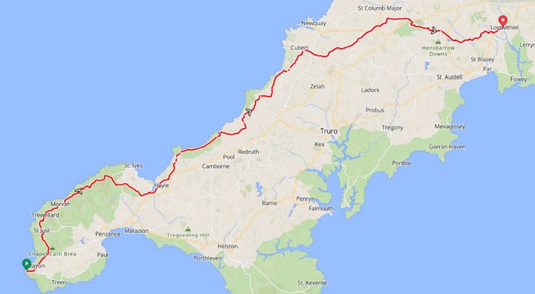
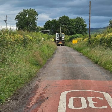
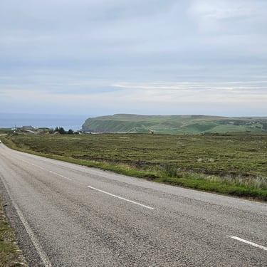
Day 1: Land's End to Lostwithiel
Day 1 (24th June) Summary
Distance 70.9 miles: Total Ascent = 1,750m (5,700ft)*
Elapsed time = 7hrs 23mins: Moving time = 6hrs 12mins
Average moving speed = 11.4mph
*Ascent according to my Garmin Edge 530. I omitted to tell my Edge 1040 to begin recording at the start of the ride.
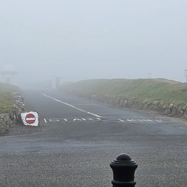
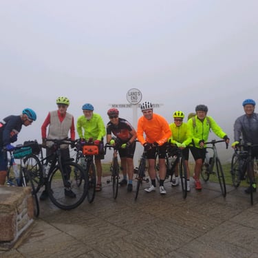
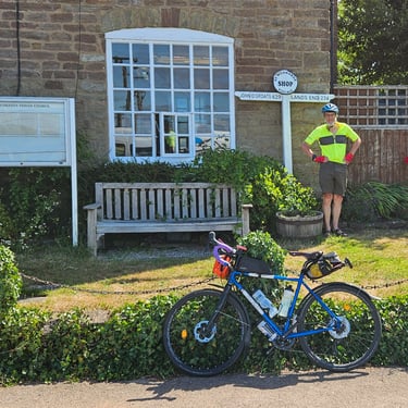
First a mention of the Queens Hotel in Penzance. A good breakfast was a little compensation for a bad night's sleep. The duvet was thicker than the one I use at home in winter so I just used the cover, which was slightly too thin to provide adequate warmth. There were two very thick pillows which I didn't use as I like a thin pillow so I used folded towels and the bed was a little soft.
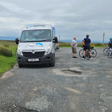
We started breakfast at 7am to give plenty of time for getting ready to depart to Land's End at 08:30. The weather at this time was somewhat dull and sufficiently drizzly for me to put on my rain jacket. After a photo by the Land's End sign we set off at about 09:15. By the time we reached Hayle (22 miles) the weather had improved and I changed my jacket. My target refreshment stop was at about 35 miles where there appeared to be a pleasant cafe and bike shop. This was reached after about 3 hours and I wasn't disappointed. After ordering tea and a big scone I visited the shop in search of a seat post clamp, Something adequate was found so I was able to return the borrowed clamp to the van,
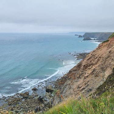
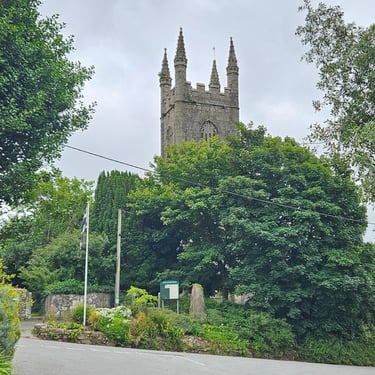
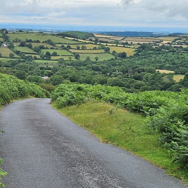
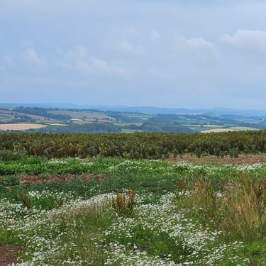
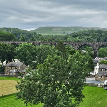
Duly rested and refuelled we continued with the battle with the Cornish hills. This day's hills weren't big but were often fairly steep and the downhill sections need extensive use of brakes due to bends, narrow roads and villages. The hills seemed to get steeper as the day progressed. I think we all were happy to reach Lostwithiel where the Best Western hotel appears to be a welcome improvement on the previous night's accommodation.
Day 2: Lostwithiel to Whiddon Down
Day 2 (25th June) Summary
Distance 52.4 miles: Total Ascent = 1,960m (6,400ft)*
Elapsed time = 7 hrs 8 mins: Moving time = 5 hrs 45 mins
Average moving speed = 9.1 mph
*Ascent according to my Garmin Edge 1040 which usually agrees closely with Google Earth. My Edge 530 usually records about 15% less climbing which is more consistent with RWGPS. I assume that the newer hardware is more accurate.
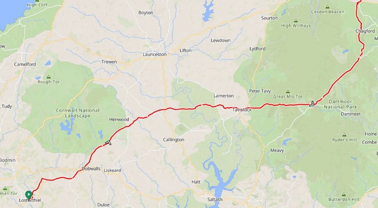
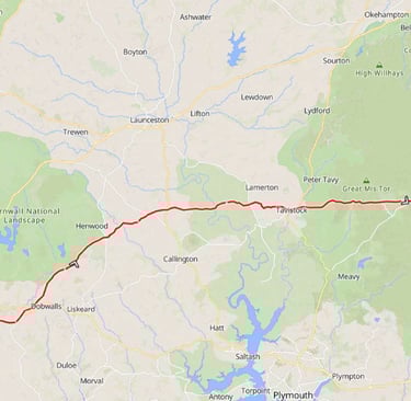
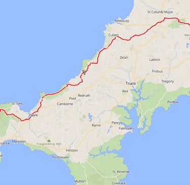
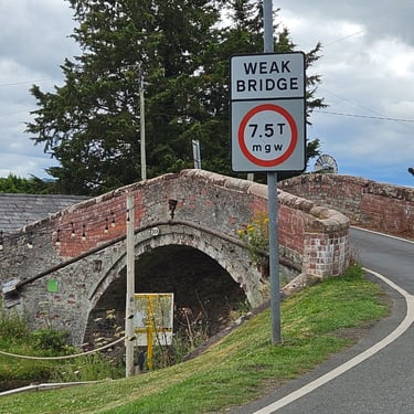
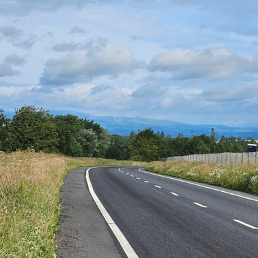
This was a hard day including the crossing of both Bodmin Moor and Dartmoor. In 2021, these two humps were encountered on separate days. The previous day's tailwind had turned into a gentle cross brooze.
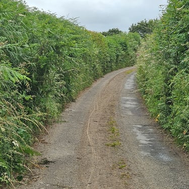
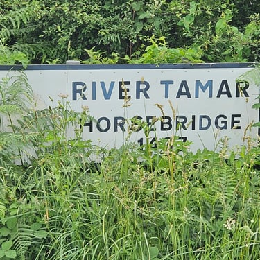
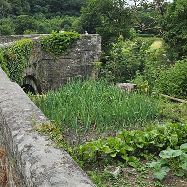
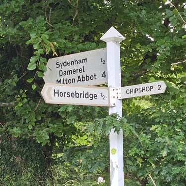
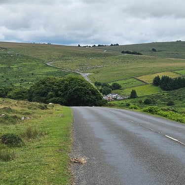
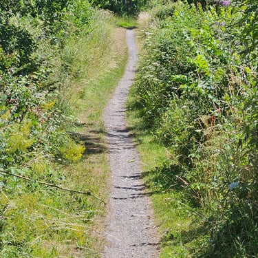
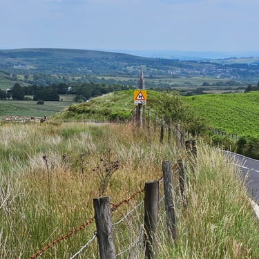
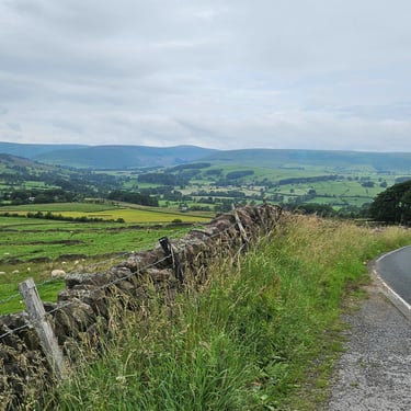
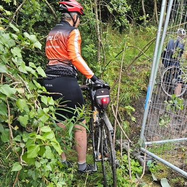
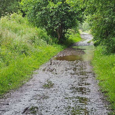
Departure from Lostwithiel was at 9am in fairly warm conditions but after a few miles the weather turned misty and damp. The route was generally upwards on moderate hills to Minions on the top of Bodmin Moor where Kevin (a leader on the Venice trip) plus Louise (who was with Kevin on the Portugal trip) were waiting for the group. After a while chatting I decided to continue as Kevin had offered to ride at the back and some of the group were having s refreshment break. There was a majot descent from Minions and then undulating riding through often narrow and overgrown lanes (the scratches on my left leg are evidence) untill another substantial descent to Horsebridge where crossing of the River Tamar marked departure from Cornwall and entry into Devon. After a climb out of the valley there were more undulations before reaching Tavistock.
I had originally planned a refreshment break in Tavistock but time spent chatting in Minions had put me behind my mental schedule so I opted to use some of the fuel I carry on the bike. This also avoided too much sitting let my muscles seize up just before the climb to the top of Dartmoor (long, but not very steep). The road over Dartmoor was good quality but this came to an end when turning off into the lanes to get to Whiddon Cross. Some of these lanes were covered with sand and gravel washed down from somewhere so caution was needed. There were also some nasty hills. One of these caught me in the wrong gear and I had to get off and push the bike.
I finally reached the Whiddon Down Travelodge just after 4pm and was very happy to discover that the generously sized room had a bathtub in which I could soak my weary legs. Progress had been much slower than on the first day.
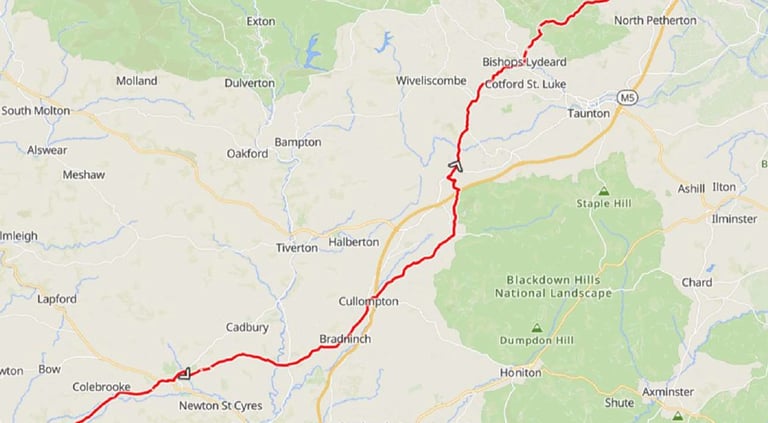
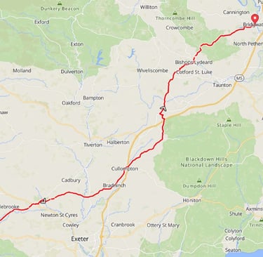
Day 3: Whiddon Down to Bridgwater
Day 3 (26th June) Summary
Distance 58.2 miles: Total Ascent =1,680m (5,500ft)*
Elapsed time = 7hrs 15 mins : Moving time = 5hrs 25 mins
Average moving speed = 10.8 mph
*Ascent according to my Garmin Edge 1040 which usually agrees closely with Google Earth. My Edge 530 usually records about 15% less climbing which is more consistent with RWGPS. I assume that the newer hardware is more accurate.
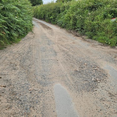
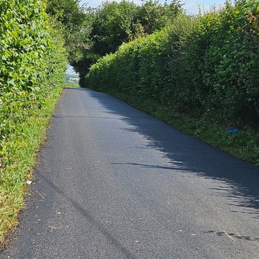
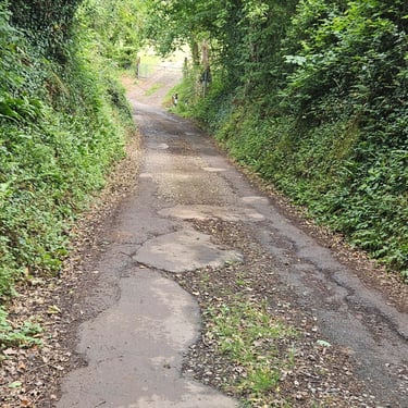
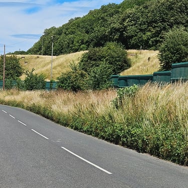
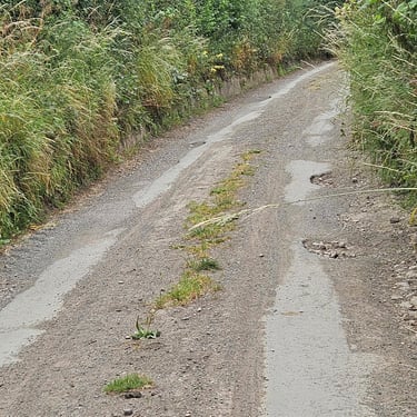
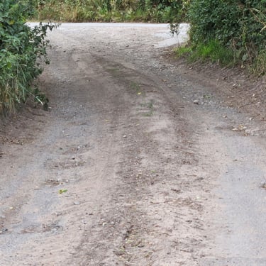
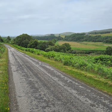
This was a less challenging day than the previous two but still contained plenty of ups and downs, many of which were in some lanes with badly degraded surfacing which required extra care.
I left Whiddon Down at 08:40 in drizzle with the objective of a 1pm lunch appointment with a brother in Milverton, The drizzle soon cleared and the first 10 miles were mainly downhill cycling but the brakes were well used in fairly narrow lanes. The route then become a mixture of hills and occasional flatter sections. There was a section of road around 21 miles which barely deserved to be classified as a road. Perhaps it was much better when the route was designed.
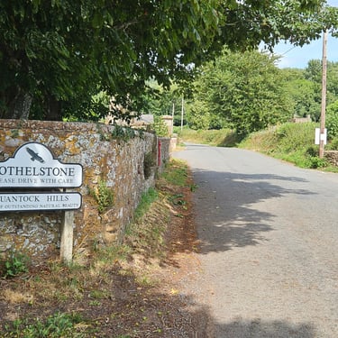
There was a very unwelcome steep hill out of Bradninch but I managed to get up it. After many more ups, downs and narrow lanes I reached my lunchtime appointment with one minute to spare. After over an hour of food, chat and recuperation I continued on my way in the knowledge that I was refuelled for the big hill of the day - Cothelstone hill up to the top of the Quantocks. I was a little worried that my legs would refuse to cooperate but, with assistance of bottom gear on the bike, I reached the top without needing to get off and push. Thereafter it was a mainly downhill journey into Bridgwater but, as it was after 3pm, traffic was starting to build up.
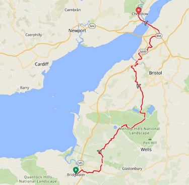
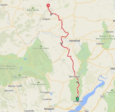
Day 4: Bridgwater to Chepstow
Day 4 (27th June) Summary
Distance 65.1 miles: Total Ascent = 1,200m (3,950ft)*
Elapsed time = 7hrs 11 mins: Moving time = 6hrs 2mins
Average moving speed = 10.8mph
*Ascent according to my Garmin Edge 1040 which usually agrees closely with Google Earth. My Edge 530 usually records about 15% less climbing which is more consistent with RWGPS. I assume that the newer hardware is more accurate.
I was surprised to achieve the same average speed as day 3 despite the route being less topographically challenging. I had expected a bit faster. Perhaps it's due to the weary body, the lack of a nice tailwind or the temperature rising above the mid 20s C.
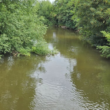
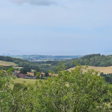
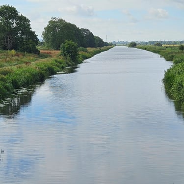
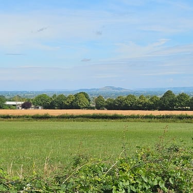
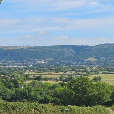
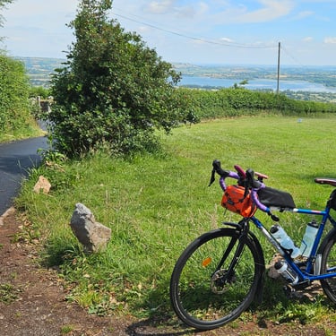
A friend decided to join me for part of the day and we would meet part way up Cheddar Gorge (where he could park his car for free). I left the Old Vicarage hotel at 08:40 after a good breakfast. Unusually for the time of day, I was wearing only a short sleeve top and didn't feel cold. Bridgwater rush hour traffic was less challenging than I expected (too many traffic lights?). First stop was to look at the King's Sedgemoor Drain followed by photo stops to capture Brent Knoll and the Mendip hills before reaching Cheddar.
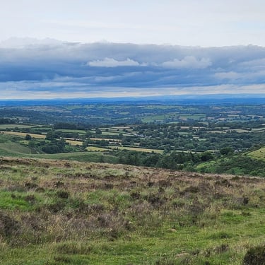
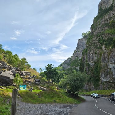
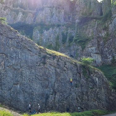
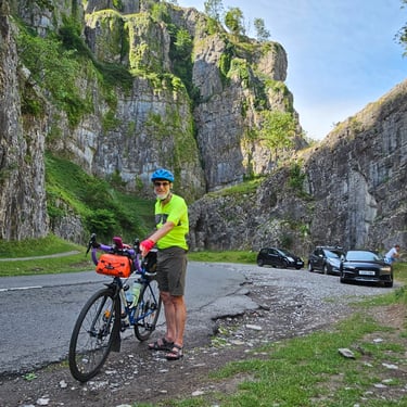
Cheddar Gorge was a scenic climb with only one short steep section and overall less challenging than the climb out of Wookey Hole on the 2021 LEJOG. My friend was waiting just above the steep section and we travelled together for about 10 miles before he turned back. I had expected a diversion due to road resurfacing but we reached there to see signs being loaded into the back of a lorry. It was delightfully smooth but the descent still needed much braking due to the narrow road with poor visibility. A few miles further on, however, there was a very rough section of lane which was as bad as the worst of those encountered on previous days.
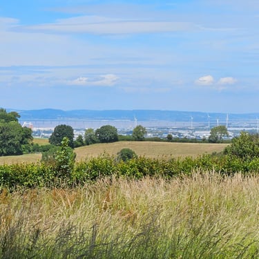
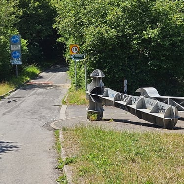
Eventually, after many more ups and downs, the Avonmouth bridge came into sight and a hammer & spanner sculpture marked the start of the climb onto the cycleway over the bridge. Bye-bye Somerset. Once over the bridge there was a section through the extensive Avonmouth industrial area before getting on a narrow gravel path which claimed to be part of the Avon Cycleway. Perhaps it was better when first built but the gravel section seems to be a job unfinished as it changed to tarmac after several hunbred metres.
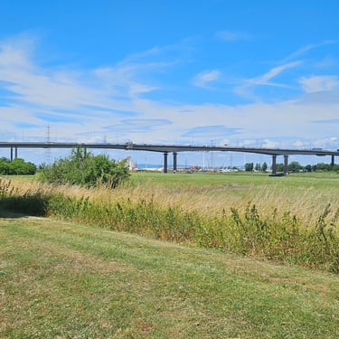
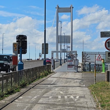
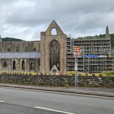
Thereafter the route followed nearly flat roads, including passing an oil storage facility built into the side of a hill, before eventually reaching the Severn bridge. I was intrigued to see a 15mph speed restriction for cyclists with speed camera monitoring. There was no risk of me troubling the technology as I was struggling to exceed 10mph, not helped by a noticeable crosswind. There was then a good cycleway to Chepstow where the Two Rivers hotel was a welcome sight. Even more welcome was a bathtub for soaking the weary limbs.
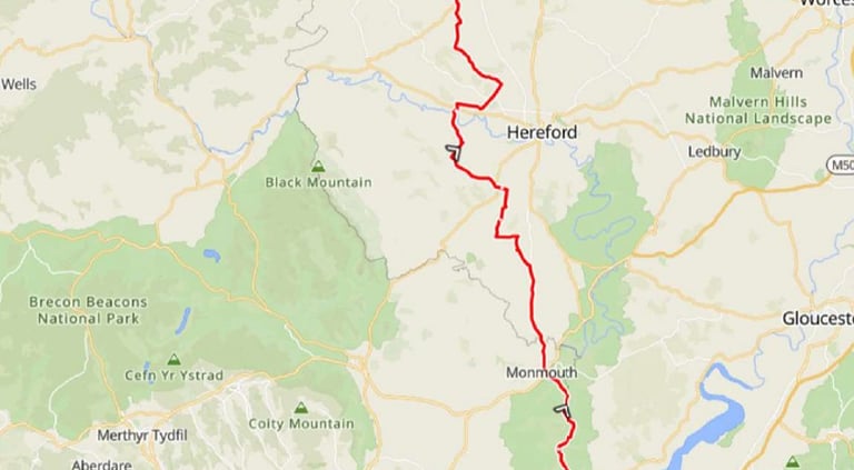
Day 5: Chepstow to Presteigne
Day 5 (28th June) Summary
Distance 66.1 miles: Total Ascent = 1,480m (4,850ft)*
Elapsed time = 6hrs 59 mins : Moving time = 6hrs 0 mins
Average moving speed = 11 mph
*Ascent according to my Garmin Edge 1040 which usually agrees closely with Google Earth. My Edge 530 usually records about 15% less climbing which is more consistent with RWGPS. I assume that the newer hardware is more accurate.
Breakfast didn't start until 8am so I didn't start cycling until 9:15 which was later than I would like given the forecast temperature. It was, however, dull for the first few miles and I wore my thin long sleeve top until I warmed up.The sky cleared and the weather progressively warmed up and was in the mid 20s C by midday. There was a strong WSW breeze which made the heat more tolerable, sometimes provided assistance and sometimes was a noticeable headwind whenever the route turned westward. From early afternoon onwards the sky turned increasingly cloudy which reduced the temperature.
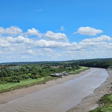
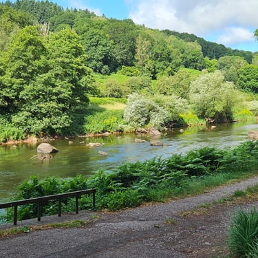
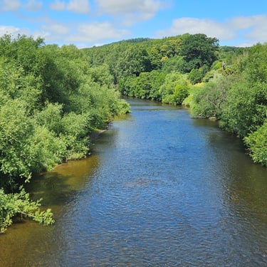
I initially made good progress. 13 miles in the first hour along the Wye valley on a good road and reached St Weonards in just under 2 hours moving time - still on good quality roads although with moderate hills after Monmouth but with minimal need to wear out the brakes. I stopped at the sign which said Lands End 234 and John O'Groats 629 (not our route which totals over 1,000 miles). Just after St Weonards, however, the route turned onto lanes needed which were rough at times and often braking to control speed on the downhill sections.
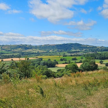
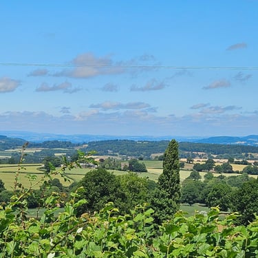
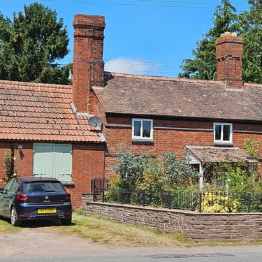
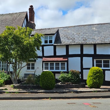
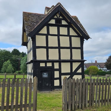
The rolling terrain offered few scenic photo opportunities but there were some interesting buildings. I opted to have no proper refreshment breaks but stopped at intervals to have a snack from my bag.
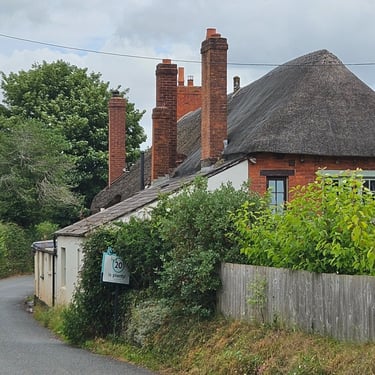
The Radnorshire Arms hotel is an interesting contrast with the previous night's accommodation. My bed is a similar generous size but the building itself is over 500 years older.
Day 6: Presteigne to Tarporley
Day 6 (29th June) Summary
Distance 81.5 miles: Total Ascent = 1,500m (5,000ft)*
Elapsed time = 8hrs 6mins : Moving time = 7hrs 19mins
Average moving speed =11.2 mph
*Ascent according to my Garmin Edge 1040 which usually agrees closely with Google Earth. My Edge 530 usually records about 15% less climbing which is more consistent with RWGPS. I assume that the newer hardware is more accurate.
This was my first 80 mile day. Notable was that I was 2mph slower than my previous record long day of 77.9 miles in August 2024. On that occasion my legs were fresh and the roads (in France) much better quality than those traversed today.
I set off at 08:45 after a continental breakfast - a mixed blessing as it was quicker than a full breakfast but I couldn't fuel up as much as usual. The weather was warm and the first of the two major hills was only about a mile from the hotel while the second was a steady climb between 25 and 29 miles. The weather for the first few hours was dull and damp with occasional heavier drizzle. The temperature rose to the mid 20s C but it was cloudy which made conditions much more tolerable. Roads were a mixture of smooth surfaces and rough lanes and anything in between with the proportion of rough being slightly less than on previous days.
The long day on the saddle provided plenty of time for cogitation. As there was a mixture of road suface qualities I realised how much difference in speed I achieved between the good and the bad. The latter needed more effort for 25 to 50% less speed. Rough lanes torture both the bike and the rider and the rough parts felt much rougher than in 2021. I had forgotten how much poor quality surface there was or maybe the bike used in 2021 handled the conditions better (it was heavier and had 50mm tyres).This time I wanted to reduce the weight to help get up the hills. Perhaps I should have used a gravel bike and/or wider tyres and a suspension seatpost to reduce the maltreatment of my posterior.
There were a few items of interest along the way but, aware that it was a long day of cycling, I didn't linger. Nor did I look for any refreshment facilities but relied on the food and water on the bike (I had filled all three water bottles in case the weather turned hot).
Eventually, more than 8 hours after setting out, I reached the hotel at the Tarporley golf club. I then had to wait about 15 minutes to get into my room which seems to be the last that housekeeping were getting ready. It's a warm room without much ventilation and no sign of any air-conditioning. Tea making facilities were hidden away in a cupboard. In compensation there was a bathtub for soaking weary limbs.
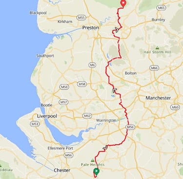
Day 7: Tarporley to Hurst Green
Day 7 (30th June) Summary
Distance 73.6 miles: Total Ascent = 1,560m (5.100ft)*
Elapsed time = 8 hrs 4 mins : Moving time = 6hrs 42 mins
Average moving speed = 11.0 mph
*Ascent according to my Garmin Edge 1040 which usually agrees closely with Google Earth. My Edge 530 usually records about 15% less climbing which is more consistent with RWGPS. I assume that the newer hardware is more accurate.
This was a day of two halves: The first half had pleasant, slightly undulating roads and comfortable temperatures and I averaged nearly 12mph. The second half had about 10 miles of urban cycling followed by more hilly terrain in uncomfortable temperatures (up to about 28C - slightly warmer than previous days with much more sunshine).
I set out at 08:30 when it was still cool. There was a significant hill about two miles into the ride after which the terrain was much smoother. The route passed over two significant bridges, one over the river Weaver and the other over the Manchester Ship Canal. I stopped for a comfort break on a road which provides emergency access to the M62 and was surprised to note that the gate wasn't locked. There was then about 10 miles of urban cycling with plent of traffic and traffic lights before reaching open countryside.
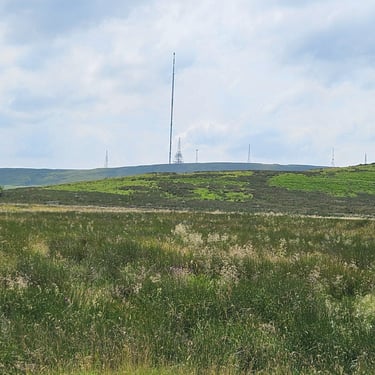
Ahead was a big hill (Winter Hill) with a TV transmitter on top but first was a lesser hill then the Rivington reservoir followed by a fuel stop at the Rivington village green tea room where I feasted on a large scone filled with cream and jam washed down by some tea. This was the first time for several daysthat progress had been good enough I had not relied on food on the bike and it was beneficial to spend some time off the saddle.
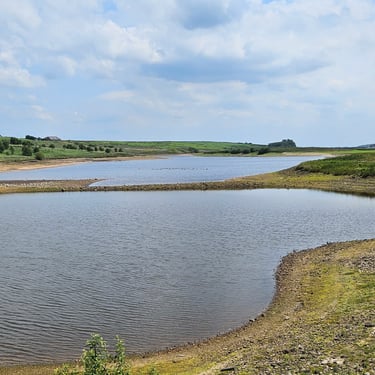
After this there was a long, but not horribly steep, climb but made more uncomfortable by the hot sunshine although rewarded by some good views. Further on there was Belmont reservoir where, in 2021, the sailing boats were active. Not this time, however, as the water level was low.
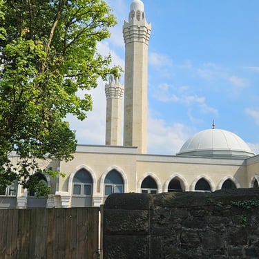
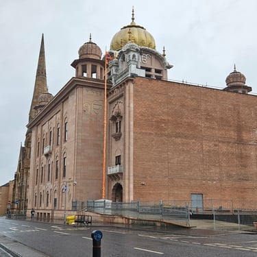
The route then skirted around the edge of Blackburn. Some grand houses which I had noticed were under construction were still unfinished but there was a big mosque which I don't recall seeing in 2021.By this time schools had finished for the day and there was noticeable traffic congestion. After Blackburn there were more moderate undulations, mainly on fairly good roads but I hit a rough patch of surfacing on an otherwise smooth descent. Something fell off my bike. I stopped and figured out that a full water bottle was missing which I eventually found in the hedge without incurring obvious damaged. Eventually I reached the Shireburn Arms in Hurst Green where my room seemed palatial. Someone loves cushions! The very thick walls provided protection from the day's heat.
Day 8: Hurst Green to Kirkby Stephen
Day 8 (1st July) Summary
Distance 61 miles: Total Ascent = 2,350m (7,700ft)*
Elapsed time = 8 hrs 17 mins : Moving time = 7 hrs 2 mins
Average moving speed = 8.7 mph
*Ascent according to my Garmin Edge 1040 which usually agrees closely with Google Earth. My Edge 530 usually records about 15% less climbing which is more consistent with RWGPS. I assume that the newer hardware is more accurate.
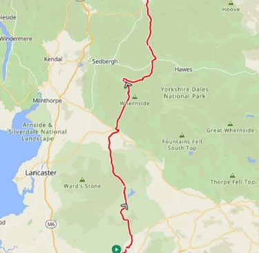
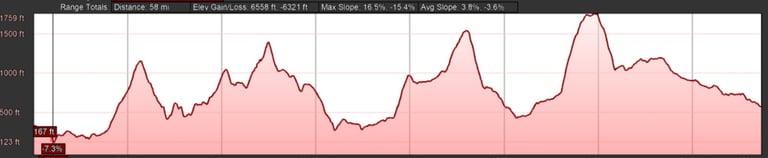
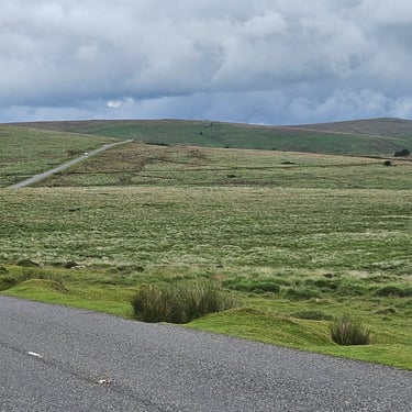
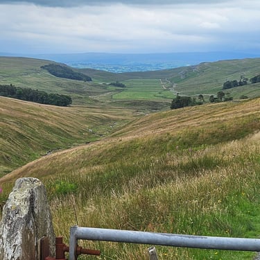
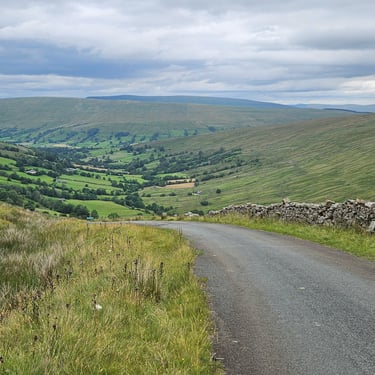
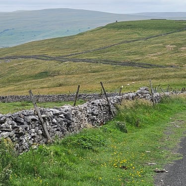
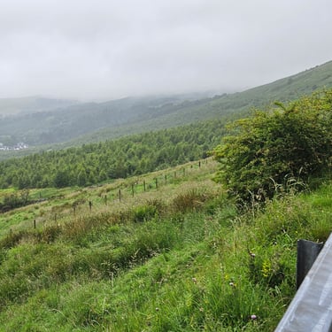
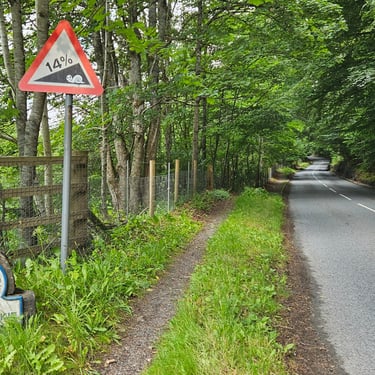
This day comprised four big hills, each a bit higher than the previous one, plus innumerable less undulations. In 2021 the first three hills comprised one day's cycling (with plenty of rain) and the fourth hill was on the next day. On that occasion the first part of that hill defeated me and I had to push the bike. This time, with lower gearing, I was successful. The weather forecast anticipated thundery showers in the afternoon. Fortunately, there was only some light rain - much nicer than the heavy rain encountered in 2021. There was some pleasant cruising on the downhill sections but usually braking was needed to keep speed under control.
The first hill was on the way to Slaidburn with the van waiting at the top for anyone who needed their water topping up. The second hill, between Slaidburn and High Bentham, is know as Cross of Greet. It's a long drag up a very open valley. The van had been waiting at the top but went back down the road to help with a puncture problem. After High Bentham there was a road closure and I opted to follow the signed diversion (which probably added a mile) rather than try to talk my way through the closure.
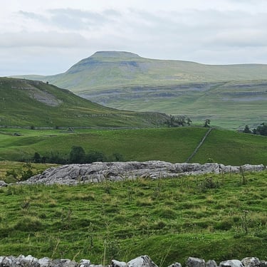
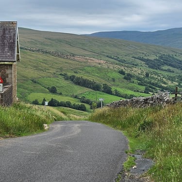
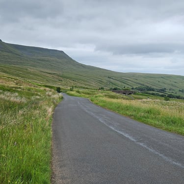
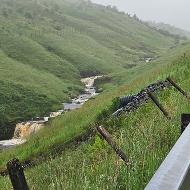
The third hill, between Ingleton and Dent, is the one carved in my memory from 2021 due to the heavy rain and the gates across the road. This time the weather was dry but the road was no less steep. At one point it's possible to see the road turn a corner and climb steeply so I was forewarned to change into a low gear. The weather was clear enough to provide views of the Pennine hills. Eventually, with steep gradients and tight bends the road descended towards Dent. It gave the impression that those travelling southwards would have some very challenging hill climbing.
Dent, with its cobbled streets, marked a slight worsening of the weather with some raindrops so I swapped my thin jacket for my waterproof jacket. After a few miles of relatively level road, Dent station came into sight up the side of the valley. The road then turned up the hill. The first section, through a series of bends, is the steepest part so I made sure that the bike was in bottom gear and slowly worked my way upwards. I stopped part way up to eat an energy bar but then continued by pedalling and slowly overtaking someone who was pushing their bike. The gradient eased after Dent station but, overall, there's more than two miles of upward slog before reaching the summit at over 530m where it was only about 15C.
There was an initial, fairly well graded, drop off the top of the hill before about 5 miles of undulations followed by a more favourably graded final few miles into Kirkby Stephen. It had been a hard day with a new personal record amount of climbing slightly surpassing one of the days in the Alps (with, surprisingly, the same average speed). I went to bed at 9:30pm - over an hour earlier than normal.
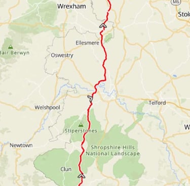
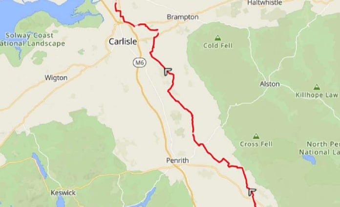
Day 9: Kirkby Stephen to Ecclefechan
Day 9 (2nd July) Summary
Distance 1.1 miles: Total Ascent = 1,340m 4,400ft)*
Elapsed time = 7 hrs 9s min: Moving time = 6 hrs 24 mins
Average moving speed = 11.1 mph
*Ascent according to my Garmin Edge 1040 which usually agrees closely with Google Earth. My Edge 530 usually records about 15% less climbing which is more consistent with RWGPS. I assume that the newer hardware is more accurate.
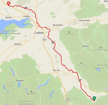
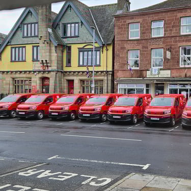
This was a potentially a pleasant day of cycling but was spoilt by the weather. One has to be thankful, however, that the day's heavy rain didn't arrive on the previous afternoon when the forecast was similar. The temperature, between 14C and 16C, was cooler than forecast but the forecast wind, increasing from WNW after midday, was correct. The day started with seeing 7 Royal Mail vans parked across the road from 8am waiting for something bigger to bring the mail for them to deliver. They were still waiting when I set out.
I set out, wearing my rain jacket, just before 9am just after a heavy shower had passed through. There was then nearly an hour of dry cycling before the next shower arrived and I deemed this to be an opportunity to discover how water resistant a new pair of shorts were. They were fine for about 15 minutes but the shower continued for about an hour of moderate rain and the shorts couldn't withstand this challenge.
There was then about an hour of fairly pleasant cycling with a bit of sunshine andthe shorts dried out. I could see some threating black clouds and when the next raindrops arrived, I quickly put on my waterproof overshorts. That was prudent, as this period of rain increased from moderate to torrential (supported by some thundery rumbles) and I spent at least 15 minutes taking refuge from the worst of it before it finally eased. The heavy rain resulted in some large puddles.
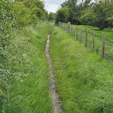
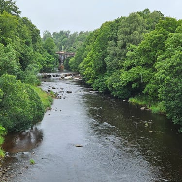
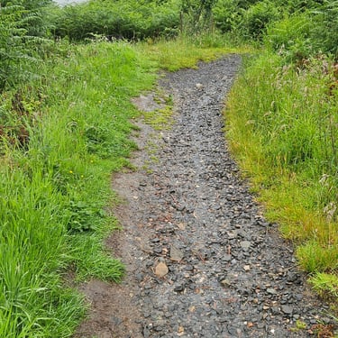
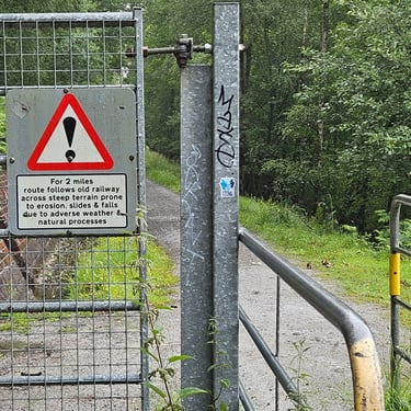
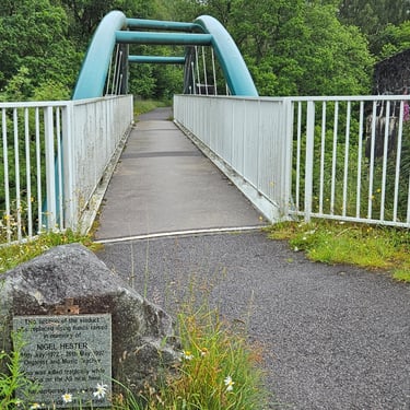
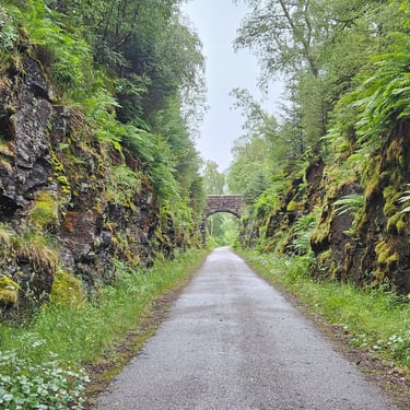
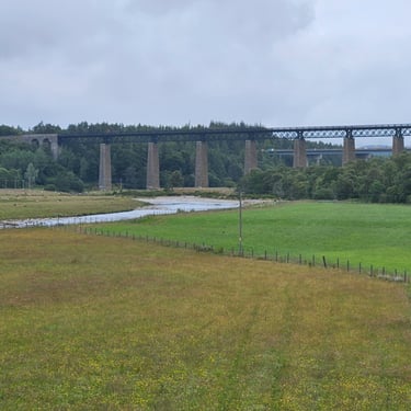
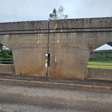
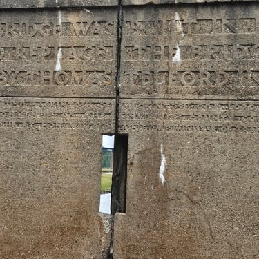
After about 1pm the rain slowly eased and soon after 3pm there was some blue sky and welcome sunshine. A section of cycle route 7 provided relief from the tarmac but was in need of some maintenance as the surface width was down to about 6" in places. During the morning I had opportunity to study the fine stonework of the former Settle & Carlisle railway and wondered if the uniform railway gradient would provide a pleasant cycleway.
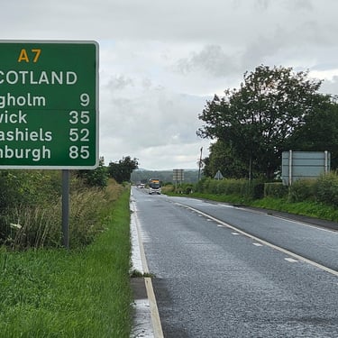
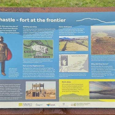
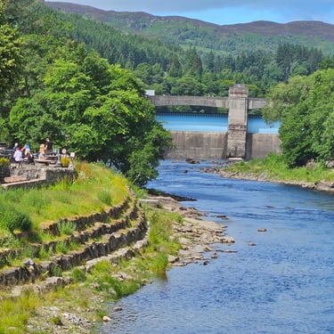
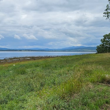
While I recognised the bridge marking the entry into Scotland, I didn't bother to stop. I was more interested in getting to the hotel in Ecclefechan for a hot shower (preferably a bath but it was absent).
Day 10: Ecclefechan to Motherwell
Day 10 (3rd July) Summary
Distance 70.7 miles: Total Ascent = 1,130m (3,700ft)*
Elapsed time = 7 hrs 17 mins : Moving time = 6 hrs 19 mins
Average moving speed = mph 11.2mph
*Ascent according to my Garmin Edge 1040 which usually agrees closely with Google Earth. My Edge 530 usually records about 15% less climbing which is more consistent with RWGPS. I assume that the newer hardware is more accurate.
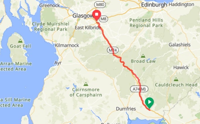
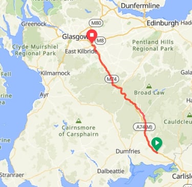

As the weather had taken a turn for the worse, I paid close attention to the forecast which indicated a SW wind, cool temperatures and increasing risk of rain as the day progressed. I remembered from 2021 that the section of the primary route was vulnerable to a westerly wind and therefore chose the alternative route which more closely followed the M74 and was about 13 miles shorter which would enable an earlier finish.
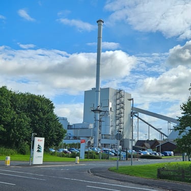
It was a clear night and there was some light in the sky at about 2:30am. The sky was completely clear at 7am but then started to cloud over. I was on the bike at 8:45am wearing my waterproof jacket plus one more layer underneath compared to the previous day. I also put on some socks as the previous day's 14C had hit my comfort threshold for cycling without socks. The first part of the day was along the old A74, much of which has a wide carriageway with a marked cycle lane along the side. The road wasn't busy and I frequently swapped between the cycle lane and the carriageway depending on which had the smoother surface. One feature on this section of road was the Steven's Croft power station which produces both electricity and heat for the adjacent timber processing factory (the waste from which provides much of the power station fuel).
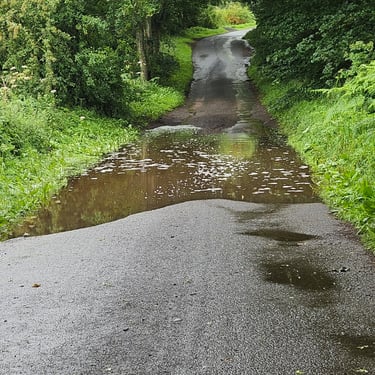
After about 12 miles the route followed minor roads to Moffat. There was an impediment to progress when a road closure completely blocked the road but an alternative route was advised by a local resident and did not add much distance. There was a particularly rough section of road on the approach to Moffat. I've been dreaming of a saddle with springs to smooth out those bumps. I passed through Moffat without stopping and cycled part way up the hill on the A701 before forking left onto the alternative route. Some rain drops prompted me to put on my overshorts.
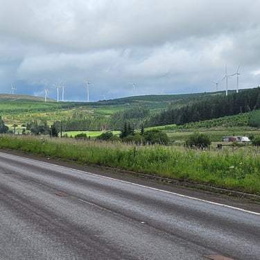
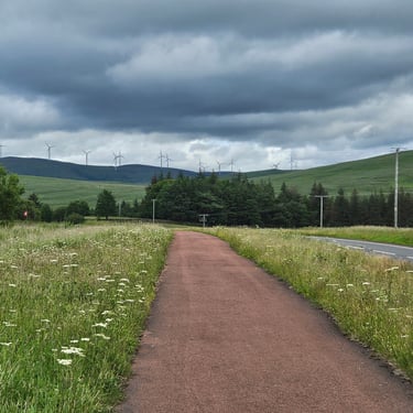
This alternative route was more pleasant than I had expected. Not long after leaving the other route there was a fine view over the valley with the motorway very prominent. Later on I passed wind farms both to the east and west. There were some relatively long sections of good cycle path (National cycle route 74) parallel to the road. A heavy shower was encountered while cycling along a section that was still on higher ground and completely exposed to the SW wind.
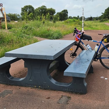
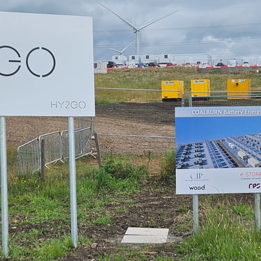
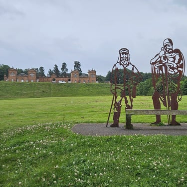
The route then descended and the next noteworthy feature was at Coalburn where there was a picnic bench by the cycle track and some interesting signs. Just after that the route passed a large battery storage facility which claimed to be 500MW. That is a unit of power, not of storage, but the internet reveals it is 1000MWhr. Soon after there were several miles of unpleasant cycling along busy roads before turning off into the Chatelherault country park, which is when the weather decided that I couldn't reach the end undrenched, and rain continued while I passed though this and the subsequent Strathclyde country park to reach the hotel just after 4pm. The road through the latter was pleasant except for the innumerable nasty speed bumps which had small gaps at the end to cycle through.
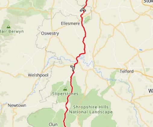
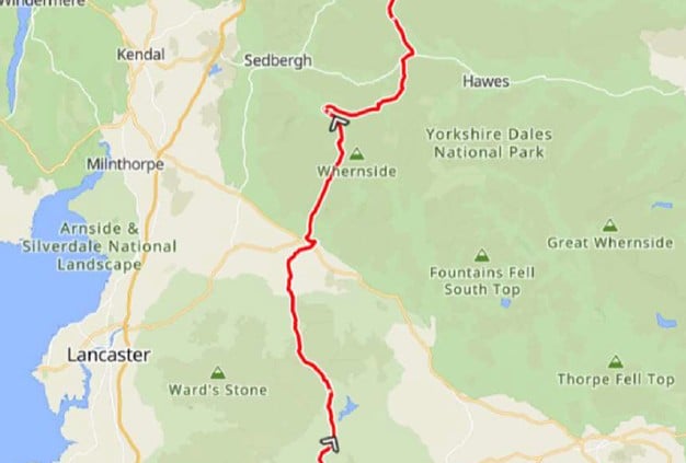
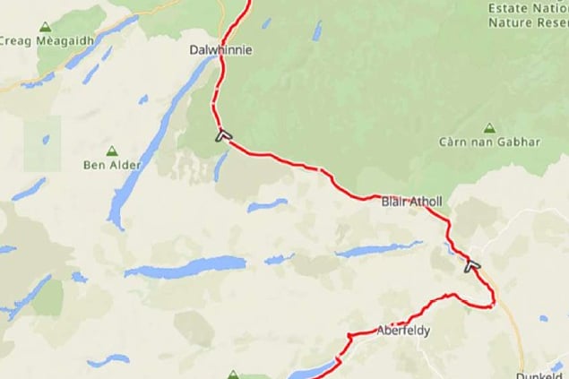
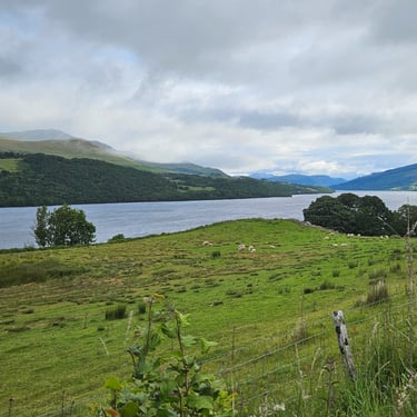
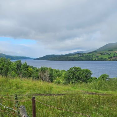
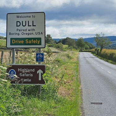
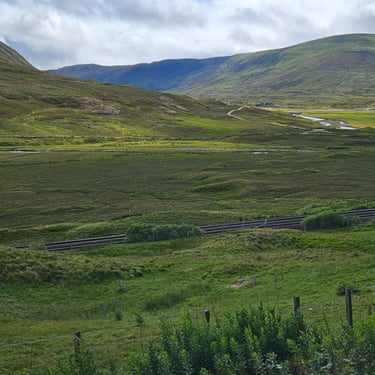
Day 11: Motherwell to Killin
Day 11 (4th July) Summary
Distance 78.5 miles: Total Ascent = 1,280m (4,300ft)*
Elapsed time = 9 hrs 12 min : Moving time = 7hrs 46 mins
Average moving speed = 10.2 mph
*Ascent according to my Garmin Edge 1040 which usually agrees closely with Google Earth. My Edge 530 usually records about 15% less climbing which is more consistent with RWGPS. I assume that the newer hardware is more accurate.
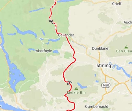
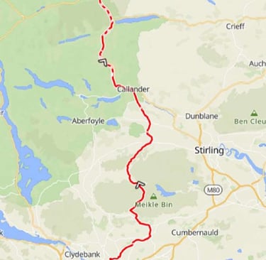
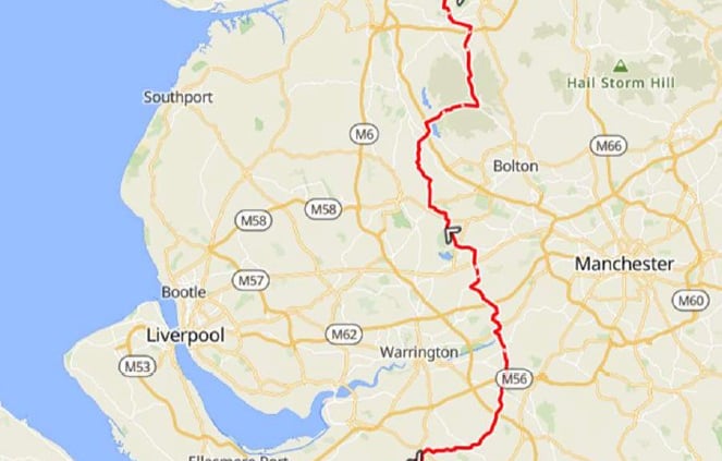
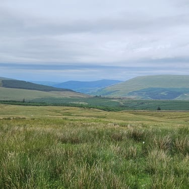
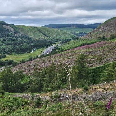
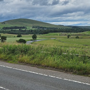
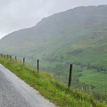
This was challenging day. The weather forcast anticipated rain and a strong SW wind. Although neither the longest or hilliest day, it involved getting into Glasgow then out through the northern suburbs plus plenty of cycle paths during the day which is slower than being on an open road. The 2021 route went west through Glasgow to Loch Lomand.
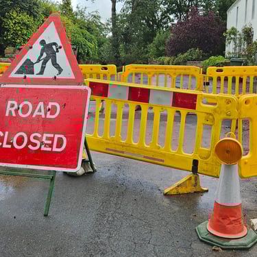
The benefit of a 7am breakfast and 8am departure was wiped out by a complete road closure for rebuilding a junction just after 4 miles. Whoever designed and signed off this work evidently weren't cyclists or they would have included on a temporary path around the edge of the work site. Four of us ended up pushing our bikes through undergrowth and across a field to get back on route which delayed progress by 3/4 hour. Those who started later were able to plan an alternative before getting close to the obstacle.
The hill between miles 32 and 35 was the biggest topograpic challenge of the day
I eventually reached the hotel just before 5:30pm.
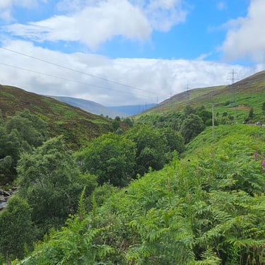
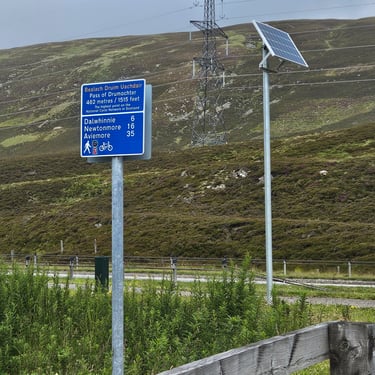
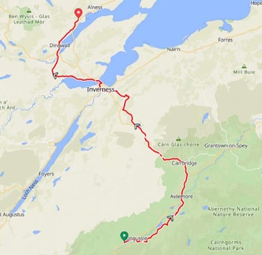
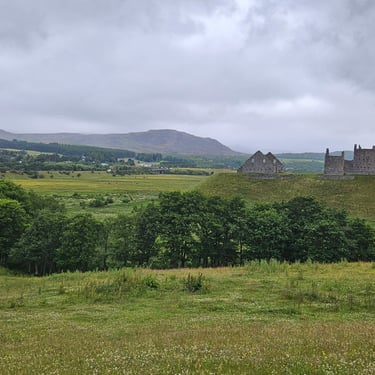
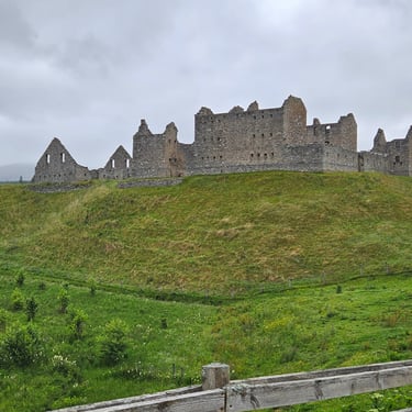
Day 12: Killin to Newtonmore
Day 12 (5th July) Summary
Distance 80.7 miles: Total Ascent = 1,700m (5,600ft)*
Elapsed time = 8 hrs 53 mins : Moving time = 7 hrs 42 mins
Average moving speed = 10.5 mph
*Ascent according to my Garmin Edge 1040 which usually agrees closely with Google Earth. My Edge 530 usually records about 15% less climbing which is more consistent with RWGPS. I assume that the newer hardware is more accurate.
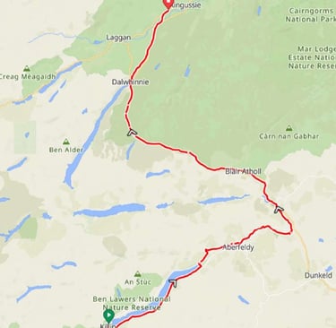
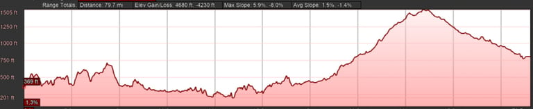
This was another slow and tiring day which was slightly longer than the previous day and with significantly more hill climbing. The weather was drier than the forecasts for the start and end points suggested but there was a brisk WSW wind which was very noticeable when cycling in a westerly direction.
I eventually reached the hotel just before 5:30pm and completing my second 80 mile day.
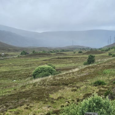
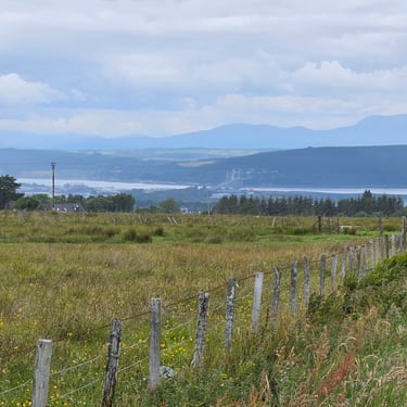
Day 13: Newtonmore to Evanton
Day 13 (6th July) Summary
Distance 76.1 miles: Total Ascent = 1,100m (3,600ft)*
Elapsed time = 7 hrs 52 mins : Moving time = 6 hrs 46 mins
Average moving speed = 11.3 mph
*Ascent according to my Garmin Edge 1040 which usually agrees closely with Google Earth. My Edge 530 usually records about 15% less climbing which is more consistent with RWGPS. I assume that the newer hardware is more accurate.
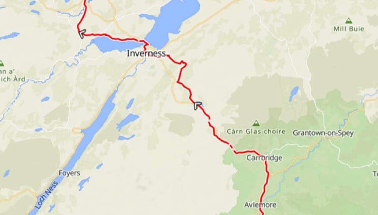
This is probably the least hilly day of the whole trip which resulted in a relatively good overall speed. It was probably also the coldest day, so far, which encouraged me to pedal a bit faster. With hindsight I should have worn my waterproof socks instead of dry weather socks as I hadn't expected either the low temperature (down to 11C at times) or an hour of light rain rather than just some dampness in the air. This left my feet, and me, feeling cold all day. There was a light breeze which started north-eastery and moved round to north-westerly by the end of the day.
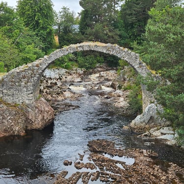
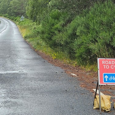
Our breakfast wasn't served until 8am and it was almost 9am when I set off after changing the battery in my temperature sensor which I had noticed wasn't working on the previous day. It was almost dry when I started but after about 15 minutes and hour of heavy drizzle appeared and the temperature dropped. The remains of the Ruthven barracks was the only notable feature in the first 20 miles and I was trying to cycle a bit faster in an attempt to keep warm. The old bridge at Carrbridge was worth a quick viewing while, a little futher on, I came across a rarity: A sign stating that a road that was closed was open to cyclists.
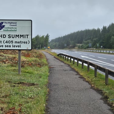
The main hill of the day was the Slochd summit, which was a gentle climb but cold at the top with some drizzle before descending towards the Moray firth.
I reached the hotel before 5pm - an improvement on the previous two days despite the later start.
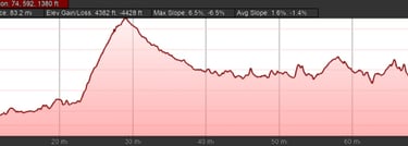
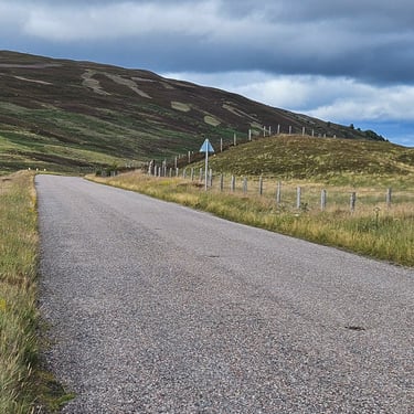
Day 14: Evanton to Bettyhill
Day 14 (7th July) Summary
Distance 77.3 miles: Total Ascent = 1,380m (4,500ft)*
Elapsed time = 8 hrs 23 mins : Moving time = 7 hrs 31 mins
Average moving speed =10.3 mph
*Ascent according to my Garmin Edge 1040 which usually agrees closely with Google Earth. My Edge 530 usually records about 15% less climbing which is more consistent with RWGPS. I assume that the newer hardware is more accurate.
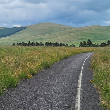
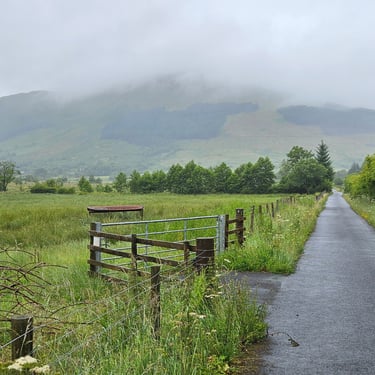
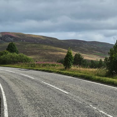
This could have been a pleasant day of cycling. Unfortunately, the wind, which had been fairly well behaved until now, had moved round to the north west and was fairly strong and chilly. A head wind is somewhat unwelcome at any time and particularly on the open sections of northern Scottish roads.
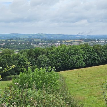
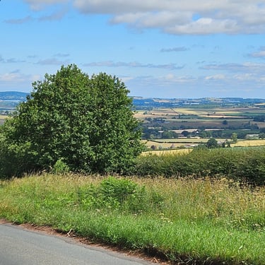
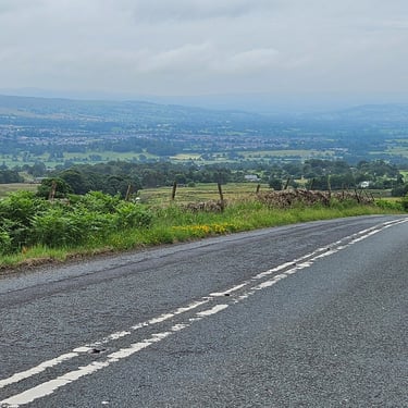
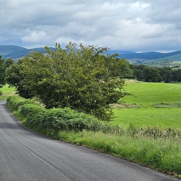
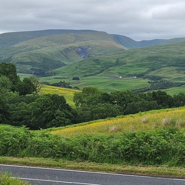
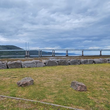
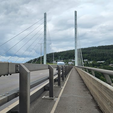
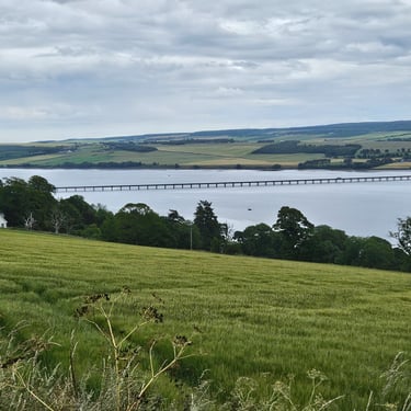
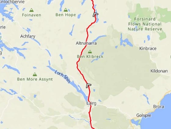
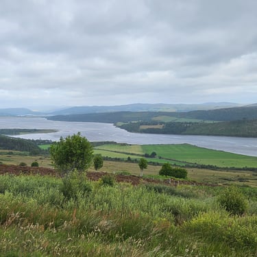
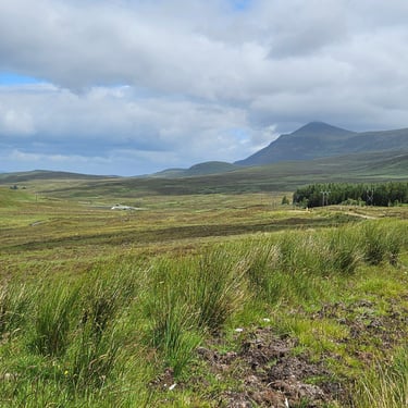
Departure was just before 08:30 and initial progress was fairly good as there was sufficient tree cover to take the edge off the wind. I reached the top of the first hill of the day in 1 1/2 hours from setting out. Visibility was fair which provided good views towards the Dornoch Firth and towards Bonar Bridge. The heather on the hills was just starting to flower whereas it was a colourful sight a few weeks later on the 2021 LEJOG.
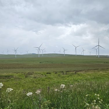
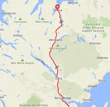
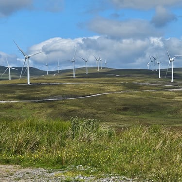
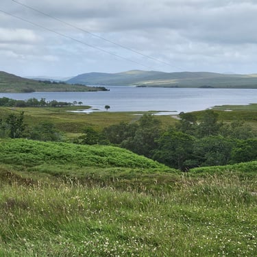
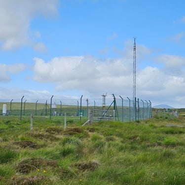
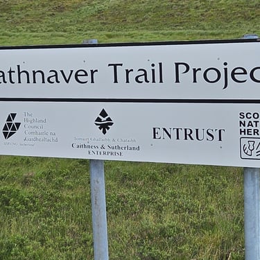
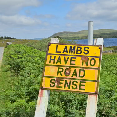
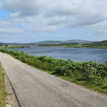
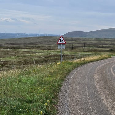
The first of the sections which was exposed to the wind was the 14 miles of mainly gentle climb from Lairg to the Crask Inn. This trended NNW so almost straight into the wind and it felt much steeper than it was and progress was slow with my speed down to 6mph at times. Then it was downhill, past the wind farm which had been under construction in 2021, to Altnaharra where the route turned north eastwards and passed one of the UK's meteorological stations and the UK's coldest recorded place on some winter nights. A few miles alongside Loch Naver was pleasant cycling. There was some sunshine and it was relatively sheltered from the wind. Some sections where the route turned eastwards even benefitted from a tailwind.
Unfortunately, the route then turned northwards again and the remaining 17 miles were a hard slog into the wind made more challenging by some steep, but relatively short, hills until the final climb up to Bettyhill.
The group's accommodation was split between the Farr Bay Inn just east of Bettyhill and the Borgie Lodge Hotel about 3 miles to the SW as the crow flies and 7 miles, plus a nasty hill, by road. The agreed plan was for all to cycle to Farr Bay and the bikes would stay there with the van providing a shuttle service to Borgie Lodge.

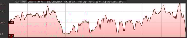
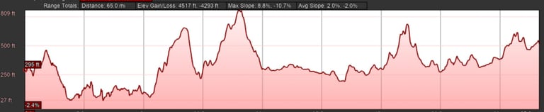
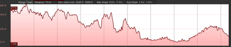
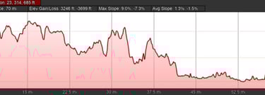
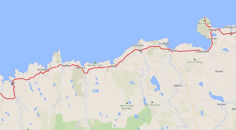
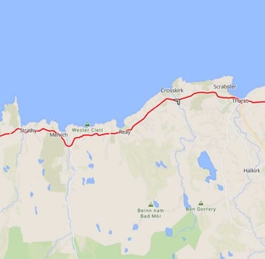
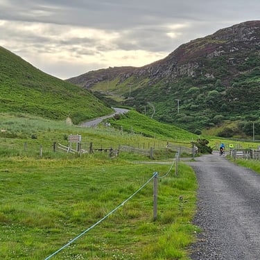
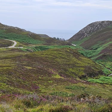
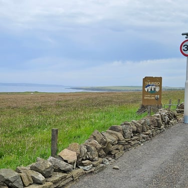
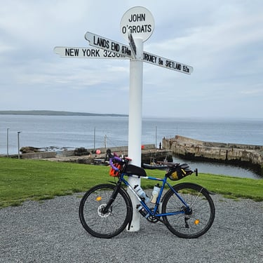
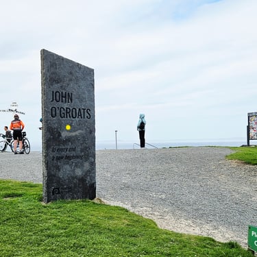
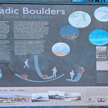
Day 15: Bettyhill to John O' Groats
Day 15 (8th July) Summary
Distance 57.6 miles: Total Ascent = 1,060m (3,500ft)*
Elapsed time = 6 hrs 46 mins : Moving time = 5 hrs 23 mins
Average moving speed = 10.7 mph
*Ascent according to my Garmin Edge 1040 which usually agrees closely with Google Earth. My Edge 530 usually records about 15% less climbing which is more consistent with RWGPS. I assume that the newer hardware is more accurate.
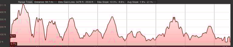
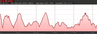
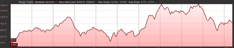
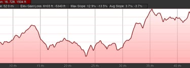
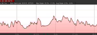
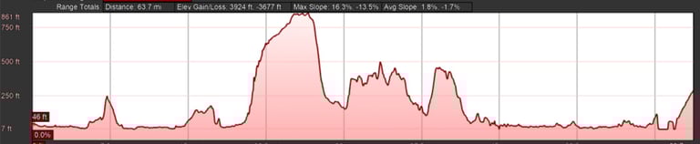
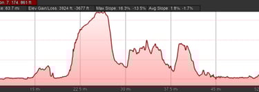
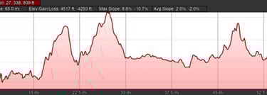
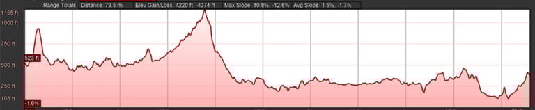
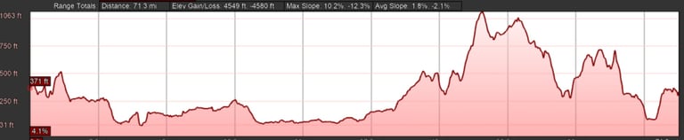
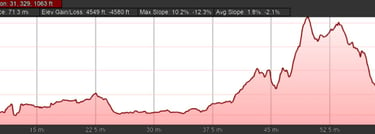
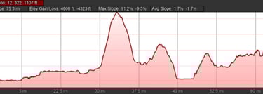
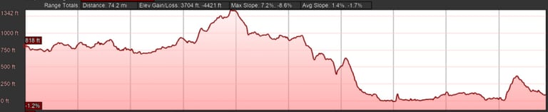
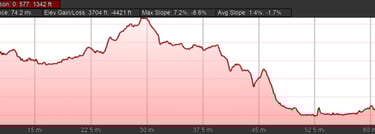
This was a more challenging day than I expected given that it was the second shortest day of the whole trip and, overall, one of the least hilly. However, as the profile show, there were a lot of moderate hills as the route crossed the valleys draining towards the coast. I think that my legs hadn't recovered from the previous day's struggle against the wind.
Breakfast was nominally at 7.45am but that's when the pre-ordered cooked breakfast arrived. by then I had devoured a bowl of the best muesli of the trip. The TV weather forecast had reported that the temperature at Altnaharra had dropped to 4C on the previous night, Fortunately, some early morning sunshine had made the temperature more comfortable. By 8.30 we were in the van to be reunited with our bikes and I set out on my bike just after 9am, by which time the weather had turned cloudy but there wasn't much wind. We were warned by our tour leader not to be over-confident on the final day.
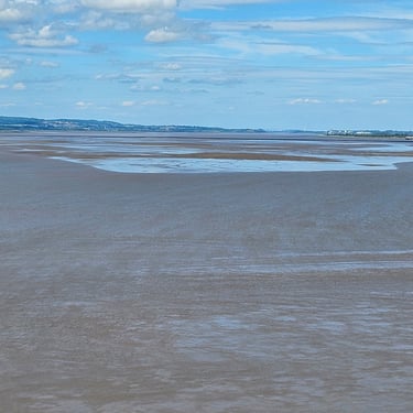
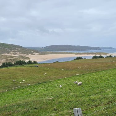
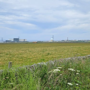
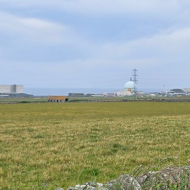
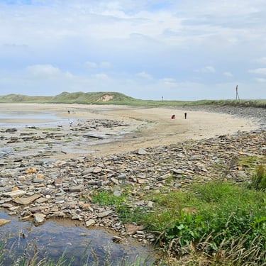
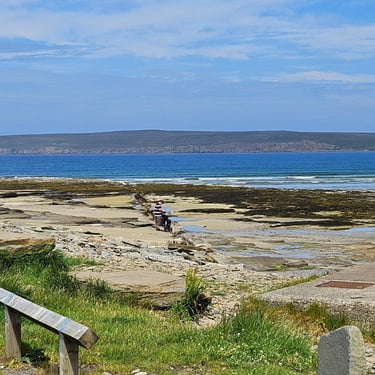
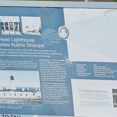
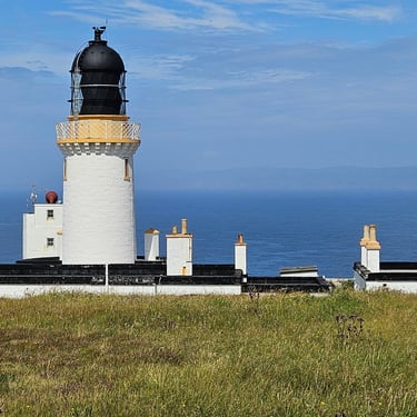
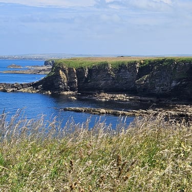
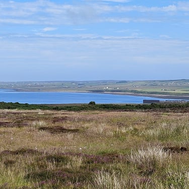
I made my usual fairly slow progress eastwards. One notable feature was the former nuclear research site at Dounreay which is now being slowly decommisioned. A lunch snack was taken in a car park adjacent to Dunnet bay when the sun made a welcome appearance, after which there was the visit to Dunnet Head and a hazy view of the Orkney islands.
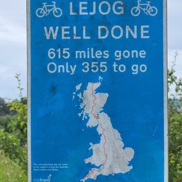
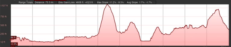
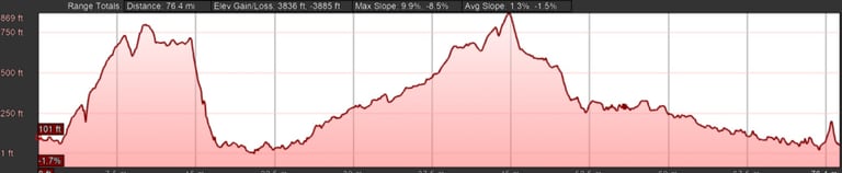
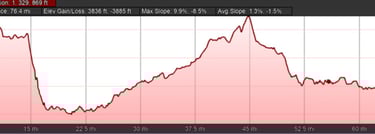
1,040 miles in 15 days is a personal record that I won't try to beat unless it's somewhere flat with no risk of a headwind.
The Journey Home and Concluding Remarks
As with 2021, I have booked the Easyjet flight from Inverness to Gatwick and train for the final part of the journey.